Category:Mining in Michigan
Jump to navigation
Jump to search
States of the United States: Alabama · Alaska · Arizona · Arkansas · California · Colorado · Connecticut · Florida · Georgia · Idaho · Illinois · Indiana · Iowa · Kansas · Kentucky · Louisiana · Maine · Maryland · Massachusetts · Michigan · Minnesota · Mississippi · Missouri · Montana · Nebraska · Nevada · New Hampshire · New Jersey · New Mexico · New York · North Carolina · North Dakota · Ohio · Oklahoma · Oregon · Pennsylvania · South Dakota · Tennessee · Texas · Utah · Vermont · Virginia · Washington · West Virginia · Wisconsin · Wyoming
Wikimedia category | |||||
| Upload media | |||||
| Instance of | |||||
|---|---|---|---|---|---|
| |||||
Subcategories
This category has the following 9 subcategories, out of 9 total.
*
- Coal mining in Michigan (2 F)
F
- Fayette Historic State Park (24 F)
H
K
L
M
Q
- Quincy Smelter (115 F)
Media in category "Mining in Michigan"
The following 44 files are in this category, out of 44 total.
-
 A Copper blast furnace, Hancock, Mich. c1906.jpg 6,897 × 8,937; 14.82 MB
-
 Calumet and hecla no 2.jpg 3,502 × 4,488; 3.72 MB
-
 Calumet and Hecla smelters, Lake Linden, Mich..jpg 16,305 × 6,591; 21.27 MB
-
 Calumet and Hecla stamp mills, Lake Linden, Mich..jpg 30,728 × 6,546; 35.04 MB
-
 Canadian mining journal July-December 1915 (1915) (14779916711).jpg 2,527 × 3,526; 1.1 MB
-
 Chemicalleachingremains.JPG 1,728 × 2,304; 799 KB
-
 Copper Country.jpg 2,408 × 3,918; 2.94 MB
-
 Copper for shipment, Houghton, Mich. 1.jpg 8,822 × 7,051; 12.56 MB
-
 Copper for shipment, Houghton, Mich. 2.jpg 8,976 × 6,996; 12.42 MB
-
 Cornish Pump.jpg 4,167 × 2,535; 3.17 MB
-
 Empire & Tilden Iron Mines, MI.jpg 720 × 480; 228 KB
-
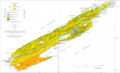
 Gogebic Iron Range.jpg 3,034 × 4,806; 3.17 MB
-
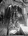
 Just Up, Ascending from the depths of a copper mine (NBY 5168).jpg 525 × 830; 84 KB
-
 Lake Superior smelter and dock, Dollar Bay, Mich..jpg 22,985 × 6,579; 31.08 MB
-
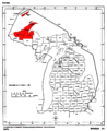 Map of Michigan highlighting Copper Country.gif 1,176 × 1,444; 90 KB
-
 Map of the Copper Range of Northern Michigan and Ontonagon County by R.M. Edwards (1907).jpg 11,830 × 9,767; 20.93 MB
-
 Marquette Iron Range.jpg 3,019 × 4,994; 2.47 MB
-
 Michigan History Museum July 2018 06 (Mining in Michigan).jpg 6,000 × 4,000; 6.13 MB
-
 Michigan-smelter-pano-c1900-1906.jpg 23,595 × 6,659; 29.34 MB
-
 Michigan-smelter.jpg 10,016 × 8,003; 12.32 MB
-
 Mill at Calcite, circa 1945.jpg 1,333 × 914; 235 KB
-
 Millfoundation.JPG 2,304 × 1,728; 752 KB
-
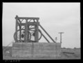
 One-Man Drill in Operation.jpg 580 × 843; 346 KB
-
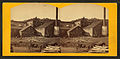
 Outline view of the Minnesota Mine.jpg 840 × 538; 153 KB
-
 Picked up on Lake Superior by S.S. Juniata.jpg 8,536 × 6,721; 10.99 MB
-
 Red Jacket Shaft, Calumet, Mich. (NBY 2797).jpg 826 × 522; 73 KB
-
 Tamarack no. 5, Calumet, Mich. c1900-1910.jpg 7,272 × 5,920; 11.87 MB
-
 The Copper and Iron Region on Lake Superior.jpg 830 × 557; 81 KB
-

-
 Tipple at copper mine. Franklin Mine, Michigan LCCN2017812991.tif 13,685 × 10,518; 137.29 MB
-
 USGS Isle Royale geologic map.png 1,440 × 877; 1.04 MB
-
 USGS Professional Paper 144, Plate 10.jpg 17,825 × 6,848; 4.14 MB
-
 USGS Professional Paper 144, Plate 11.jpg 18,492 × 6,880; 3.79 MB
-
 USGS Professional Paper 144, Plate 12.jpg 17,126 × 6,947; 3.91 MB
-
 USGS Professional Paper 144, Plate 13.jpg 17,642 × 6,864; 4 MB
-
 USGS Professional Paper 144, Plate 5.jpg 18,337 × 8,893; 4.25 MB
-
 USGS Professional Paper 144, Plate 6.jpg 18,978 × 10,062; 5.75 MB
-
 USGS Professional Paper 144, Plate 7.jpg 19,075 × 12,560; 7.27 MB
-
 USGS Professional Paper 144, Plate 8.jpg 18,558 × 7,663; 5.53 MB
-
 USGS Professional Paper 144, Plate 9.jpg 18,792 × 7,614; 5.8 MB
-

-
-

-
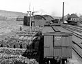
 Train of empty oar cars rounding the curve at Goose Lake, by Emery, A. G.jpg 2,737 × 1,391; 1.38 MB


_(14779916711).jpg)


.jpg)

.jpg)

.jpg)


.jpg)


.jpg)


