Category:Mining in Germany
Appearance
| Upload media | |||||
| Instance of |
| ||||
|---|---|---|---|---|---|
| Facet of | |||||
| Location |
| ||||
| |||||
Deutsch: Bergbau und Abbau von Bodenschätzen in Deutschland.
Subcategories
This category has the following 38 subcategories, out of 38 total.
!
*
A
- Heinrich von Achenbach (1 F)
- Wilhelm Albert (4 F)
B
C
E
G
- Glückauf Arbeiterproteste (24 F)
H
I
K
M
O
P
S
W
Media in category "Mining in Germany"
The following 43 files are in this category, out of 43 total.
-
Abkehrschein Morgenstern 1939.jpg 1,600 × 1,126; 1.3 MB
-
Alte Elisabeth.jpg 500 × 336; 103 KB
-
Ausbauhölzer.JPG 1,200 × 1,600; 616 KB
-
Bergbau stollen1.jpg 500 × 332; 75 KB
-
BergbauKunstAnimation.gif 320 × 202; 79 KB
-
Bergisch Gladbach - Bergisches Museum 37 ies.jpg 3,888 × 2,592; 1.24 MB
-
Das Ruhrgebiet als Seenplatte.jpg 800 × 445; 103 KB
-
David Richtschacht.jpg 500 × 359; 113 KB
-
DörenbergSchnautgangstein retouched.jpg 2,038 × 3,072; 1.91 MB
-
Eb kb brand erbisdorf.jpg 1,200 × 1,402; 1.56 MB
-
Eb-formation branderbisdorf.2.jpg 1,200 × 1,271; 1.16 MB
-
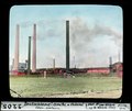
ETH-BIB-Deutschland-Grube und Kokerei, Ober-Schlesien-Dia 247-02205.tif 3,368 × 2,833; 27.38 MB
-
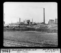
ETH-BIB-Deutschland-Grube, Separation-Dia 247-02192.tif 3,524 × 2,830; 9.58 MB
-
ETH-BIB-Deutschland-Grube, von Osten, Ober-Schlesien-Dia 247-02206.tif 3,293 × 2,825; 8.96 MB
-
Gabe Gottes.jpg 3,072 × 2,304; 472 KB
-
Grube Viktoria Gilsbach.jpg 5,312 × 2,988; 8.1 MB
-
Höfer (Eschede) IMG 0963.jpg 3,888 × 2,592; 6.54 MB
-
Höfer (Eschede) IMG 0965.jpg 3,888 × 2,592; 3.87 MB
-
Höfer (Eschede) IMG 0966.jpg 3,888 × 2,592; 5.52 MB
-
Höfer (Eschede) IMG 0967.jpg 3,888 × 2,592; 3.96 MB
-
Höfer (Eschede) IMG 0968.jpg 3,888 × 2,592; 4.52 MB
-
Höfer (Eschede) IMG 0969.jpg 2,592 × 3,888; 5.42 MB
-
Höfer (Eschede) IMG 0970.jpg 3,888 × 2,592; 5.81 MB
-
Italian Gastarbeiter Coal Mines Western Germany.png 800 × 532; 349 KB
-
Lachtertafel 1821.JPG 1,091 × 822; 361 KB
-
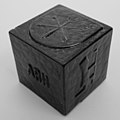
Mansfelder Schlackenstein SW RK01.jpg 3,212 × 3,189; 2.07 MB
-
Mansfelder Schlackenstein SW RK02.jpg 3,200 × 3,200; 2 MB
-
Mittelalterliche Baue.jpg 1,920 × 2,560; 3.11 MB
-
Naumann, geognostische charte sachsen 1836.JPG 1,477 × 2,422; 728 KB
-
Saxonia Museum fuer saechsische Vaterlandskunde V 41.jpg 2,471 × 1,749; 1 MB
-
Scaling in Rohr01.jpeg 640 × 480; 93 KB
-
Schurfschein.jpg 1,139 × 1,913; 2.47 MB
-
St Anna Zschorlau 08.jpg 3,072 × 2,048; 1.02 MB
-
Stollenmundloch02.jpg 1,536 × 1,024; 528 KB
-
Strossenbau 2.png 896 × 560; 144 KB
-
Tonabbau bei Haus Kilver.jpg 2,048 × 735; 167 KB
-
Verstufungstafel Ursula Tiefer Erbstolln.jpg 2,080 × 1,544; 314 KB
-
Wetterkarte Phillipsstollen Sauerland GLAM 368 PK.jpg 3,828 × 2,555; 2.44 MB
-
Wetterkarte Phillipsstollen Sauerland GLAM 372 PK.jpg 3,181 × 2,353; 1.86 MB
-
Zeche Monopol Schacht Grimberg 1.jpg 1,784 × 1,340; 242 KB
-
Бремсберг.jpg 1,788 × 2,706; 4.34 MB


