Category:Mining in Anglesey
Jump to navigation
Jump to search
Subcategories
This category has the following 2 subcategories, out of 2 total.
*
P
Media in category "Mining in Anglesey"
The following 21 files are in this category, out of 21 total.
-

-
 Mining rights marker above the B5111 - geograph.org.uk - 1278663.jpg 640 × 480; 100 KB
-

-

-
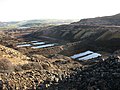
 Precipitation ponds at Mona Mine - geograph.org.uk - 1195228.jpg 640 × 480; 81 KB
-

-
 Remains of the Mona Mine Yard - geograph.org.uk - 1195208.jpg 640 × 480; 39 KB
-

-
 Ruined copper mine buildings - geograph.org.uk - 1404548.jpg 640 × 378; 62 KB
-

-

-
 The eastern face of Twll Mawr - geograph.org.uk - 1195484.jpg 640 × 480; 82 KB
-
 The Pearl Shaft beam engine house - geograph.org.uk - 1194959.jpg 480 × 640; 103 KB
-

-

-
 Twll Mawr -the eastern open cast working - geograph.org.uk - 1195250.jpg 640 × 480; 102 KB
-
 Twll Mawr and the summit windmill - geograph.org.uk - 1195305.jpg 480 × 640; 105 KB
-
 View east from the Pearl Shaft - geograph.org.uk - 1180426.jpg 640 × 480; 57 KB
-
-

-
 Waste tip above Twll Mawr - geograph.org.uk - 1195479.jpg 640 × 480; 76 KB


