Category:Miniature Speed Atlas (1627) Pieter van den Keere
Jump to navigation
Jump to search
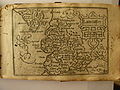
1627 small format atlas with maps by Pieter van den Keere, printed by George Humble  Map of Huntingdonshire from the "Miniature Speed" atlas of 1627 | |||||
| Upload media | |||||
| Instance of |
| ||||
|---|---|---|---|---|---|
| Edition or translation of |
| ||||
| Creator |
| ||||
| Based on |
| ||||
| |||||
English: England Wales Scotland and Ireland Described and Abridged With ye Historie Relation of things worthy memory from a farr larger Voulume 1627 And are to bee sould by Georg Humble at ye Whithorse in popeshead Alley (1627)
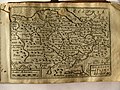
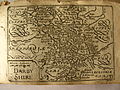
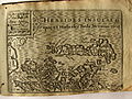
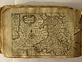
A set of miniature maps, engraved by Pieter van den Keere, based mainly on Christopher Saxton. They are believed to have been first issued between c. 1605–10 in Amsterdam. They were reprinted in 1627 by George Humble, the publisher of the 1610 atlas by John Speed. To capitalise on the value of Speed's name, the collection was retitled as above, and came to be known as the Miniature Speed. [1]
Media in category "Miniature Speed Atlas (1627) Pieter van den Keere"
The following 33 files are in this category, out of 33 total.
-
 17th Century map of Cheshire.JPG 3,456 × 2,592; 5.39 MB
-
 17th Century map of Connaught.jpg 3,456 × 2,592; 6.82 MB
-
 17th Century map of Denbighshire and Flintshire.jpg 3,456 × 2,592; 5.54 MB
-
 17th Century map of Derbyshire.JPG 3,456 × 2,592; 5.99 MB
-
 17th Century map of Glamorganshire.JPG 3,456 × 2,592; 5.35 MB
-
 17th Century map of Gloucestershire.JPG 3,456 × 2,592; 5.42 MB
-
 17th Century map of Herefordshire.JPG 3,456 × 2,592; 5.34 MB
-
 17th Century map of Huntingdonshire.JPG 3,456 × 2,592; 5.1 MB
-
 17th Century map of Leicestershire.JPG 3,456 × 2,592; 5.37 MB
-
 17th Century map of Lincolnshire.JPG 3,456 × 2,592; 7.03 MB
-
 17th Century map of North and Mid-Wales.jpg 3,456 × 2,592; 5.05 MB
-
 17th Century map of North-East Scotland.jpg 3,456 × 2,592; 5.84 MB
-
 17th Century map of Pembrokeshire.jpg 3,204 × 2,404; 5.96 MB
-
 17th Century map of Rutlandshire.jpg 3,456 × 2,592; 5.32 MB
-
 17th Century map of Scotland.jpg 3,456 × 2,592; 7.21 MB
-
 17th Century map of Shropshire.jpg 3,456 × 2,592; 5.18 MB
-
 17th Century map of Southern Scotland.jpg 3,456 × 2,592; 5.19 MB
-
 17th Century map of Staffordshire.jpg 3,456 × 2,592; 4.96 MB
-
 17th Century map of the Hebrides Islands.jpg 3,456 × 2,592; 5.83 MB
-
 17th Century map of the Orkney Islands.JPG 3,456 × 2,592; 5.45 MB
-
 17th Century map of Ulster.jpg 3,456 × 2,592; 7.42 MB
-
 17th Century map of Wales.jpg 3,370 × 2,555; 6.71 MB
-
 17th Century map of Warwickshire.jpg 3,456 × 2,592; 5.83 MB
-
 17th Century map of Westmorland and Cumberland.jpg 3,456 × 2,592; 4.95 MB
-
 17th Century map of Worcestershire.jpg 3,456 × 2,592; 4.94 MB
-
 17th Century map pf Lancashire.JPG 3,456 × 2,592; 4.64 MB
-
 17th Century maps of Holy Island, Guernsey, Farne Island, and Jersey.JPG 3,456 × 2,592; 5.68 MB
-
 17the Century map of Linster.jpg 3,456 × 2,592; 7.43 MB
-
 17the Century map of Montgomeryshire and Merioniothshire.jpg 3,456 × 2,592; 6.61 MB
-
 17the Century map of Mounmouthshire.jpg 3,456 × 2,592; 5.24 MB
-
 17the Century map of Nottinghamshire.jpg 3,456 × 2,592; 5.82 MB
-
 Anglesey and Carnarvan.jpg 3,456 × 2,592; 5.36 MB
-
 The-curse-of-the-gloucesters.jpg 3,456 × 2,592; 4.56 MB


