Category:Mine surveying
Jump to navigation
Jump to search
| Upload media | |||||
| Instance of | |||||
|---|---|---|---|---|---|
| Subclass of | |||||
| |||||
Subcategories
This category has the following 2 subcategories, out of 2 total.
M
- Mine compasses (15 F)
Media in category "Mine surveying"
The following 23 files are in this category, out of 23 total.
-
 Allerheiligenstollen.jpg 2,098 × 825; 455 KB
-
 Bergwerk Schoenberg Freiburg Breisgau Riss Sicherheitspfeiler.jpg 960 × 680; 102 KB
-
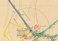
 BinghamCynGeologyMap.jpg 1,743 × 1,143; 780 KB
-
De-Markscheider.ogg 2.2 s; 22 KB
-
De-Markscheiderin.ogg 2.4 s; 25 KB
-
 Eylesbarrow mine plan01.gif 800 × 746; 87 KB
-
 Firstnagel1.jpg 1,922 × 604; 916 KB
-

-

-

-

-
 Fotothek df tg 0007852 Bergbau ^ Bergnotar ^ Markscheider.jpg 800 × 439; 151 KB
-
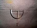 Gonbogen.JPG 2,048 × 1,536; 1.23 MB
-
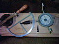
 Gonbogen2.jpg 2,968 × 1,918; 5.2 MB
-
 Grubenplan Eisenberg Brilon.jpg 2,513 × 2,393; 489 KB
-
 Hängezeug1.jpg 1,024 × 768; 388 KB
-
 Hängezeug2.JPG 2,272 × 1,704; 3.14 MB
-
 Lachterkette.jpg 3,033 × 1,532; 3.29 MB
-
 MinongMineLocation.JPG 1,151 × 789; 145 KB
-
 OldRoomAndPillar.png 1,313 × 837; 174 KB
-
 Streichwinkel.svg 512 × 724; 271 KB
-
 User markscheider.jpg 220 × 320; 26 KB
-
 Vermessung mit Freiburger Hängezeug.jpg 2,448 × 2,448; 1.38 MB


