Category:Milwich
Jump to navigation
Jump to search
village in United Kingdom  | |||||
| Upload media | |||||
| Instance of | |||||
|---|---|---|---|---|---|
| Location | Stafford, Staffordshire, West Midlands, England | ||||
| Said to be the same as | Milwich (Wikimedia duplicated page, civil parish) | ||||
 | |||||
Subcategories
This category has the following 4 subcategories, out of 4 total.
Media in category "Milwich"
The following 52 files are in this category, out of 52 total.
-
 A Pub in the Countryside - geograph.org.uk - 269786.jpg 640 × 429; 81 KB
-
 Access to Milwich Church - geograph.org.uk - 2700140.jpg 640 × 428; 52 KB
-
 Across Pasture towards Dayhills - geograph.org.uk - 2700162.jpg 640 × 428; 84 KB
-
 All Saints' Church, Milwich - geograph.org.uk - 5788496.jpg 1,600 × 1,200; 652 KB
-
 B5027 approaching Milwich - geograph.org.uk - 2147823.jpg 640 × 480; 106 KB
-
 Beacon Bank - geograph.org.uk - 1159926.jpg 640 × 480; 195 KB
-

-
 Butterhill Lane - geograph.org.uk - 3142601.jpg 640 × 480; 69 KB
-
 Coton Green Farm, Coton - geograph.org.uk - 2673460.jpg 640 × 428; 80 KB
-
 Dead trees. - geograph.org.uk - 1159903.jpg 480 × 640; 163 KB
-
 Farm Buildings on Mill Lane, Coton - geograph.org.uk - 2700116.jpg 640 × 428; 126 KB
-

-
 Farmland near Castle Farm - geograph.org.uk - 1148653.jpg 640 × 457; 139 KB
-
 Farmland near Garshall House - geograph.org.uk - 1148660.jpg 640 × 457; 144 KB
-
 Footpath Approaching Milwich - geograph.org.uk - 2271056.jpg 1,496 × 1,122; 669 KB
-
 Footpath At Beacon Bank - geograph.org.uk - 2269549.jpg 1,496 × 1,122; 572 KB
-
 Footpath on a bank in Mill Lane - geograph.org.uk - 2700126.jpg 640 × 428; 138 KB
-
 Footpath To Coton Mill Farm - geograph.org.uk - 2271022.jpg 1,496 × 1,122; 673 KB
-
 Footpath To Coton Mill Farm - geograph.org.uk - 2271026.jpg 1,496 × 1,122; 651 KB
-
 Footpath To Milwich Church - geograph.org.uk - 2269538.jpg 1,496 × 1,122; 711 KB
-
 Footpath To Milwich Church - geograph.org.uk - 2269557.jpg 1,496 × 1,122; 808 KB
-
 Footpath To Milwich Church - geograph.org.uk - 2269588.jpg 1,496 × 1,122; 726 KB
-
 Former dwelling in Milwich - geograph.org.uk - 5789271.jpg 1,600 × 1,200; 588 KB
-
 Garshall Green Ford - geograph.org.uk - 3793662.jpg 3,872 × 2,592; 2.85 MB
-
 House on a Road Junction, Coton Hill - geograph.org.uk - 2674750.jpg 640 × 428; 66 KB
-
 Lane near Wythysitch Farm - geograph.org.uk - 2147841.jpg 640 × 480; 88 KB
-

-

-
 Milwich - geograph.org.uk - 962458.jpg 640 × 480; 78 KB
-
 Milwich Church and Vicarage - geograph.org.uk - 269732.jpg 640 × 429; 78 KB
-
 Milwich from Cromer Hill - geograph.org.uk - 1159893.jpg 640 × 480; 163 KB
-

-
 Old school building at Milwich - geograph.org.uk - 5789249.jpg 1,600 × 1,200; 562 KB
-
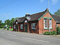
 Old School, Milwich - geograph.org.uk - 962356.jpg 640 × 439; 55 KB
-
 Old School, Milwich.jpg 1,600 × 1,200; 606 KB
-
 OS trig point, Cromer Hill - geograph.org.uk - 1159869.jpg 480 × 640; 199 KB
-

-
 Short Footpath at Coton - geograph.org.uk - 2700103.jpg 640 × 428; 105 KB
-
 Thatched cottage, Milwich - geograph.org.uk - 962452.jpg 640 × 480; 80 KB
-
 The B5027 through Milwich - geograph.org.uk - 5789346.jpg 1,600 × 1,200; 679 KB
-
 The Disappearing Road - geograph.org.uk - 2700185.jpg 640 × 409; 74 KB
-
 The Green Man, Milwich - geograph.org.uk - 5788476.jpg 1,600 × 1,200; 507 KB
-
 The Toll House, Milwich - geograph.org.uk - 962462.jpg 640 × 480; 76 KB
-
 Track Near Beacon Bank - geograph.org.uk - 2271020.jpg 1,496 × 1,122; 972 KB
-
 Uttoxeter Road at Coton Hill - geograph.org.uk - 2147900.jpg 640 × 480; 81 KB
-
 Uttoxeter Road at Priors Ley - geograph.org.uk - 2147801.jpg 640 × 480; 92 KB
-
 Uttoxeter Road near Coton Hayes - geograph.org.uk - 2147929.jpg 640 × 480; 90 KB
-

-
 View from Garshall Green - geograph.org.uk - 2250275.jpg 640 × 428; 166 KB
-
 View from Garshall Green - geograph.org.uk - 2250278.jpg 640 × 428; 175 KB
-
 View Near Beacon Bank - geograph.org.uk - 2270255.jpg 1,496 × 1,122; 568 KB
-
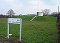 Water Installation - geograph.org.uk - 376522.jpg 640 × 461; 72 KB


.jpg)


