Category:Milton-under-Wychwood
Jump to navigation
Jump to search
human settlement in United Kingdom  | |||||
| Upload media | |||||
| Instance of | |||||
|---|---|---|---|---|---|
| Location | West Oxfordshire, Oxfordshire, South East England, England | ||||
| Population |
| ||||
| official website | |||||
 | |||||
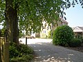
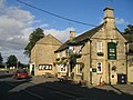
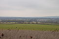
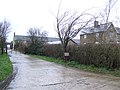
English: Milton-under-Wychwood is a village and civil parish about north of Burford, Oxfordshire, just off the A361 between Burford and Chipping Norton.
Subcategories
This category has only the following subcategory.
Media in category "Milton-under-Wychwood"
The following 125 files are in this category, out of 125 total.
-
 A424 at Habber Gallows Hill - geograph.org.uk - 2651738.jpg 640 × 480; 50 KB
-
 A424 at Habber Gallows Hill - geograph.org.uk - 2651743.jpg 640 × 480; 61 KB
-
 A424 climbing to Habber Gallows Hill - geograph.org.uk - 2651735.jpg 640 × 480; 51 KB
-
 Allotments at Milton - geograph.org.uk - 2397148.jpg 4,288 × 3,216; 1.69 MB
-
 Allotments at Milton-under-Wychwood - geograph.org.uk - 6608883.jpg 6,000 × 4,000; 4.56 MB
-
 Blackheath Clump trig point - geograph.org.uk - 2751548.jpg 1,024 × 719; 125 KB
-
 Building compound on the edge of Milton-under-Wychwood - geograph.org.uk - 6624756.jpg 5,764 × 3,844; 6.27 MB
-
 Byway to the gallows - geograph.org.uk - 4223064.jpg 4,320 × 3,240; 5.22 MB
-

-
 Cotswolds field edge - geograph.org.uk - 4402729.jpg 800 × 450; 181 KB
-
 Cottages and farmhouse - geograph.org.uk - 4223078.jpg 4,320 × 3,240; 5.14 MB
-
 Crossing Lyneham Road on the Oxfordshire Way - geograph.org.uk - 3301126.jpg 2,048 × 1,536; 674 KB
-
 Crossroads at Upper Milton - geograph.org.uk - 1092026.jpg 640 × 480; 83 KB
-
 Crossroads by Springhill farm - geograph.org.uk - 2679161.jpg 640 × 480; 68 KB
-
 Driveway to Crow's Castle - geograph.org.uk - 383409.jpg 640 × 480; 85 KB
-
 Entering Milton under Wychwood - geograph.org.uk - 2679154.jpg 640 × 480; 79 KB
-
 Evenlode valley - geograph.org.uk - 2403689.jpg 4,288 × 3,216; 4.68 MB
-
 Exit onto Shipton road - geograph.org.uk - 2679152.jpg 640 × 480; 75 KB
-
 Extended Cemetery - geograph.org.uk - 2405317.jpg 4,288 × 3,216; 2.76 MB
-
 Farmland near Bruern Abbey - geograph.org.uk - 994112.jpg 640 × 426; 114 KB
-
 Farmland near Milton-under-Wychwood - geograph.org.uk - 6624780.jpg 6,000 × 4,000; 4.47 MB
-
 Field edge path - geograph.org.uk - 2397142.jpg 4,288 × 3,216; 1.57 MB
-
 Field of barley near High Lodge Farm - geograph.org.uk - 6624796.jpg 6,000 × 4,000; 3.84 MB
-
 Field of barley near High Lodge Farm - geograph.org.uk - 6625225.jpg 6,000 × 4,000; 3.79 MB
-
 Footpath leaves the road - geograph.org.uk - 2397221.jpg 4,288 × 3,216; 1.67 MB
-
 Footpath to Shipton Under Wychwood - geograph.org.uk - 2083956.jpg 640 × 480; 111 KB
-
 Footpath towards Tangley - geograph.org.uk - 6625505.jpg 6,000 × 4,000; 4.19 MB
-

-

-

-
 Heath Farm (1) - geograph.org.uk - 2397231.jpg 4,288 × 3,216; 1.43 MB
-
 Heath Farm (2) - geograph.org.uk - 2397235.jpg 4,288 × 3,216; 1.71 MB
-
 High Lodge Cottage - geograph.org.uk - 309093.jpg 640 × 480; 66 KB
-
 High Lodge Farm (1) - geograph.org.uk - 4223053.jpg 4,320 × 3,240; 4.88 MB
-
 High Lodge Farm (2) - geograph.org.uk - 4223056.jpg 4,320 × 3,240; 4.76 MB
-
 High Lodge Farm - geograph.org.uk - 6625405.jpg 6,000 × 4,000; 4.54 MB
-
 High Street, Milton under Wychwood - geograph.org.uk - 5712023.jpg 640 × 480; 67 KB
-
 High Street, Milton under Wychwood - geograph.org.uk - 5712285.jpg 640 × 480; 72 KB
-
 High Street, Milton under Wychwood - geograph.org.uk - 5712294.jpg 640 × 480; 68 KB
-
 High Street, Milton under Wychwood - geograph.org.uk - 5715775.jpg 640 × 480; 62 KB
-
 High Street, Milton under Wychwood - geograph.org.uk - 5739858.jpg 640 × 480; 80 KB
-
 High Street, Milton under Wychwood - geograph.org.uk - 5739873.jpg 640 × 480; 53 KB
-
 High Street, Milton under Wychwood - geograph.org.uk - 5739884.jpg 640 × 480; 63 KB
-
 High Street, Milton-under-Wychwood - geograph.org.uk - 6608163.jpg 5,774 × 3,851; 6 MB
-
 Housing on Chestnut Lane - geograph.org.uk - 6624716.jpg 6,000 × 4,000; 3.93 MB
-
 Junction near Milton Under Wychwood - geograph.org.uk - 1412412.jpg 640 × 427; 63 KB
-
 Lane in the rain, 2015 - geograph.org.uk - 4402724.jpg 800 × 450; 195 KB
-
 Lane passing Manor farm - geograph.org.uk - 2679159.jpg 640 × 480; 87 KB
-

-

-
 Lyneham Road - geograph.org.uk - 6617533.jpg 6,000 × 4,000; 4.59 MB
-

-
 Milton under Wychwood - geograph.org.uk - 232784.jpg 640 × 480; 64 KB
-
 Milton under Wychwood - geograph.org.uk - 5711933.jpg 640 × 480; 92 KB
-
 Milton Under Wychwood Co Op - geograph.org.uk - 2569336.jpg 640 × 478; 78 KB
-
 Milton Under Wychwood high street - geograph.org.uk - 1513410.jpg 640 × 427; 68 KB
-
 Milton Under Wychwood village hall - geograph.org.uk - 1031748.jpg 640 × 480; 65 KB
-

-

-

-

-

-
 Miltonunderwychwood.jpg 720 × 540; 114 KB
-
 Minor road from the A261 to the A424 - geograph.org.uk - 1564564.jpg 640 × 480; 130 KB
-

-
 Muddy public footpath near to Bruern Wood - geograph.org.uk - 3301124.jpg 2,048 × 1,536; 951 KB
-
 Old rectory at Milton under Wychwood - geograph.org.uk - 5711743.jpg 640 × 360; 123 KB
-
 Old School House, Milton-under-Wychwood - geograph.org.uk - 4249576.jpg 3,264 × 2,448; 2.55 MB
-
 Old School House, side view from churchyard - geograph.org.uk - 4249575.jpg 3,264 × 2,448; 1.83 MB
-
 Oxfordshire Way (1) - geograph.org.uk - 2397650.jpg 4,288 × 3,216; 1.04 MB
-
 Oxfordshire Way (2) - geograph.org.uk - 2397655.jpg 4,288 × 3,216; 5.75 MB
-
 Oxfordshire Way - geograph.org.uk - 4756951.jpg 640 × 480; 81 KB
-
 Oxfordshire Way - geograph.org.uk - 4756954.jpg 640 × 480; 89 KB
-
 Oxfordshire Way crosses Lyneham Road - geograph.org.uk - 2397641.jpg 4,288 × 3,216; 1.53 MB
-
 Paddock off Lyneham Road - geograph.org.uk - 6617570.jpg 6,000 × 4,000; 4.24 MB
-
 Path leaves road - geograph.org.uk - 4223081.jpg 4,320 × 3,240; 4.71 MB
-
 Path meets road - geograph.org.uk - 2397216.jpg 4,288 × 3,216; 1.22 MB
-
 Path with horses (1) - geograph.org.uk - 4223082.jpg 4,320 × 3,240; 4.57 MB
-
 Path with horses (2) - geograph.org.uk - 4223083.jpg 4,320 × 3,240; 4.57 MB
-
 Pea crop near Milton-under-Wychwood - geograph.org.uk - 6609148.jpg 6,000 × 4,000; 5.23 MB
-
 Quarry Hill cottage - geograph.org.uk - 2679165.jpg 640 × 480; 78 KB
-
 Quietly rusting - geograph.org.uk - 4222400.jpg 4,320 × 3,240; 5.19 MB
-
 Recreation ground at Milton-under-Wychwood - geograph.org.uk - 6608176.jpg 6,000 × 4,000; 4.17 MB
-
 Road junction in the centre of Milton - geograph.org.uk - 6608150.jpg 6,000 × 4,000; 3.01 MB
-
 Road through Milton Under Wychwood - geograph.org.uk - 1526091.jpg 640 × 427; 45 KB
-
 Road to Milton Under Wychwood - geograph.org.uk - 1412393.jpg 640 × 427; 100 KB
-
 Roads and byway - geograph.org.uk - 4223062.jpg 4,320 × 3,240; 4.7 MB
-
 Saints Simon ^ Jude, Milton-under-Wychwood - geograph.org.uk - 4249571.jpg 2,804 × 2,103; 1.86 MB
-
 Sheep near Heath Farm - geograph.org.uk - 6617552.jpg 6,000 × 4,000; 3.78 MB
-
 Shipton Road, Milton under Wychwood - geograph.org.uk - 5711975.jpg 640 × 480; 112 KB
-
 Shipton Road, Milton under Wychwood - geograph.org.uk - 5711997.jpg 640 × 480; 73 KB
-
 Shipton Road, Milton-under-Wychwood, Oxon - geograph.org.uk - 6509635.jpg 1,024 × 681; 150 KB
-
 Springhill Cottages, Upper Milton - geograph.org.uk - 1216016.jpg 640 × 427; 89 KB
-

-

-

-

-

-

-
 Stone Porch, High Street - geograph.org.uk - 5715771.jpg 640 × 480; 84 KB
-
 Terrace House, High Street - geograph.org.uk - 5715773.jpg 640 × 480; 100 KB
-

-
 The A424, Habber Gallows Hill - geograph.org.uk - 6349008.jpg 1,854 × 1,235; 820 KB
-
 The Bungalow Holding - geograph.org.uk - 2397226.jpg 4,288 × 3,216; 1.59 MB
-
 The Evenlode valley - geograph.org.uk - 6617520.jpg 6,000 × 4,000; 4.62 MB
-

-

-
 The Heath - geograph.org.uk - 6608186.jpg 6,000 × 4,000; 5.64 MB
-
 The old school - geograph.org.uk - 2397212.jpg 4,288 × 3,216; 1.24 MB
-
 The Oxfordshire Way by the Evenlode valley - geograph.org.uk - 6616472.jpg 6,000 × 4,000; 4.22 MB
-
 The Oxfordshire Way near Heath Farm - geograph.org.uk - 6616513.jpg 6,000 × 4,000; 5.22 MB
-

-
 Towards the woods - geograph.org.uk - 2398561.jpg 4,288 × 3,216; 2.61 MB
-
 Track to Habber Gallows Hill - geograph.org.uk - 1513422.jpg 640 × 427; 71 KB
-
 Track to Milton Downs farm - geograph.org.uk - 1412388.jpg 640 × 427; 88 KB
-
 Turning to Milton - geograph.org.uk - 1216033.jpg 640 × 427; 52 KB
-
 Valley view - geograph.org.uk - 2398566.jpg 4,288 × 3,216; 2.4 MB
-
 View from Milton-under-Wychwood.JPG 3,008 × 2,000; 2.66 MB
-
 Wellington Way - geograph.org.uk - 6624735.jpg 6,000 × 4,000; 3.58 MB
-
 Wheat field near Heath Farm - geograph.org.uk - 6616493.jpg 6,000 × 4,000; 4.42 MB
-

-
 Wychwood Baptist Church - geograph.org.uk - 6624694.jpg 6,000 × 4,000; 4.57 MB
-
 Footpath and stile - geograph.org.uk - 309062.jpg 640 × 480; 150 KB
-
 Heath Farm - geograph.org.uk - 309058.jpg 640 × 480; 101 KB
-
 Lyneham railway crossing - geograph.org.uk - 309054.jpg 640 × 480; 88 KB


_-_geograph.org.uk_-_2397231.jpg)
_-_geograph.org.uk_-_2397235.jpg)

_-_geograph.org.uk_-_4223053.jpg)
_-_geograph.org.uk_-_4223056.jpg)


,_Shipton_Road,_Milton-under-Wychwood,_Oxon_-_geograph.org.uk_-_6509619.jpg)
,_Shipton_Road,_Milton-under-Wychwood,_Oxon_-_geograph.org.uk_-_6509625.jpg)


_-_geograph.org.uk_-_2397650.jpg)
_-_geograph.org.uk_-_2397655.jpg)


_-_geograph.org.uk_-_4223082.jpg)
_-_geograph.org.uk_-_4223083.jpg)


,_3_High_Street,_Milton-under-Wychwood,_Oxon_-_geograph.org.uk_-_6509548.jpg)
_-_pub_sign,_3_High_Street,_Milton-under-Wychwood,_Oxon_-_geograph.org.uk_-_6509557.jpg)


