Category:Millstone Grit
Jump to navigation
Jump to search
Subcategories
This category has the following 18 subcategories, out of 18 total.
*
- Millstone Grit beaches (4 F)
- Millstone Grit screes (3 F)
+
.
- Millstone Grit sculptures (2 F)
C
- Canyards Hills (4 F)
F
Media in category "Millstone Grit"
The following 66 files are in this category, out of 66 total.
-
 A stone that's tilting off the edge - geograph.org.uk - 1775503.jpg 3,872 × 2,592; 3.49 MB
-
 Above Winnats Pass - geograph.org.uk - 924079.jpg 640 × 481; 120 KB
-
 Almscliffe crag1.JPG 3,648 × 2,736; 4.72 MB
-
 Arnfield 3312.JPG 3,488 × 2,616; 2.13 MB
-
 Arnfield 3316.JPG 3,488 × 2,616; 2.11 MB
-
 Arnfield 3318.JPG 3,488 × 2,616; 2.15 MB
-
 Arnfield 3324.JPG 3,488 × 2,616; 2.14 MB
-
 Arnfield 3325.JPG 3,488 × 2,616; 2.17 MB
-
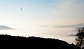 Balloons over Grindleford - geograph.org.uk - 592796.jpg 640 × 378; 28 KB
-
 Bleaklow Hill - geograph.org.uk - 210616.jpg 640 × 480; 87 KB
-
 BoulsworthHill.jpg 1,607 × 1,200; 148 KB
-
 Canyards Hill - geograph.org.uk - 980163.jpg 640 × 480; 118 KB
-
 Chaotic jumble of rocks and gravel - geograph.org.uk - 506349.jpg 640 × 480; 202 KB
-
 Dean Brook - White Coppice Geology Trail - geograph.org.uk - 197174.jpg 640 × 480; 196 KB
-

-
 Garreg Lwyd from the south - geograph.org.uk - 1354814.jpg 640 × 480; 75 KB
-

-
 Ingleborough summit (7685).jpg 4,288 × 2,848; 6.28 MB
-
 Ingleborough summit (7688).jpg 4,288 × 2,848; 5.62 MB
-
 Ingleborough summit (7698).jpg 4,288 × 2,848; 5.25 MB
-
 Kirkby Malzeard Moor - geograph.org.uk - 1523301.jpg 640 × 480; 56 KB
-
 Limestone on the moor - geograph.org.uk - 1360710.jpg 640 × 480; 114 KB
-
 Little Almscliffe - geograph.org.uk - 1010051.jpg 640 × 480; 65 KB
-
 Little Cragg - Littledale - geograph.org.uk - 1711141.jpg 2,448 × 3,264; 1.7 MB
-

-
 Looking towards Harworth pit - geograph.org.uk - 1350430.jpg 640 × 480; 53 KB
-
 Luds Church - geograph.org.uk - 852024.jpg 640 × 479; 142 KB
-

-
 Millstone grit rock formation - geograph.org.uk - 1524306.jpg 640 × 480; 100 KB
-
 Millstone Grit Whelpstone Crag - geograph.org.uk - 1704698.jpg 1,909 × 1,273; 1.3 MB
-
 Near Botton Crag - geograph.org.uk - 770639.jpg 640 × 480; 95 KB
-
 Oak growing on rocks, Brimham Rocks - geograph.org.uk - 441882.jpg 427 × 640; 370 KB
-

-
 One of the Twynau Gwynion - geograph.org.uk - 933153.jpg 640 × 480; 120 KB
-
 Outcrop above Widdop Reservoir dam - geograph.org.uk - 269700.jpg 480 × 640; 120 KB
-
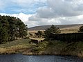
 Pasture and moor at Fellbeck - geograph.org.uk - 977357.jpg 640 × 480; 66 KB
-
 Pennine Way, rocks on Kinder Scout, Peak District, Derbyshire (8120100239).jpg 2,592 × 1,944; 1.46 MB
-
 Pennine Way, view from Kinder Scout, Peak District, Derbyshire (8120091031).jpg 2,592 × 1,944; 1.59 MB
-
 Pennine Way, view from Kinder Scout, Peak District, Derbyshire (8120110556).jpg 2,592 × 1,944; 1.33 MB
-
 Raven Scar with Ingleborough behind - geograph.org.uk - 26322.jpg 640 × 480; 73 KB
-

-

-
 Rocks in Chevin Country Park, Otley - geograph.org.uk - 177073.jpg 640 × 480; 136 KB
-
 Rocks on Kinder Scout plateau - geograph.org.uk - 2061358.jpg 2,048 × 1,536; 1.1 MB
-
 Rocks, Chevin Country Park, Otley - geograph.org.uk - 177631.jpg 640 × 480; 158 KB
-
 Saith Maen - Pedwar - geograph.org.uk - 913450.jpg 480 × 640; 125 KB
-
 Saith Maen - Saith - geograph.org.uk - 913457.jpg 480 × 640; 97 KB
-
 Sgwd yr Eira, Afon Hepste.jpg 1,280 × 960; 343 KB
-

-
 Slopes of Mow Cop - geograph.org.uk - 641569.jpg 640 × 480; 132 KB
-
 The Cuckoo Stone, Erringden - geograph.org.uk - 1521984.jpg 640 × 480; 141 KB
-
 The faces on Kinder - geograph.org.uk - 1830899.jpg 640 × 428; 76 KB
-
 The Quarterly journal of the Geological Society of London (13936854901).jpg 1,201 × 2,100; 636 KB
-
 The Stone Table^ - geograph.org.uk - 1824703.jpg 3,872 × 2,592; 4.14 MB
-
 Tree clinging to Millstone Grit - geograph.org.uk - 426757.jpg 640 × 480; 146 KB
-
 Tree Tops - geograph.org.uk - 1024411.jpg 640 × 480; 106 KB
-
 Trig Pillar Wolfhole Crag - geograph.org.uk - 113974.jpg 640 × 480; 115 KB
-
 Trig point at Whelpstone Crag - geograph.org.uk - 1704723.jpg 1,909 × 1,273; 1.29 MB
-
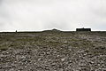
 Trig point, Capplestone Gate - geograph.org.uk - 1760172.jpg 4,000 × 3,000; 2.89 MB
-
 Waterfall in Cwm Dyar - geograph.org.uk - 1174713.jpg 480 × 640; 131 KB
-
 Windgate Edge - geograph.org.uk - 199550.jpg 640 × 480; 107 KB
-
 Church Street in Honley - geograph.org.uk - 31236.jpg 640 × 480; 79 KB
-
 Elland Edge Escarpment - geograph.org.uk - 693044.jpg 640 × 427; 73 KB
-
 Millstone Grit, Clougha - geograph.org.uk - 348537.jpg 640 × 480; 99 KB
-
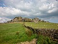
 Stanage Edge - geograph.org.uk - 7262.jpg 640 × 480; 143 KB
-


.jpg)
.jpg)
.jpg)


.jpg)
.jpg)
.jpg)


.jpg)


Categories:
- Geologic groups of the United Kingdom
- Carboniferous formations in England
- Sandstone formations in England
- Carboniferous sedimentary rocks in the United Kingdom
- Geologic groups of England
- Geology of the Lake District
- Geologic formations of Ireland
- Mudstone formations in the United Kingdom
- Siltstone formations in the United Kingdom
- Derbyshire Dome
- Carboniferous sedimentary rocks in England
- Fossil bearing geologic formations in the United Kingdom
- Marros Group