Category:Mills in West Yorkshire
Jump to navigation
Jump to search
Subcategories
This category has the following 11 subcategories, out of 11 total.
Media in category "Mills in West Yorkshire"
The following 82 files are in this category, out of 82 total.
-
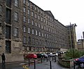 A Mill - Dean Clough - geograph.org.uk - 606733.jpg 640 × 521; 43 KB
-
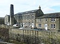
 Acre Mills, Lindley - geograph.org.uk - 34354.jpg 640 × 263; 170 KB
-
 Albion Mills - geograph.org.uk - 24291.jpg 640 × 480; 102 KB
-
 Albion Mills, Brook Lane, Golcar - geograph.org.uk - 486434.jpg 640 × 427; 75 KB
-
 Anchor Mills and River Calder - geograph.org.uk - 440209.jpg 427 × 640; 132 KB
-
 Barncliffe Mills, Shepley - geograph.org.uk - 786954.jpg 640 × 480; 93 KB
-
 Bath Mills and albert Mills, Lockwood - geograph.org.uk - 702092.jpg 640 × 416; 69 KB
-
 Block, Nortonthorpe Mills.jpg 2,000 × 1,428; 902 KB
-
 Bottoms Mills - Bradford Road - geograph.org.uk - 690750.jpg 640 × 480; 60 KB
-

-
 Burdett Mill - geograph.org.uk - 738289.jpg 432 × 640; 106 KB
-
 Calder bank mills, Dewsbury - geograph.org.uk - 772037.jpg 640 × 410; 70 KB
-
 Calderbank Mills, Dewsbury - geograph.org.uk - 775343.jpg 418 × 640; 45 KB
-
 Converted Mill - Bottoms - geograph.org.uk - 736642.jpg 518 × 640; 81 KB
-
 Corporation Mill, Sowerby Bridge - geograph.org.uk - 696116.jpg 640 × 622; 102 KB
-
 Croft Street, Dewsbury - geograph.org.uk - 230177.jpg 480 × 640; 70 KB
-
 Deighton Mill - geograph.org.uk - 737959.jpg 480 × 640; 69 KB
-
 Disused Mill - Pool Road - geograph.org.uk - 1408468.jpg 640 × 480; 220 KB
-
 Dunkirk Mill, Oxenhope.jpg 2,000 × 1,474; 904 KB
-
 Exchange Mill.jpg 480 × 640; 90 KB
-

-

-
 Former Walkley's Clogs - geograph.org.uk - 158208.jpg 640 × 423; 95 KB
-
 Gatehead Mill, Stainland - geograph.org.uk - 721408.jpg 480 × 640; 110 KB
-
 Gatehead Mill, Stainland - geograph.org.uk - 721419.jpg 640 × 480; 102 KB
-
 George Street Mills - geograph.org.uk - 625068.jpg 413 × 640; 56 KB
-
 George Street Mills - geograph.org.uk - 641065.jpg 425 × 640; 64 KB
-
 George Street Mills, Milnsbridge - geograph.org.uk - 145077.jpg 640 × 405; 104 KB
-
 Globe Mill, Slaithwaite - geograph.org.uk - 625109.jpg 640 × 434; 97 KB
-
 Golcar Mills - geograph.org.uk - 169174.jpg 640 × 479; 89 KB
-
 Goose Eye Mill - geograph.org.uk - 57361.jpg 640 × 480; 151 KB
-
 Green Lane Mill, Cartworth - geograph.org.uk - 1603604.jpg 640 × 480; 130 KB
-
 Hare Park Mills, Liversedge - geograph.org.uk - 247916.jpg 640 × 474; 75 KB
-
 Hollins Mill - geograph.org.uk - 1355051.jpg 640 × 480; 92 KB
-
 Holme Mill, Golcar - geograph.org.uk - 625139.jpg 640 × 433; 66 KB
-
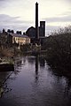
 Hunslet Mills and the River Aire. - geograph.org.uk - 57132.jpg 640 × 480; 82 KB
-
 Interior, Derelict Mill, Becks Road - geograph.org.uk - 814102.jpg 1,024 × 683; 247 KB
-
 Interior, Derelict Mill, Becks Road - geograph.org.uk - 814104.jpg 1,024 × 683; 177 KB
-
 Interior, Derelict Mill, Becks Road - geograph.org.uk - 814106.jpg 1,024 × 683; 182 KB
-
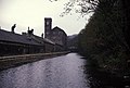
 Leeds and Liverpool Canal, Dock Lane, Shipley - geograph.org.uk - 1737814.jpg 3,072 × 2,304; 4.42 MB
-

-
 Lumbutts village - geograph.org.uk - 661665.jpg 640 × 535; 63 KB
-
 Mill building, Waingate, Linthwaite - geograph.org.uk - 496041.jpg 640 × 474; 93 KB
-

-

-
 Mill tower, Albert Street, Lockwood - geograph.org.uk - 259563.jpg 500 × 640; 70 KB
-
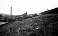
 Mills and Railway, Cornholme - geograph.org.uk - 81752.jpg 480 × 640; 77 KB
-

-

-
 Mills on Britannia Road, Golcar - geograph.org.uk - 494064.jpg 640 × 414; 95 KB
-
 Mills on the A644 - geograph.org.uk - 54953.jpg 640 × 480; 113 KB
-
 New Houses, Old Mill - geograph.org.uk - 81760.jpg 640 × 480; 114 KB
-
 New Mill, Scammonden - geograph.org.uk - 691051.jpg 640 × 464; 141 KB
-
 North Dean Mill, West Vale - geograph.org.uk - 1478358.jpg 640 × 480; 98 KB
-
 Norwood Green Mill - geograph.org.uk - 379835.jpg 640 × 389; 104 KB
-
 Nutclough Mill - geograph.org.uk - 1325310.jpg 640 × 480; 80 KB
-
 Nutclough Mill - Victoria Road - geograph.org.uk - 1142396.jpg 640 × 431; 257 KB
-
 Pool paper mill - geograph.org.uk - 42278.jpg 640 × 480; 101 KB
-
 Pool Paper Mill - geograph.org.uk - 753979.jpg 640 × 395; 79 KB
-
 Prospect Mill, West Vale - geograph.org.uk - 1478349.jpg 640 × 480; 86 KB
-
 Prospect Mills Cleckheaton.jpg 640 × 468; 73 KB
-

-
 Ramp at Gatehead Mill, Stainland - geograph.org.uk - 721426.jpg 640 × 480; 112 KB
-

-
 Springhead Mills, Oakworth - geograph.org.uk - 94764.jpg 640 × 480; 92 KB
-

-
 Thornhill Edge from the ruins of Mug Mill - geograph.org.uk - 137031.jpg 640 × 480; 105 KB
-
 Town Ing Mills, Stainland - geograph.org.uk - 585392.jpg 640 × 419; 73 KB
-
 Vale Mills.jpg 640 × 427; 111 KB
-
 Victoria Mills - Knowler Hill - geograph.org.uk - 705783.jpg 640 × 480; 62 KB
-

-

-
 Wildspur Mills - geograph.org.uk - 320739.jpg 640 × 422; 86 KB
-
 Yew Tree Mill, Holme Valley.jpg 512 × 640; 75 KB
-
 Armitage Bridge Mills - geograph.org.uk - 489370.jpg 640 × 399; 54 KB
-
 Bowers Mill - geograph.org.uk - 1451385.jpg 640 × 480; 72 KB
-
 Burrwood Court - geograph.org.uk - 1451359.jpg 375 × 500; 84 KB
-

-
 Croft Mill off Northgate, Almondbury - geograph.org.uk - 731371.jpg 575 × 640; 95 KB
-
 Frostholme Mill - Burnley Road - geograph.org.uk - 540340.jpg 640 × 456; 55 KB
-
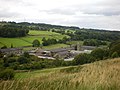
 Low Bradley - geograph.org.uk - 319951.jpg 422 × 640; 72 KB
-
 Mill - Pudsey Road - geograph.org.uk - 540339.jpg 483 × 640; 49 KB


_-_geograph.org.uk_-_132883.jpg)


,_Oakes,_Lindley_cum_Quarmby_(near_Huddersfield)_-_geograph.org.uk_-_338687.jpg)


