Category:Millersneuk
Jump to navigation
Jump to search
Millersneuk lies to the south of Lenzie, Kirkintilloch, East Dunbartonshire.
Media in category "Millersneuk"
The following 10 files are in this category, out of 10 total.
-
 BP station, Lenzie - geograph.org.uk - 1476173.jpg 640 × 480; 120 KB
-
 Crosshill Road, Lenzie - geograph.org.uk - 1476160.jpg 640 × 480; 140 KB
-
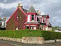 Lenzie Townhouse - geograph.org.uk - 57754.jpg 640 × 480; 157 KB
-
 Lindsaybeg Road - geograph.org.uk - 1476188.jpg 640 × 480; 139 KB
-
 Low bridge approaching - geograph.org.uk - 1473870.jpg 640 × 480; 153 KB
-
 Millersneuk Railway Bridge - geograph.org.uk - 441350.jpg 640 × 480; 142 KB
-
 Private road and mini-roundabout - geograph.org.uk - 1476198.jpg 640 × 480; 155 KB
-
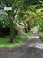 Private road to Lenzie Tennis Club - geograph.org.uk - 1476185.jpg 480 × 640; 199 KB
-
 Small burn in Millersneuk, Kirkintilloch - geograph.org.uk - 1476204.jpg 640 × 480; 183 KB
-
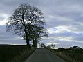 The Road to Blacklands - geograph.org.uk - 128746.jpg 640 × 480; 73 KB


