Category:Millerd's Map of Bristol
Jump to navigation
Jump to search
English: Millerd's map of Bristol was printed in 1673
Media in category "Millerd's Map of Bristol"
The following 14 files are in this category, out of 14 total.
-
 Bristol Castle South Prospect.jpg 2,080 × 3,632; 2.55 MB
-
 BristolCastle.jpg 261 × 496; 51 KB
-
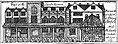
 Corn Market, Wine Street from Millerd's Map.jpg 1,070 × 437; 208 KB
-
 Custom House on the Back from Millerd's Map.jpg 2,208 × 3,664; 2.45 MB
-
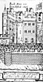
 Great Gatehouse from Millerd's Map of Bristol.jpg 2,080 × 4,384; 2.87 MB
-
 Great House Bristol.jpg 4,349 × 2,216; 3.15 MB
-
 Guild Hall Broad Street from Millerd's Map of Bristol.jpg 3,504 × 2,008; 2.77 MB
-
 Mediaeval town of Bristol.jpg 1,540 × 1,324; 926 KB
-
 Merchant's Tolzey, Bristol from Millerd's Map.jpg 1,159 × 429; 225 KB
-
 Millerd Map of Bristol.jpg 5,931 × 5,365; 4.6 MB
-
 Millerd's Map of Bristol.jpg 5,918 × 5,566; 10.36 MB
-
 Millerd1728dcastle.jpg 1,363 × 2,545; 2.37 MB
-
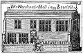 Old Merchant's Hall from Millerd's Map of Bristol.jpg 3,040 × 2,000; 2.13 MB
-
 Roger's House from Millerd's Map of Bristol.jpg 1,952 × 3,584; 2.35 MB


