Category:Milford on Sea
Jump to navigation
Jump to search
village in Hampshire, England  | |||||
| Upload media | |||||
| Instance of | |||||
|---|---|---|---|---|---|
| Location | Milford-on-Sea, New Forest, Hampshire, South East England, England | ||||
| official website | |||||
 | |||||
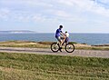
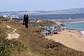
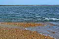
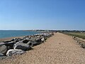
English: The large village of Milford on Sea on the south coast of England in the county of Hampshire. With a population of approximately 5,000, it has hotels, restaurants, cafés, tea rooms, small shops and scattered pubs across its broader parish. Many are close to its small high street, which fronts a village green. Its green cliffs fade to the east into nothing; in the west served by flights of steps and have car parks, which, along with many flats, have close views of the Needles, which are the main, large chalk rocks immediately next to the Isle of Wight and the most significant offshore rocks rising above the waterline from this point until the far, northern county of Yorkshire heading anti-clockwise round the coast. In summer the population is particularly increased by tourists, across a panoply of accommodation. In the east its land is known as Keyhaven, which itself is from north to south: Keyhaven and Pennington Marshes, a pub-served hamlet almost surrounded by harbour/lagoon and Hurst Spit which contains Hurst Castle both facing the Isle of Wight. Do not place any of those photographs directly in this head category.
Subcategories
This category has the following 14 subcategories, out of 14 total.
A
- All Saints, Milford on Sea (104 F)
D
- Downton, Hampshire (35 F)
K
L
- Lymore Ford (2 F)
M
- Milford on Sea Baptist Church (16 F)
- Milford on Sea LNR (2 F)
P
R
- Red Lion pub, Milford on Sea (3 F)
S
- Sturt Pond (16 F)
Media in category "Milford on Sea"
The following 200 files are in this category, out of 538 total.
(previous page) (next page)-
 "Love Lane" - geograph.org.uk - 2753250.jpg 1,024 × 768; 1.19 MB
-

-
 "Woodland View" - geograph.org.uk - 2752894.jpg 1,024 × 675; 851 KB
-
 "Woodland View" - geograph.org.uk - 2753013.jpg 1,024 × 705; 870 KB
-
 A boat leaving Keyhaven - geograph.org.uk - 4375208.jpg 1,500 × 999; 120 KB
-
 A Light for the night - geograph.org.uk - 4259337.jpg 3,632 × 2,024; 2.55 MB
-
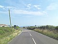
 A337 Christchurch Road - geograph.org.uk - 3734931.jpg 800 × 450; 220 KB
-
 A337 junction with Barnes Lane - geograph.org.uk - 3015043.jpg 800 × 600; 385 KB
-
 All Saints Church, Milford on Sea - geograph.org.uk - 5917549.jpg 1,024 × 683; 184 KB
-
 All Saints' church hall, Milford on Sea - geograph.org.uk - 5332442.jpg 1,600 × 1,200; 769 KB
-
 All Saints' church, Milford on Sea - geograph.org.uk - 5332424.jpg 1,600 × 1,200; 946 KB
-

-
 Approaching Hurst Castle - geograph.org.uk - 5611502.jpg 800 × 600; 103 KB
-
 Aubrey Farm - geograph.org.uk - 2706568.jpg 1,024 × 625; 714 KB
-
 B3058 enters Milford-on-Sea - geograph.org.uk - 3642866.jpg 3,489 × 2,608; 1.17 MB
-
 B3058 northwest of Rook Cliff - geograph.org.uk - 3642912.jpg 3,648 × 2,736; 1.68 MB
-
 B3058 passes The Bay Tree - geograph.org.uk - 3642935.jpg 3,492 × 2,315; 1.01 MB
-
 B3058 temporary traffic-lights southwest of Lymore Farm - geograph.org.uk - 3642967.jpg 3,648 × 2,736; 2.57 MB
-

-
 Beach and sea defences by Hurst Castle - geograph.org.uk - 4448621.jpg 1,500 × 999; 206 KB
-
 Beach and sea defences by Hurst Castle - geograph.org.uk - 4448624.jpg 1,500 × 999; 211 KB
-
 Beach at Milford on Sea - geograph.org.uk - 5084840.jpg 640 × 427; 95 KB
-
 Beach beside Sturt Pond - geograph.org.uk - 5917545.jpg 1,024 × 683; 251 KB
-
 Beach Car Park Scene - geograph.org.uk - 5461603.jpg 800 × 600; 87 KB
-
 Beach hut at Milford on Sea - geograph.org.uk - 3458188.jpg 962 × 1,500; 152 KB
-
 Beach Huts - geograph.org.uk - 4788169.jpg 640 × 480; 70 KB
-
 Beach huts at Milford - geograph.org.uk - 6391256.jpg 1,024 × 768; 535 KB
-
 Beach huts at Milford on Sea - geograph.org.uk - 5749388.jpg 2,700 × 1,977; 711 KB
-
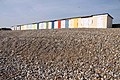 Beach Huts at Milford-on-Sea - geograph.org.uk - 1225259.jpg 640 × 427; 114 KB
-
 Beach huts below Hordle Cliff - geograph.org.uk - 3458169.jpg 1,500 × 981; 223 KB
-
 Beach huts near Milford on Sea, Hampshire, England.jpg 3,924 × 2,896; 3.8 MB
-
 Beach Huts, Milford on Sea. - panoramio.jpg 3,648 × 2,736; 2.51 MB
-
 Beach View - geograph.org.uk - 5461599.jpg 591 × 800; 149 KB
-
 Bench View - geograph.org.uk - 5461615.jpg 800 × 587; 123 KB
-
 Blandford Court - geograph.org.uk - 2753241.jpg 1,024 × 494; 467 KB
-
 Blocks of Flats at Hordle Cliff - geograph.org.uk - 2651632.jpg 640 × 364; 207 KB
-
 Blue skies over the sea - geograph.org.uk - 4122391.jpg 1,500 × 983; 172 KB
-
 Boat detail, Keyhaven Harbour - geograph.org.uk - 4293539.jpg 640 × 427; 104 KB
-

-
-
 Boats in Mount Lake - geograph.org.uk - 4453251.jpg 1,500 × 999; 145 KB
-
 Boats moored in Mount Lake - geograph.org.uk - 5917572.jpg 1,024 × 683; 192 KB
-
 Boatyard Keyhaven - geograph.org.uk - 4788209.jpg 640 × 480; 48 KB
-
 Braxton Courtyard and postbox - geograph.org.uk - 3429808.jpg 640 × 451; 77 KB
-
 Braxton Gardens - geograph.org.uk - 4034212.jpg 1,024 × 768; 234 KB
-
 Braxton Gardens and Tea Room - geograph.org.uk - 3002381.jpg 1,024 × 683; 838 KB
-
 Bridge over Danes Stream - geograph.org.uk - 2751306.jpg 1,024 × 698; 929 KB
-
 Bridge View - geograph.org.uk - 6283667.jpg 800 × 600; 90 KB
-
 Broken notice - geograph.org.uk - 2217942.jpg 640 × 427; 69 KB
-
 Cagiva Mito Evo.png 600 × 489; 463 KB
-
 Car park for the Smugglers inn, Milford on Sea - geograph.org.uk - 5332472.jpg 1,600 × 1,200; 820 KB
-
 Car park on Cliff Road, Milford on Sea - geograph.org.uk - 5332500.jpg 1,600 × 910; 499 KB
-
 Carrington Farm House - geograph.org.uk - 2426462.jpg 640 × 427; 261 KB
-
 Carrington Lane, Milford on Sea - geograph.org.uk - 2426429.jpg 640 × 422; 281 KB
-
 Castle Walk - geograph.org.uk - 6284244.jpg 800 × 600; 124 KB
-
 Chalets at Woodland View - geograph.org.uk - 2753030.jpg 1,024 × 650; 618 KB
-
 Chip shop in Milford-on-Sea - geograph.org.uk - 5874633.jpg 640 × 480; 59 KB
-
 Christchurch Road just west of Downton - geograph.org.uk - 6150405.jpg 1,024 × 683; 311 KB
-
 Cliff Path - geograph.org.uk - 4788228.jpg 640 × 480; 71 KB
-
 Cliff Path - geograph.org.uk - 5461591.jpg 800 × 588; 120 KB
-
 Cliff Path View - geograph.org.uk - 5461044.jpg 800 × 600; 136 KB
-
 Cliff Road Flats - geograph.org.uk - 5461587.jpg 800 × 600; 118 KB
-
 Cliff Scene - geograph.org.uk - 5461582.jpg 800 × 600; 117 KB
-
 Cliff Signs - geograph.org.uk - 5461608.jpg 800 × 589; 132 KB
-
 Cliff-top path, Hordle Cliff - geograph.org.uk - 1430889.jpg 640 × 427; 104 KB
-
 Clifftop apartments, Milford on Sea - geograph.org.uk - 5917562.jpg 1,024 × 683; 199 KB
-
 Clifftops - Milford on Sea - geograph.org.uk - 3617659.jpg 2,368 × 1,024; 750 KB
-
 Clliff Road approaches junction with Downton Lane - geograph.org.uk - 3642849.jpg 3,648 × 2,736; 1.54 MB
-

-

-
 Coastal view at Milford on Sea - geograph.org.uk - 3457671.jpg 1,500 × 1,000; 288 KB
-
 Coastline near Milford on Sea, Hampshire, England (2).jpg 3,978 × 2,972; 3.76 MB
-
 Coastline near Milford on Sea, Hampshire, England.jpg 3,970 × 2,958; 4.25 MB
-
 Coat of Arms on Hurst Castle - geograph.org.uk - 4453194.jpg 1,500 × 1,044; 226 KB
-
 Colourful beach hut, Milford - geograph.org.uk - 2807801.jpg 2,336 × 1,559; 695 KB
-
 Commercial Green House - geograph.org.uk - 2753146.jpg 1,024 × 554; 664 KB
-
 Continuation of West Road - geograph.org.uk - 2753004.jpg 1,024 × 658; 660 KB
-
 Copse at Vidle Van Farm - geograph.org.uk - 2706483.jpg 1,024 × 684; 755 KB
-
 Cottages at Braxton on Lymore Lane - geograph.org.uk - 3429803.jpg 640 × 421; 110 KB
-

-
 Danes Stream - geograph.org.uk - 2753065.jpg 1,024 × 709; 1.14 MB
-
 Danes Stream at Shorefield Park - geograph.org.uk - 2752904.jpg 1,024 × 768; 1.31 MB
-
 Decayed jetty - geograph.org.uk - 6551180.jpg 1,600 × 1,067; 182 KB
-
 Deer in a field near Keyhaven - geograph.org.uk - 5876887.jpg 640 × 480; 89 KB
-

-
 Door at Hurst Point Lighthouse - geograph.org.uk - 2213821.jpg 427 × 640; 33 KB
-
 Downton , Christchurch Road A337 - geograph.org.uk - 5733724.jpg 6,000 × 4,000; 7.28 MB
-
 Downton , Downton Lane - geograph.org.uk - 5734474.jpg 6,000 × 4,000; 7.48 MB
-
 Downton , Hordle Lane - geograph.org.uk - 5733726.jpg 6,000 × 4,000; 6.34 MB
-
 Downton , The Old Barn - geograph.org.uk - 5733728.jpg 6,000 × 4,000; 6.29 MB
-
 Downton Lane - geograph.org.uk - 5456506.jpg 800 × 600; 156 KB
-
 Downton Lane Junction - geograph.org.uk - 5452087.jpg 800 × 600; 90 KB
-
 Downton, footpath - geograph.org.uk - 1752631.jpg 800 × 600; 205 KB
-
 Downton, Lymington SO41, UK - panoramio.jpg 2,048 × 1,536; 502 KB
-
 Eastern tip of Hurst Spit - geograph.org.uk - 5917996.jpg 1,024 × 683; 222 KB
-
 Efford, footbridge - geograph.org.uk - 2744174.jpg 1,024 × 768; 345 KB
-
 Entrance to Braxton Gardens and Tea Room - geograph.org.uk - 3002378.jpg 1,024 × 654; 735 KB
-
 Erosion at Hordle Cliffs - geograph.org.uk - 2751262.jpg 1,024 × 768; 869 KB
-
 Everton , Christchurch Road A377 - geograph.org.uk - 5733740.jpg 6,000 × 4,000; 6.33 MB
-
 Everton , Grassy Field ^ Gate - geograph.org.uk - 5734469.jpg 5,537 × 3,692; 6.73 MB
-
 Ferry Queue - geograph.org.uk - 6284108.jpg 800 × 600; 120 KB
-
 Field at Manor Road - geograph.org.uk - 2753151.jpg 1,024 × 604; 598 KB
-
 Field with Bean Crops - geograph.org.uk - 2426347.jpg 640 × 480; 409 KB
-
 Fishing on Hurst Beach - geograph.org.uk - 4448595.jpg 1,500 × 999; 262 KB
-
 Flood Gate at Saltgrass Lane - geograph.org.uk - 6347334.jpg 800 × 534; 326 KB
-
 Flooded Saltgrass Lane - geograph.org.uk - 4375211.jpg 1,500 × 999; 146 KB
-
 Flooded Saltgrass Lane - geograph.org.uk - 4375214.jpg 1,500 × 999; 168 KB
-

-
 Footbridge over Danes Stream - geograph.org.uk - 2752901.jpg 1,024 × 710; 1.07 MB
-
 Footbridge over Danes Stream - geograph.org.uk - 2753053.jpg 1,024 × 720; 1.03 MB
-
 Footbridge over Danes Stream - geograph.org.uk - 3048633.jpg 640 × 480; 118 KB
-
 Footbridge over Danes Stream - geograph.org.uk - 4293514.jpg 640 × 427; 75 KB
-
 Footbridge over Danes Stream - geograph.org.uk - 4453253.jpg 1,500 × 951; 164 KB
-
 Footbridge over the outlet of Sturt Pond - geograph.org.uk - 5917539.jpg 1,024 × 683; 204 KB
-
 Footbridge over the stream - geograph.org.uk - 2714690.jpg 1,500 × 1,000; 253 KB
-
 Footbridge over the stream - geograph.org.uk - 2714708.jpg 1,500 × 987; 235 KB
-
 Footbridge Scene - geograph.org.uk - 6283675.jpg 800 × 600; 140 KB
-
 Footbridge to Hurst Beach - geograph.org.uk - 6550599.jpg 1,600 × 1,067; 359 KB
-
 Footpath across the Reed Beds - geograph.org.uk - 2706602.jpg 1,024 × 684; 835 KB
-
 Footpath at Milford on Sea - geograph.org.uk - 2426324.jpg 640 × 480; 398 KB
-
 Footpath at Milford on Sea - geograph.org.uk - 2426367.jpg 640 × 480; 357 KB
-
 Footpath at Milford on Sea - geograph.org.uk - 2426377.jpg 640 × 480; 381 KB
-

-
 Footpath Entrance - geograph.org.uk - 3425789.jpg 1,024 × 683; 1.22 MB
-
 Footpath in nature reserve, Milford on Sea - geograph.org.uk - 5917558.jpg 1,024 × 683; 364 KB
-
 Footpath to Taddiford car park - geograph.org.uk - 1430909.jpg 480 × 640; 112 KB
-
 Ford at Lymore - geograph.org.uk - 5114558.jpg 1,440 × 960; 2.4 MB
-
 Ford at Shorefied Holiday Park - geograph.org.uk - 5114617.jpg 1,440 × 960; 2.35 MB
-
 Ford at Shorefield Holiday Park - geograph.org.uk - 5114600.jpg 1,440 × 960; 2.41 MB
-
 From the bridge over Avon Water - geograph.org.uk - 6550592.jpg 1,600 × 1,067; 456 KB
-
 Garage and estate agents, Milford on Sea - geograph.org.uk - 5332468.jpg 1,600 × 1,200; 764 KB
-
 Garden access path with signage - geograph.org.uk - 5876881.jpg 640 × 480; 96 KB
-
 Gates guarding entrance to Barnes Manor - geograph.org.uk - 356707.jpg 640 × 480; 137 KB
-

-
 High Street Milford - geograph.org.uk - 3429937.jpg 640 × 459; 68 KB
-
 High Street Scene - geograph.org.uk - 5461040.jpg 800 × 590; 92 KB
-
 High Street, Milford On Sea - geograph.org.uk - 2594428.jpg 4,000 × 3,000; 3.35 MB
-
 High Street, Milford on Sea, Hampshire, England.jpg 2,260 × 1,688; 1.45 MB
-
 Hordle Cliff - geograph.org.uk - 500052.jpg 640 × 430; 62 KB
-
 Hordle Cliff Car Park - geograph.org.uk - 2651569.jpg 640 × 427; 212 KB
-

-
 Houses in Milford-on-Sea - geograph.org.uk - 5872909.jpg 640 × 480; 86 KB
-
 Hurst Beach - geograph.org.uk - 4448581.jpg 1,500 × 999; 242 KB
-
 Hurst Beach - geograph.org.uk - 4448586.jpg 1,500 × 999; 264 KB
-
 Hurst Beach - geograph.org.uk - 4448590.jpg 1,500 × 999; 244 KB
-
 Hurst Beach - geograph.org.uk - 4650901.jpg 640 × 480; 104 KB
-
 Hurst Beach - geograph.org.uk - 4650907.jpg 640 × 480; 85 KB
-
 Hurst Beach - geograph.org.uk - 6347346.jpg 800 × 534; 402 KB
-
 Hurst Castle - geograph.org.uk - 3967027.jpg 1,024 × 634; 470 KB
-
 Hurst Castle - geograph.org.uk - 4626604.jpg 1,600 × 1,065; 345 KB
-
 Hurst Castle - geograph.org.uk - 5434243.jpg 640 × 480; 58 KB
-
 Hurst Castle - geograph.org.uk - 6193524.jpg 1,024 × 768; 186 KB
-
 Hurst Castle - geograph.org.uk - 6259538.jpg 1,024 × 768; 371 KB
-
 Hurst Castle and Spit - geograph.org.uk - 4425730.jpg 1,920 × 1,080; 456 KB
-
 Hurst Castle Ferry - geograph.org.uk - 3967033.jpg 1,024 × 692; 505 KB
-
 Hurst Castle Ferry Terminal - geograph.org.uk - 6193533.jpg 1,024 × 768; 230 KB
-
 Hurst Castle Ferry, Keyhaven - geograph.org.uk - 6192362.jpg 1,024 × 768; 200 KB
-

-
 Hurst Castle from Hurst Spit - geograph.org.uk - 4448602.jpg 1,500 × 999; 136 KB
-
 Hurst Castle lighthouse - geograph.org.uk - 4671032.jpg 1,024 × 740; 166 KB
-
 Hurst Castle View - geograph.org.uk - 6283749.jpg 800 × 600; 141 KB
-
 Hurst Castle, the ferry departs - geograph.org.uk - 3648444.jpg 640 × 480; 57 KB
-

-

-
 Hurst Castle, The Solent, Isle-of-Wight - geograph.org.uk - 4362964.jpg 3,008 × 2,000; 1.72 MB
-
 Hurst Castle, view over the harbour - geograph.org.uk - 3648223.jpg 640 × 480; 54 KB
-
 Hurst Lighthouse from Hurst Spit - geograph.org.uk - 4448614.jpg 1,500 × 999; 121 KB
-
 Hurst Point high lighthouse - geograph.org.uk - 4672241.jpg 1,024 × 768; 177 KB
-
 Hurst Point high lighthouse - geograph.org.uk - 5107528.jpg 640 × 480; 75 KB
-
 Hurst Point Lighthouse - geograph.org.uk - 4453219.jpg 999 × 1,500; 109 KB
-
 Hurst Point Lighthouse - geograph.org.uk - 4788174.jpg 640 × 480; 56 KB
-
 Hurst Point lighthouse - geograph.org.uk - 5917618.jpg 1,024 × 683; 142 KB
-
 Hurst Point lighthouse - geograph.org.uk - 5917621.jpg 683 × 1,024; 153 KB
-
 Hurst Point Lighthouse - geograph.org.uk - 6193532.jpg 1,024 × 768; 156 KB
-
 Hurst Point lighthouse and ferry - geograph.org.uk - 5917615.jpg 683 × 1,024; 122 KB
-
 Hurst Point Path - geograph.org.uk - 6283636.jpg 800 × 600; 127 KB
-
 Hurst Point Scene - geograph.org.uk - 6284229.jpg 800 × 600; 150 KB
-
 Hurst Ridge - geograph.org.uk - 6283694.jpg 800 × 600; 155 KB
-
 Hurst Spit - geograph.org.uk - 3936750.jpg 2,592 × 1,944; 1,018 KB
-
 Hurst Spit - geograph.org.uk - 3967173.jpg 1,024 × 666; 651 KB
-
 Hurst Spit - geograph.org.uk - 4453234.jpg 1,500 × 999; 249 KB
-
 Hurst Spit - geograph.org.uk - 5619039.jpg 2,848 × 2,144; 1.48 MB
-
 Hurst Spit - geograph.org.uk - 6193528.jpg 1,024 × 768; 197 KB
-
 Hurst Spit looking west - geograph.org.uk - 4453249.jpg 1,500 × 958; 268 KB
-
 Impressive brick chimneys, Milford on Sea - geograph.org.uk - 5332453.jpg 1,600 × 1,200; 782 KB
-
 In the churchyard of All Saints, Milford on Sea - geograph.org.uk - 5917551.jpg 1,024 × 683; 209 KB
-
 Inner Court Yard, Hurst Castle - geograph.org.uk - 3967156.jpg 1,024 × 685; 694 KB
-
 Inner Courtyard, Hurst Castle - geograph.org.uk - 3967160.jpg 1,024 × 768; 756 KB
-
 Isle of Wight - geograph.org.uk - 5611500.jpg 800 × 600; 101 KB
-
 Jetty and Inlet at Hurst Castle - geograph.org.uk - 3967164.jpg 1,024 × 691; 653 KB
-
 Jetty in Avon Water - geograph.org.uk - 6391252.jpg 1,024 × 768; 336 KB
-
 Junction in Lymore Lane - geograph.org.uk - 5918203.jpg 1,024 × 683; 296 KB
-
 Junction View - geograph.org.uk - 5452121.jpg 800 × 600; 90 KB
-
 Keyhaven Cross - geograph.org.uk - 5456511.jpg 600 × 800; 95 KB
-
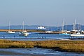
 Keyhaven Harbour - geograph.org.uk - 4125003.jpg 1,500 × 999; 142 KB
-
 Keyhaven Harbour - geograph.org.uk - 4125006.jpg 1,500 × 999; 130 KB
-
 Keyhaven Harbour - geograph.org.uk - 4293486.jpg 640 × 427; 65 KB
-
 Keyhaven harbour - geograph.org.uk - 4375207.jpg 1,500 × 999; 189 KB
-
 Keyhaven Lake - geograph.org.uk - 3617671.jpg 3,264 × 2,448; 1.4 MB
-
 Keyhaven Lake - geograph.org.uk - 6192372.jpg 1,024 × 768; 140 KB


.jpg)


