Category:Milford, County Armagh
Jump to navigation
Jump to search
village in County Armagh, Northern Ireland | |||||
| Upload media | |||||
| Instance of | |||||
|---|---|---|---|---|---|
| Location | Northern Ireland | ||||
 | |||||
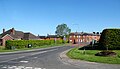
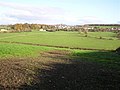
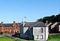
English: Milford , is a small village in County Armagh, Northern Ireland, one mile from Armagh city. It grew up around the linen mill owned by the McCrum family in the 19th century. It had a population of 301 in the 2001 Census. It is situated in the Armagh City and District Council area.
( (Áth an Mhuilinn) )
Media in category "Milford, County Armagh"
The following 24 files are in this category, out of 24 total.
-
 Baltarran Road, Milford - geograph.org.uk - 5181164.jpg 2,412 × 1,808; 1.18 MB
-
 Baltarran Road, Milford - geograph.org.uk - 5260334.jpg 2,448 × 1,869; 920 KB
-
 Bungalow on Magheraville Road, Milford - geograph.org.uk - 5263269.jpg 3,352 × 1,972; 1.12 MB
-
 Bus shelter on the Monaghan Road at Milford - geograph.org.uk - 5260055.jpg 4,000 × 3,000; 2.67 MB
-
 Bus stop and shelter on the A3 at Milford - geograph.org.uk - 5180821.jpg 2,578 × 1,528; 1,023 KB
-
 Drumlin landscape between the Monaghan and Killylea roads - geograph.org.uk - 5180654.jpg 4,000 × 3,000; 1.88 MB
-
 Drumlin topography north of the Monaghan Road at Milford - geograph.org.uk - 5260050.jpg 3,668 × 1,826; 773 KB
-
 Farmland north of the A3 at Milford - geograph.org.uk - 5180680.jpg 3,871 × 2,903; 1.65 MB
-
 Farmland on the north side of the Monaghan Road - geograph.org.uk - 5180631.jpg 3,953 × 2,965; 1.75 MB
-
 Flush Bracket, Milford - geograph.org.uk - 5059347.jpg 640 × 640; 257 KB
-
 Former mill workers' cottages at Milford - geograph.org.uk - 5263090.jpg 3,729 × 1,861; 1.32 MB
-
 Former parkland on the outskirts of Milford - geograph.org.uk - 5263283.jpg 3,660 × 1,796; 1,011 KB
-
 Houses in Annee's Terrace, Milford - geograph.org.uk - 5263203.jpg 3,834 × 2,219; 1.5 MB
-
 Milford Orange Hall, County Armagh - geograph-5059333.jpg 640 × 478; 77 KB
-
 Milford Townland - geograph.org.uk - 606923.jpg 640 × 479; 57 KB
-
 Milford, County Armagh - geograph.org.uk - 606930.jpg 640 × 479; 79 KB
-

-
 Road leading from the A3 to the village of Milford - geograph.org.uk - 5263205.jpg 2,000 × 1,694; 841 KB
-
 Shelter belt on farmland between Milford and Armagh - geograph.org.uk - 5260046.jpg 3,606 × 2,012; 1.13 MB
-
 Soccer field at Milford - geograph.org.uk - 5263195.jpg 3,034 × 1,599; 857 KB
-
 The rear of Milford Orange Hall, County Armagh - geograph-5263179.jpg 2,188 × 1,488; 655 KB
-

-
 Wet land west of the A3 at Milford - geograph.org.uk - 5181157.jpg 3,498 × 2,624; 1.43 MB
-
 Wetland alongside the A3 (Monaghan Road) - geograph.org.uk - 5260324.jpg 3,767 × 1,971; 1.09 MB


_-_geograph.org.uk_-_5260357.jpg)

_-_geograph.org.uk_-_5260324.jpg)