
Category:Milbertshofen-Am Hart
borough of Munich   | |||||
| Upload media | |||||
| Instance of | |||||
|---|---|---|---|---|---|
| Named after | |||||
| Location | Munich, Upper Bavaria, Bavaria, Germany | ||||
| Population |
| ||||
| Area |
| ||||
| Elevation above sea level |
| ||||
| official website | |||||
 | |||||
Subcategories
This category has the following 10 subcategories, out of 10 total.
!
A
O
Media in category "Milbertshofen-Am Hart"
The following 10 files are in this category, out of 10 total.
-
 Abschlußprüfung zum Fleischbeschauer .jpg 4,128 × 2,322; 4.62 MB
-
 BMW FIZ.jpg 4,032 × 3,024; 6.4 MB
-
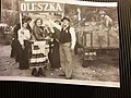
 Hochzeit in Oleszka .jpg 4,128 × 2,322; 3.83 MB
-
 Hochzeit in Oleszka 1914.jpg 4,128 × 2,322; 3.88 MB
-
 München - Spiridon-Louis-Ring.jpg 5,184 × 3,456; 9.69 MB
-
 München - Stadtbezirk 11 (Karte) - Milbertshofen - Am Hart.png 328 × 739; 38 KB
-
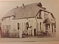 Oleszka .jpg 4,128 × 3,096; 3.73 MB
-
 Oleszka.jpg 4,128 × 3,096; 4.46 MB
-
 Oma mit Enkelkindern .jpg 4,128 × 2,322; 3.29 MB
-
 Onkel Ferdinand .jpg 2,322 × 4,128; 3.59 MB


_-_Milbertshofen_-_Am_Hart.png)


