Category:Middletown, County Armagh
Jump to navigation
Jump to search
village in County Armagh, Northern Ireland | |||||
| Upload media | |||||
| Instance of | |||||
|---|---|---|---|---|---|
| Location | Northern Ireland | ||||
| Different from |
| ||||
 | |||||
English: Middletown, historically known as Killecannagan , is a small village in County Armagh, Northern Ireland, two miles from Tynan and close to the border with County Monaghan. In the 2001 Census it had a population of 240 people. It is situated in the Armagh City and District Council area. The place name "Middletown" or "Coillidh Chanannáin" is also used to refer to the countryside surrounding the villages.
Media in category "Middletown, County Armagh"
The following 44 files are in this category, out of 44 total.
-
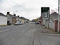
 A3 Main Street, Middleton - geograph.org.uk - 3191317.jpg 640 × 480; 55 KB
-
 Bench Mark, Middletown - geograph.org.uk - 4848088.jpg 640 × 640; 234 KB
-
 Bench Marks, Middletown - geograph.org.uk - 4848080.jpg 640 × 462; 152 KB
-

-
 Borderline Tiles at Middletown, Co Armagh - geograph.org.uk - 4985200.jpg 1,600 × 1,200; 285 KB
-
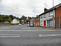
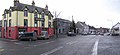
 Businesses on Main Street, Middletown - geograph.org.uk - 4985391.jpg 1,600 × 1,155; 464 KB
-
 Canal Court, Middletown, Co Armagh - geograph.org.uk - 4985148.jpg 1,600 × 1,200; 344 KB
-
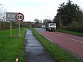
 Coolkill Road, Middletown - geograph.org.uk - 5181290.jpg 2,470 × 2,187; 748 KB
-
 Coolkill Road, Middletown - geograph.org.uk - 5181296.jpg 4,000 × 3,000; 2.34 MB
-
 Derelict house on Main Street in Middletown - geograph.org.uk - 4985290.jpg 1,600 × 1,200; 296 KB
-

-
 Dr Smith memorial panel (1) - geograph.org.uk - 3191243.jpg 640 × 480; 75 KB
-
 Dr Smith memorial panel (2) - geograph.org.uk - 3191247.jpg 640 × 480; 61 KB
-
 Dr Smith memorial panel (3) - geograph.org.uk - 3191251.jpg 640 × 480; 65 KB
-

-
 Flush Bracket, Middletown - geograph.org.uk - 4848086.jpg 640 × 640; 203 KB
-
 Former Market House, Middleton - geograph.org.uk - 3191227.jpg 640 × 480; 81 KB
-
 Hughes Bar, Middletown - geograph.org.uk - 3191349.jpg 640 × 480; 46 KB
-
 Lennons, Middleton - geograph.org.uk - 3191221.jpg 640 × 480; 62 KB
-

-
 Middletown GAA banner on Main Street - geograph.org.uk - 4985296.jpg 1,600 × 1,314; 354 KB
-
 Middletown Post Office - geograph.org.uk - 4837873.jpg 640 × 480; 109 KB
-
 Middletown, County Armagh - geograph.org.uk - 3191331.jpg 640 × 480; 47 KB
-
 Postbox, Middletown - geograph.org.uk - 4837881.jpg 548 × 640; 123 KB
-
 Religious notice, Middletown - geograph.org.uk - 3191337.jpg 640 × 480; 74 KB
-
 Road junction, Middletown - geograph.org.uk - 3191347.jpg 640 × 480; 48 KB
-
 Seat and plaque, Middletown - geograph.org.uk - 3191233.jpg 640 × 480; 87 KB
-
 Shops at Middletown - geograph.org.uk - 5177514.jpg 3,000 × 2,725; 1.55 MB
-
 Text on notice, Middletown - geograph.org.uk - 3191339.jpg 640 × 480; 53 KB
-
 The Coolkill Road junction on the A3 at Middletown - geograph.org.uk - 4985169.jpg 1,600 × 1,333; 489 KB
-
 The Post Office, Middletown, Co Armagh - geograph.org.uk - 5176818.jpg 2,839 × 3,785; 1.95 MB
-
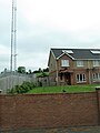 Transmitter mast on the western outskirts of Middletown - geograph.org.uk - 5181304.jpg 2,459 × 3,277; 1.12 MB
-
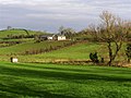
 Tynan Estate, Coolkill Road - geograph.org.uk - 1396716.jpg 640 × 480; 113 KB
-
 Clanickly Townland - geograph.org.uk - 628295.jpg 640 × 479; 52 KB
-
 Clanicky Townland - geograph.org.uk - 617741.jpg 640 × 479; 59 KB
-
 Coolkill Townland - geograph.org.uk - 617746.jpg 640 × 479; 60 KB
-
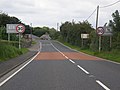 Entering Middletown - geograph.org.uk - 537286.jpg 640 × 480; 82 KB
-
 Groves Lower - geograph.org.uk - 673204.jpg 640 × 479; 59 KB
-
 Heading east to Cavancreevy - geograph.org.uk - 673194.jpg 640 × 479; 81 KB
-
 Knockbane Townland - geograph.org.uk - 673279.jpg 640 × 479; 64 KB
-
 Knockbane Townland - geograph.org.uk - 673282.jpg 640 × 479; 70 KB
-
 Knockbane Townland - geograph.org.uk - 673284.jpg 640 × 479; 55 KB
-
 Middletown, County Armagh - geograph.org.uk - 617737.jpg 640 × 292; 30 KB
-
 Road at Middletown - geograph.org.uk - 617738.jpg 640 × 479; 51 KB


_-_geograph.org.uk_-_3191243.jpg)
_-_geograph.org.uk_-_3191247.jpg)
_-_geograph.org.uk_-_3191251.jpg)


