Category:Mid-Atlantic Ridge
Jump to navigation
Jump to search
- (en) Mid-Atlantic Ridge
- (ca) Dorsal mesoatlàntica
- (cs) Středoatlantský hřbet
- (da) Midtatlantiske ryg
- (de) Mittelatlantischer Rücken
- (es) Dorsal mesoatlántica
- (et) Kesk-Atlandi mäestik
- (eu) Dortsal mesoatlantikoa
- (fr) Dorsale médio-atlantique
- (gl) Dorsal mesoatlántica
- (he) הרכס המרכז-אטלנטי
- (is) Atlantshafshryggurinn
- (it) Dorsale medio atlantica
- (ja) 大西洋中央海嶺
- (ko) 대서양 중앙 해령
- (ksh) Meddel Atlanntish Rögge
- (nl) Mid-Atlantische Rug
- (nn) Den midtatlantiske ryggen
- (no) Den midtatlantiske ryggen
- (pl) Grzbiet Śródatlantycki
- (pt) Dorsal meso-atlântica
- (ru) Срединно-Атлантический хребет
- (scn) Dursali Mediu Atlàntica
- (sl) Srednjeoceanski hrbet
- (sr) Атлантско-океанска област
- (sv) Mittatlantiska ryggen
- (sw) Mgongo kati wa Atlantiki
- (tr) Orta Atlantik Sırtı
- (uk) Серединно-Атлантичний хребет
- (vi) Sống núi giữa Đại Tây Dương
- (zh) 大西洋洋中脊
Atlantic Ocean tectonic plate boundary | |||||
| Upload media | |||||
| Instance of | |||||
|---|---|---|---|---|---|
| Location | international waters | ||||
| Located in or next to body of water | |||||
| Has part(s) |
| ||||
| Heritage designation |
| ||||
 | |||||
Subcategories
This category has the following 22 subcategories, out of 22 total.
A
- Atlantis Fracture Zone (2 F)
E
G
J
K
- Kolbeinsey Ridge (8 F)
L
- Logatchev Hydrothermal Field (17 F)
M
R
- Rainbow Vent Field (13 F)
- Romanche Trench (1 F)
S
T
V
Media in category "Mid-Atlantic Ridge"
The following 102 files are in this category, out of 102 total.
-
1st-SOUSE-sensors.png 300 × 280; 155 KB
-
Arctic Ocean bathymetric features.png 803 × 664; 664 KB
-
Atlantic bathymetry (cropped - South).jpg 2,683 × 2,108; 3.22 MB
-
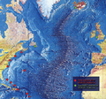
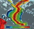
Atlantic bathymetry.jpg 4,000 × 5,000; 9.12 MB
-
Atlantic Central Ridge.JPG 490 × 653; 98 KB
-
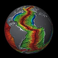
Atlantic Ocean surface.jpg 982 × 958; 249 KB
-
Atlantic Oceanic-Crust.jpg 600 × 600; 301 KB
-
Blacksmoker in Atlantic Ocean.jpg 1,208 × 1,780; 1.76 MB
-
Cape Verde Rise.jpg 1,825 × 2,000; 1.22 MB
-
Charlie-gibbs-full-extent.png 1,020 × 626; 310 KB
-
Charliegibbsschema-en.svg 1,052 × 744; 18 KB
-
Cratons West Gondwana AR.svg 745 × 710; 170 KB
-
Cratons West Gondwana IT.svg 745 × 710; 170 KB
-
Cratons West Gondwana-es.svg 745 × 710; 196 KB
-
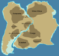
Cratons West Gondwana.svg 745 × 710; 170 KB
-
Divia briandi (MNHN-IM-2000-32536).jpeg 7,087 × 4,961; 4.24 MB
-
Dorsale1.JPG 2,592 × 1,944; 2.32 MB
-
DUPAL.png 1,019 × 529; 28 KB
-
Expl2219 - Flickr - NOAA Photo Library.jpg 1,920 × 1,080; 385 KB
-
Expl2220 - Flickr - NOAA Photo Library.jpg 1,920 × 1,080; 379 KB
-
Expl2221 - Flickr - NOAA Photo Library.jpg 1,920 × 1,080; 550 KB
-
Expl2222 - Flickr - NOAA Photo Library.jpg 1,920 × 1,080; 462 KB
-
Expl2223 - Flickr - NOAA Photo Library.jpg 1,920 × 1,080; 308 KB
-
Expl2224 - Flickr - NOAA Photo Library.jpg 1,920 × 1,080; 747 KB
-
Expl2225 - Flickr - NOAA Photo Library.jpg 1,920 × 1,080; 758 KB
-
Expl2226 - Flickr - NOAA Photo Library.jpg 1,920 × 1,080; 580 KB
-
Expl2227 - Flickr - NOAA Photo Library.jpg 1,920 × 1,080; 462 KB
-
Expl2228 - Flickr - NOAA Photo Library.jpg 1,920 × 1,080; 420 KB
-
Expl2229 - Flickr - NOAA Photo Library.jpg 1,920 × 1,080; 404 KB
-
Expl2230 - Flickr - NOAA Photo Library.jpg 1,920 × 1,080; 379 KB
-
Expl2231 - Flickr - NOAA Photo Library.jpg 1,920 × 1,080; 388 KB
-
Expl2236 - Flickr - NOAA Photo Library.jpg 1,920 × 1,080; 512 KB
-
Expl2237 - Flickr - NOAA Photo Library.jpg 1,920 × 1,080; 542 KB
-
Expl2238 - Flickr - NOAA Photo Library.jpg 1,920 × 1,080; 527 KB
-
Expl2239 - Flickr - NOAA Photo Library.jpg 1,920 × 1,080; 499 KB
-
Expl2240 - Flickr - NOAA Photo Library.jpg 1,920 × 1,080; 490 KB
-
Expl2241 - Flickr - NOAA Photo Library.jpg 1,920 × 1,080; 472 KB
-
Expl2242 - Flickr - NOAA Photo Library.jpg 1,920 × 1,080; 501 KB
-
Expl2243 - Flickr - NOAA Photo Library.jpg 1,920 × 1,080; 682 KB
-
Expl2244 - Flickr - NOAA Photo Library.jpg 1,920 × 1,106; 606 KB
-
Expl2245 - Flickr - NOAA Photo Library.jpg 1,920 × 1,080; 469 KB
-
Expl2246 - Flickr - NOAA Photo Library.jpg 1,920 × 1,080; 554 KB
-
Expl2247 - Flickr - NOAA Photo Library.jpg 1,920 × 1,080; 381 KB
-
Expl2248 - Flickr - NOAA Photo Library.jpg 1,920 × 1,080; 384 KB
-
Expl2249 - Flickr - NOAA Photo Library.jpg 1,920 × 1,080; 360 KB
-
Expl2250 - Flickr - NOAA Photo Library.jpg 1,920 × 1,080; 519 KB
-
Expl2251 - Flickr - NOAA Photo Library.jpg 1,920 × 1,080; 276 KB
-
Expl2253 - Flickr - NOAA Photo Library.jpg 1,920 × 1,080; 265 KB
-
Expl2254 - Flickr - NOAA Photo Library.jpg 1,920 × 1,080; 576 KB
-
Expl2255 - Flickr - NOAA Photo Library.jpg 1,920 × 1,080; 1.24 MB
-
Expl2256 - Flickr - NOAA Photo Library.jpg 1,920 × 1,080; 482 KB
-
Expl2257 - Flickr - NOAA Photo Library.jpg 1,920 × 1,080; 497 KB
-
Expl2259 - Flickr - NOAA Photo Library.jpg 1,920 × 1,080; 432 KB
-
Expl2260 - Flickr - NOAA Photo Library.jpg 1,920 × 1,080; 701 KB
-
Expl2261 - Flickr - NOAA Photo Library.jpg 1,920 × 1,080; 592 KB
-
Expl2262 - Flickr - NOAA Photo Library.jpg 1,920 × 1,080; 692 KB
-
Expl2263 - Flickr - NOAA Photo Library.jpg 1,920 × 1,080; 538 KB
-
Expl2264 - Flickr - NOAA Photo Library.jpg 1,920 × 1,080; 420 KB
-
Expl2265 - Flickr - NOAA Photo Library.jpg 1,920 × 1,080; 357 KB
-
Expl2266 - Flickr - NOAA Photo Library.jpg 1,920 × 1,080; 552 KB
-
Expl2267 - Flickr - NOAA Photo Library.jpg 1,920 × 1,080; 392 KB
-
Expl2268 - Flickr - NOAA Photo Library.jpg 1,920 × 1,080; 514 KB
-
Expl2269 - Flickr - NOAA Photo Library.jpg 1,920 × 1,080; 480 KB
-
Expl2275 - Flickr - NOAA Photo Library.jpg 1,920 × 1,080; 236 KB
-
Expl2278 - Flickr - NOAA Photo Library.jpg 1,920 × 1,080; 218 KB
-
Expl2279 - Flickr - NOAA Photo Library.jpg 1,920 × 1,080; 254 KB
-
Expl2280 - Flickr - NOAA Photo Library.jpg 1,920 × 1,080; 307 KB
-
Expl2281 - Flickr - NOAA Photo Library.jpg 1,920 × 1,080; 329 KB
-
Expl2282 - Flickr - NOAA Photo Library.jpg 1,920 × 1,080; 282 KB
-
Expl2283 - Flickr - NOAA Photo Library.jpg 1,911 × 1,033; 270 KB
-
Expl2285 - Flickr - NOAA Photo Library.jpg 1,920 × 1,080; 206 KB
-
Expl2286 - Flickr - NOAA Photo Library.jpg 1,920 × 1,080; 604 KB
-
Expl2287 - Flickr - NOAA Photo Library.jpg 1,920 × 1,080; 530 KB
-
Expl2288 - Flickr - NOAA Photo Library.jpg 1,920 × 1,080; 344 KB
-
Expl2289 - Flickr - NOAA Photo Library.jpg 1,790 × 1,337; 424 KB
-
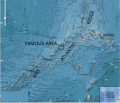
FAMOUS on MAR.svg 917 × 784; 3.85 MB
-
Grindavik eruption 14 januar 2024.jpg 4,000 × 2,252; 2.92 MB
-
Gunnuhver 2018 10.jpg 2,560 × 1,920; 1.78 MB
-
IBCAO betamap.jpg 762 × 868; 710 KB
-
Iceland Aurora 1.jpg 4,928 × 3,264; 9.2 MB
-
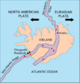
Iceland Mid-Atlantic Ridge Fig16.gif 376 × 390; 9 KB
-
Internal wave breaking in the Rainbow Ridge.jpg 2,400 × 1,800; 1.11 MB
-
Map00323 - Flickr - NOAA Photo Library.jpg 1,284 × 1,278; 409 KB
-
Map00324 - Flickr - NOAA Photo Library.jpg 2,000 × 1,515; 226 KB
-
Meyers b2 s0003 b1.png 392 × 188; 18 KB
-
Mid-atlantic ridge map.png 200 × 415; 21 KB
-
N-Atlantic-grav.png 504 × 339; 301 KB
-
N-Atlantic-topo (de).png 502 × 354; 288 KB
-
N-Atlantic-topo.png 504 × 352; 288 KB
-
NAM-SAM-AFR-triple junction.jpg 800 × 800; 209 KB
-
North Atlantic crust age 1996.gif 607 × 520; 174 KB
-
Poralia Expl2252 - Flickr - NOAA Photo Library.jpg 1,920 × 1,080; 394 KB
-
Propagating Rift.png 840 × 696; 60 KB
-
Romanche Trench.jpg 800 × 559; 215 KB
-
Sulis 20180918222021.jpg 5,968 × 3,352; 731 KB
-
Sulis 20180921235633.jpg 5,968 × 3,352; 1.26 MB
-
Thingvellir, Iceland (21677114683).jpg 4,608 × 3,072; 1.51 MB
-
Vemafracturezone-qgis.svg 1,052 × 744; 2.34 MB
-
Vematransform.svg 1,020 × 609; 393 KB
-
WalvisRidge.jpg 541 × 419; 104 KB
Categories:
- Volcanism of the Atlantic Ocean
- Mid-ocean ridges of the Atlantic Ocean
- Structural geology of Europe
- Geology of North America by important geologic unit
- Structural geology of Africa
- Structural geology of South America
- Geology of the Atlantic Ocean
- Rift zones (extensional regime)
- Landforms of the Atlantic Ocean
- Submarine volcanism of the Atlantic Ocean
- Volcanoes in the Atlantic Ocean
- Tentative List for future World Heritage Sites in Portugal
- Fault zones in Europe
- Topography of the Atlantic Ocean
- Magmatism of the Atlantic Ocean
