Category:Meuselbacher Kuppe
Jump to navigation
Jump to search
| Object location | | View all coordinates using: OpenStreetMap |
|---|
mountain  | |||||
| Upload media | |||||
| Instance of | |||||
|---|---|---|---|---|---|
| Location | Landkreis Saalfeld-Rudolstadt, Thuringia, Germany | ||||
| Mountain range | |||||
| Elevation above sea level |
| ||||
 | |||||
Media in category "Meuselbacher Kuppe"
The following 16 files are in this category, out of 16 total.
-
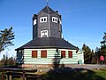
 Fröbelturm Blick (Cursdorf).jpg 3,072 × 2,304; 4.41 MB
-
 Fröbelturm Blick Cursdorf.jpg 2,971 × 950; 859 KB
-
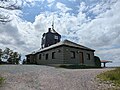
 Meuselbacher Kuppe 1.jpg 3,072 × 2,304; 2.77 MB
-
 Meuselbacher Kuppe 2.jpg 3,072 × 2,304; 2.9 MB
-
 Meuselbacher Kuppe 3.jpg 3,072 × 2,304; 3 MB
-
 Meuselbacher Kuppe 4.jpg 3,072 × 2,304; 2.9 MB
-
 Meuselbacher Kuppe 5.jpg 3,072 × 2,304; 3.87 MB
-
 Meuselbacher Kuppe 6.jpg 1,024 × 768; 143 KB
-
 Meuselbacher Kuppe 7.jpg 4,080 × 3,072; 3.69 MB
-
 Meuselbacher Kuppe.jpg 700 × 525; 288 KB
-
 Meuselbacher-Kuppe-1.jpg 3,534 × 2,356; 2.52 MB
-
 Meuselbacher-Kuppe-2.jpg 3,648 × 2,736; 2.32 MB
-
 Meuselbacher-Kuppe-3.jpg 2,490 × 3,320; 1.56 MB
-
 Meuselbacher-Kuppe-Blick-1.jpg 3,368 × 2,245; 2.22 MB
-
 Meuselbacher-Kuppe-Blick-2.jpg 6,341 × 2,443; 2.43 MB
-
 Meuselbacher-Kuppe-Blick-3.jpg 3,219 × 2,146; 1.93 MB
.jpg)


