Category:Metham
Jump to navigation
Jump to search
English: Metham is a hamlet in the East Riding of Yorkshire, England, it forms part of the civil parish of Laxton.
village in United Kingdom | |||||
| Upload media | |||||
| Instance of | |||||
|---|---|---|---|---|---|
| Location | Laxton, East Riding of Yorkshire, Yorkshire and the Humber, England | ||||
 | |||||
Media in category "Metham"
The following 22 files are in this category, out of 22 total.
-
 A Ploughed Field - geograph.org.uk - 256249.jpg 640 × 480; 104 KB
-
 A Very Large Hedge - geograph.org.uk - 256769.jpg 640 × 480; 99 KB
-
 An Untidy Hedge - geograph.org.uk - 256759.jpg 640 × 480; 101 KB
-
 Arable land south of Newland - geograph.org.uk - 807971.jpg 640 × 427; 75 KB
-
 Big Fields - geograph.org.uk - 250193.jpg 640 × 480; 99 KB
-
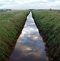 Cotness Drain, Laxton - geograph.org.uk - 635716.jpg 625 × 640; 100 KB
-
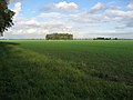
 Fields towards Cotness - geograph.org.uk - 1366501.jpg 640 × 480; 49 KB
-
 Fields towards High Metham.jpg 640 × 407; 49 KB
-
 Looking Towards A Grove - geograph.org.uk - 256245.jpg 640 × 480; 109 KB
-
 Metham Hall Farm.jpg 640 × 480; 72 KB
-
 Metham Hall.jpg 640 × 480; 194 KB
-
 NW of Yokefleet - geograph.org.uk - 115273.jpg 640 × 480; 180 KB
-
 Public footpath to Waterside House - geograph.org.uk - 1366524.jpg 640 × 480; 77 KB
-
 Track to Low Metham Grange.jpg 640 × 480; 81 KB
-
 Travelling To Laxton - geograph.org.uk - 256772.jpg 640 × 480; 99 KB
-
 Travelling To Yokefleet - geograph.org.uk - 256764.jpg 640 × 480; 103 KB
-
 Vanishing Point - geograph.org.uk - 252797.jpg 640 × 480; 101 KB
-
 View near Metham (5079544680).jpg 2,560 × 1,707; 2.92 MB
-
 Warping Drain - geograph.org.uk - 1603694.jpg 640 × 480; 80 KB
-
 Warping Drain from Plank Bridge - geograph.org.uk - 1366518.jpg 640 × 480; 88 KB
-
 West of Yokefleet - geograph.org.uk - 115274.jpg 640 × 480; 116 KB
-
 Yokefleet, looking south..JPG 2,180 × 1,534; 1.09 MB


.jpg)


