Category:Meteorological maps of France
Jump to navigation
Jump to search
Subcategories
This category has the following 3 subcategories, out of 3 total.
Media in category "Meteorological maps of France"
The following 29 files are in this category, out of 29 total.
-
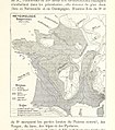
329 of 'La France Illustrée- géographie générale ... Par F. J' (11293642324).jpg 1,271 × 1,446; 562 KB
-
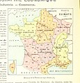
334 of 'La France Illustrée- géographie générale ... Par F. J' (11292267583).jpg 1,271 × 1,441; 594 KB
-
338 of 'La France Illustrée- géographie générale ... Par F. J' (11292901755).jpg 1,271 × 1,430; 492 KB
-
Carte de France des climats avec l'humidité maximum - JPEG.jpg 586 × 678; 84 KB
-
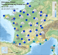
Carte Météo France 12 mars 2009 matin.png 600 × 569; 702 KB
-
Carte Météo France 13 mars 2009 après-midi.png 600 × 569; 627 KB
-
Carte Météo France 8 avril 2009 après-midi.png 600 × 569; 628 KB
-
Carte météo France du 17 mars 2009 matin.png 600 × 569; 628 KB
-
Episode cévenol.png 1,116 × 1,160; 440 KB
-
France pluviometrie moyenne annuelle 1981-2010 CHELSA bio12 V-2-1.png 2,480 × 3,507; 1.23 MB
-
Franciaország éghajlata.png 1,286 × 961; 88 KB
-
Image taken from page 50 of 'Geographie Générale ... Avec index, etc' (11288313725).jpg 1,265 × 1,316; 431 KB
-
Klaus storm track - 20090124 - map-it.svg 2,000 × 1,922; 1.08 MB
-
Météo France 10 mars 2009 matin.png 601 × 568; 706 KB
-
Météo France 25 mai 2009 soirée.png 602 × 570; 638 KB
-
Météo France 30 janvier 2010 matinee.png 600 × 569; 630 KB
-
Température de la mer janvier 2009.png 457 × 610; 84 KB
-
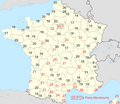
Température minimale le 12 août 2003 (le plus chaud de l'année) en France.png 1,104 × 957; 303 KB
-
Températures maximales le 12 août 2003 (le plus chaud de l'année) en France.png 1,105 × 968; 309 KB
-
Too hot to handle ESA19642327.gif 2,029 × 1,813; 3.38 MB
-
Trend frost days dec.png 740 × 449; 57 KB
