Category:Mesoregions of Poland
Jump to navigation
Jump to search
Subcategories
This category has the following 71 subcategories, out of 71 total.
A
B
C
D
E
F
G
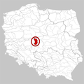
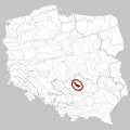
- Garb Tarnogórski (2 F)
I
J
K
L
M
N
O
- Orneta Plain (3 F)
P
- Polanów Upland (3 F)
- Płaskowyż Rybnicki (1 F)
R
S
- Szczecin Heights (1 F)
T
U
W
Ł
Ś
Ż
Media in category "Mesoregions of Poland"
The following 200 files are in this category, out of 291 total.
(previous page) (next page)-
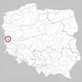
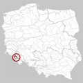
 313.25 Równina Goleniowska.png 750 × 750; 198 KB
-
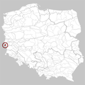
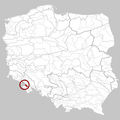
 313.27 Wzgórza Bukowe.png 750 × 750; 196 KB
-
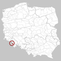
 313.28 Równina Wełtyńska.png 750 × 750; 196 KB
-
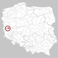
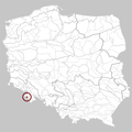
 313.32 Równina Nowogardzka.png 750 × 750; 198 KB
-
 313.41 Wybrzeże Słowińskie.png 750 × 750; 202 KB
-
 313.43 Równina Słupska.png 750 × 750; 198 KB
-
 313.44 Wysoczyzna Damnicka.png 750 × 750; 198 KB
-
 313.46 Pradolina Redy-Łeby.png 750 × 750; 197 KB
-
 313.51 Pobrzeże Kaszubskie.png 750 × 750; 198 KB
-
 313.52 Mierzeja Helska.png 750 × 750; 196 KB
-
 313.53 Mierzeja Wiślana.png 750 × 750; 196 KB
-
 313.55 Wysoczyzna Elbląska.png 750 × 750; 197 KB
-
 313.57 Wybrzeże Staropruskie.png 750 × 750; 196 KB
-
 314.44 Wysoczyzna Łobeska.png 750 × 750; 197 KB
-
 314.45 Pojezierze Drawskie.png 750 × 750; 200 KB
-
 314.47 Pojezierze Bytowskie.png 750 × 750; 197 KB
-
 314.62 Pojezierze Dobiegniewskie.png 750 × 750; 197 KB
-
 314.64 Pojezierze Wałeckie.png 750 × 750; 198 KB
-
 314.66 Pojezierze Szczecineckie.png 750 × 750; 197 KB
-
 314.67 Równina Charzykowska.png 750 × 750; 199 KB
-
 314.68 Dolina Gwdy.png 750 × 750; 199 KB
-
 314.71 Bory Tucholskie.png 750 × 750; 201 KB
-
 314.72 Dolina Brdy.png 750 × 750; 197 KB
-
 314.81 Dolina Kwidzyńska.png 750 × 750; 197 KB
-
 315.14 Pojezierze Dobrzyńskie.png 750 × 750; 201 KB
-
 315.15 Garb Lubawski.png 750 × 750; 199 KB
-
 315.16 Równina Urszulewska.png 750 × 750; 198 KB
-
 315.31 Kotlina Freienwaldzka.png 750 × 750; 197 KB
-
 315.33 Dolina Środkowej Noteci.png 750 × 750; 197 KB
-
 315.41 Lubuski Przełom Odry.png 750 × 750; 196 KB
-
 315.42 Pojezierze Łagowskie.png 750 × 750; 199 KB
-
 315.44 Bruzda Zbąszyńska.png 750 × 750; 197 KB
-
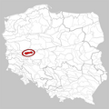
 315.51 Pojezierze Poznańskie.png 750 × 750; 200 KB
-
 315.52 Poznański Przełom Warty.png 750 × 750; 196 KB
-
 315.54 Pojezierze Gnieźnieńskie.png 750 × 750; 202 KB
-
 315.55 Równina Inowrocławska.png 750 × 750; 198 KB
-
 315.56 Równina Wrzesińska.png 750 × 750; 199 KB
-
 315.57 Pojezierze Kujawskie.png 750 × 750; 197 KB
-
 315.61 Dolina Środkowej Odry.png 750 × 750; 197 KB
-
 315.62 Kotlina Kargowska.png 750 × 750; 196 KB
-
 315.63 Dolina Środkowej Obry.png 750 × 750; 197 KB
-
 315.64 Kotlina Śremska.png 750 × 750; 197 KB
-
 315.71 Wzniesienia Gubińskie.png 750 × 750; 197 KB
-
 315.72 Dolina Dolnego Bobru.png 750 × 750; 196 KB
-
 315.73 Wysoczyzna Czerwieńska.png 750 × 750; 196 KB
-
 315.74 Wał Zielonogórski.png 750 × 750; 196 KB
-
 315.81 Pojezierze Sławskie.png 750 × 750; 196 KB
-
 315.82 Pojezierze Krzywińskie.png 750 × 750; 196 KB
-
 315.83 Równina Kościańska.png 750 × 750; 196 KB
-
 315.84 Wał Żerkowski.png 750 × 750; 196 KB
-
 317.23 Kotlina Zasiecka.png 750 × 750; 196 KB
-
 317.46 Wał Mużakowski.png 750 × 750; 195 KB
-
 317.74 Bory Dolnośląskie.png 750 × 750; 198 KB
-
 317.75 Równina Szprotawska.png 750 × 750; 196 KB
-
 317.76 Wysoczyzna Lubińska.png 750 × 750; 197 KB
-
 317.77 Równina Legnicka.png 750 × 750; 197 KB
-
 317.78 Równina Chojnowska.png 750 × 750; 197 KB
-
 318.11 Wysoczyzna Leszczyńska.png 750 × 750; 198 KB
-
 318.12 Wysoczyzna Kaliska.png 750 × 750; 199 KB
-
 318.13 Dolina Konińska.png 750 × 750; 197 KB
-
 318.14 Kotlina Kolska.png 750 × 750; 198 KB
-
 318.15 Wysoczyzna Kłodawska.png 750 × 750; 197 KB
-
 318.16 Równina Rychwalska.png 750 × 750; 198 KB
-
 318.17 Wysoczyzna Turecka.png 750 × 750; 197 KB
-
 318.18 Kotlina Sieradzka.png 750 × 750; 197 KB
-
 318.19 Wysoczyzna Łaska.png 750 × 750; 198 KB
-
 318.21 Kotlina Grabowska.png 750 × 750; 197 KB
-
 318.22 Wysoczyzna Złoczewska.png 750 × 750; 197 KB
-
 318.23 Kotlina Szczercowska.png 750 × 750; 197 KB
-
 318.24 Wysoczyzna Wieruszowska.png 750 × 750; 197 KB
-
 318.31 Obniżenie Nowosolskie.png 750 × 750; 196 KB
-
 318.32 Pradolina Głogowska.png 750 × 750; 197 KB
-
 318.33 Kotlina Żmigrodzka.png 750 × 750; 197 KB
-
 318.34 Kotlina Milicka.png 750 × 750; 197 KB
-
 318.41 Wzniesienia Żarskie.png 750 × 750; 196 KB
-
 318.42 Wzgórza Dalkowskie.png 750 × 750; 199 KB
-
 318.43 Obniżenie Ścinawskie.png 750 × 750; 196 KB
-
 318.44 Wzgórza Trzebnickie.png 750 × 750; 197 KB
-
 318.45 Wzgórza Twardogórskie.png 750 × 750; 197 KB
-
 318.46 Wzgórza Ostrzeszowskie.png 750 × 750; 196 KB
-
 318.51 Wysoczyzna Rościsławska.png 750 × 750; 196 KB
-
 318.52 Pradolina Wrocławska.png 750 × 750; 201 KB
-
 318.53 Równina Wrocławska.png 750 × 750; 200 KB
-
 318.54 Dolina Nysy Kłodzkiej.png 750 × 750; 196 KB
-
 318.55 Równina Niemodlińska.png 750 × 750; 197 KB
-
 318.56 Równina Oleśnicka.png 750 × 750; 200 KB
-
 318.57 Równina Opolska.png 750 × 750; 200 KB
-
 318.58 Płaskowyż Głubczycki.png 750 × 750; 200 KB
-
 318.58.5 Obniżenie Prudnickie.png 750 × 750; 145 KB
-
 318.59 Kotlina Raciborska.png 750 × 750; 200 KB
-
 318.61 Wysoczyzna Płońska.png 750 × 750; 199 KB
-
 318.62 Równina Raciąska.png 750 × 750; 198 KB
-
 318.63 Wzniesienia Mławskie.png 750 × 750; 199 KB
-
 318.64 Wysoczyzna Ciechanowska.png 750 × 750; 199 KB
-
 318.65 Równina Kurpiowska.png 750 × 750; 199 KB
-
 318.66 Dolina Dolnej Narwi.png 750 × 750; 199 KB
-
 318.67 Międzyrzecze Łomżyńskie.png 750 × 750; 199 KB
-
 318.71 Równina Kutnowska.png 750 × 750; 199 KB
-
 318.72 Równina Łowicko-Błońska.png 750 × 750; 200 KB
-
 318.73 Kotlina Warszawska.png 750 × 750; 198 KB
-
 318.74 Dolina Dolnego Bugu.png 750 × 750; 197 KB
-
 318.75 Dolina Środkowej Wisły.png 750 × 750; 201 KB
-
 318.76 Równina Warszawska.png 750 × 750; 199 KB
-
 318.77 Równina Kozienicka.png 750 × 750; 198 KB
-
 318.78 Równina Wołomińska.png 750 × 750; 197 KB
-
 318.79 Równina Garwolińska.png 750 × 750; 197 KB
-
 318.81 Wysoczyzna Bełchatowska.png 750 × 750; 199 KB
-
 318.82 Wzniesienia Łódzkie.png 750 × 750; 198 KB
-
 318.83 Wysoczyzna Rawska.png 750 × 750; 198 KB
-
 318.84 Równina Piotrkowska.png 750 × 750; 198 KB
-
 318.85 Dolina Białobrzeska.png 750 × 750; 197 KB
-
 318.86 Równina Radomska.png 750 × 750; 201 KB
-
 318.91 Podlaski Przełom Bugu.png 750 × 750; 201 KB
-
 318.92 Wysoczyzna Kałuszyńska.png 750 × 750; 197 KB
-
 318.93 Obniżenie Węgrowskie.png 750 × 750; 198 KB
-
 318.94 Wysoczyzna Siedlecka.png 750 × 750; 199 KB
-
 318.95 Wysoczyzna Żelechowska.png 750 × 750; 198 KB
-
 318.96 Równina Łukowska.png 750 × 750; 200 KB
-
 318.97 Pradolina Wieprza.png 750 × 750; 196 KB
-
 318.98 Wysoczyzna Lubartowska.png 750 × 750; 197 KB
-
 332.11 Wzgórza Strzegomskie.png 750 × 750; 195 KB
-
 332.12 Równina Świdnicka.png 750 × 750; 196 KB
-
 332.13 Masyw Ślęży.png 750 × 750; 196 KB
-
 332.14 Wzgórza Niemczańsko-Strzelińskie.png 750 × 750; 197 KB
-
 332.15 Obniżenie Podsudeckie.png 750 × 750; 196 KB
-
 332.16 Obniżenie Otmuchowskie.png 750 × 750; 196 KB
-
 332.17 Przedgórze Paczkowskie.png 750 × 750; 196 KB
-
 332.25 Obniżenie Żytawsko-Zgorzeleckie.png 750 × 750; 197 KB
-
 332.26 Pogórze Izerskie.png 750 × 750; 198 KB
-
 332.27 Pogórze Kaczawskie.png 750 × 750; 196 KB
-
 332.28 Pogórze Wałbrzyskie.png 750 × 750; 196 KB
-
 332.34 Góry Izerskie.png 750 × 750; 196 KB
-
 332.35 Góry Kaczawskie.png 750 × 750; 196 KB
-
 332.36 Kotlina Jeleniogórska.png 750 × 750; 196 KB
-
 332.37 Karkonosze.png 750 × 750; 196 KB
-
 332.38 Rudawy Janowickie.png 750 × 750; 196 KB
-
 332.41 Brama Lubawska.png 750 × 750; 196 KB
-
 332.42 Góry Wałbrzyskie.png 750 × 750; 196 KB
-
 332.43 Góry Kamienne.png 750 × 750; 196 KB
-
 332.44 Góry Sowie.png 750 × 750; 196 KB
-
 332.45 Góry Bardzkie.png 750 × 750; 195 KB
-
 332.46 Obniżenie Noworudzkie.png 750 × 750; 196 KB
-
 332.47 Obniżenie Ścinawki.png 750 × 750; 196 KB
-
 332.48 Góry Stołowe.png 750 × 750; 196 KB
-
 332.51 Pogórze Orlickie.png 750 × 750; 196 KB
-
 332.52 Góry Orlickie.png 750 × 750; 196 KB
-
 332.53 Góry Bystrzyckie.png 750 × 750; 196 KB
-
 332.54 Kotlina Kłodzka.png 750 × 750; 197 KB
-
 332.61 Góry Złote.png 750 × 750; 196 KB
-
 332.62 Masyw Śnieżnika.png 750 × 750; 196 KB
-
 332.63 Góry Opawskie.png 750 × 750; 197 KB
-
 341.11 Chełm.png 750 × 750; 196 KB
-
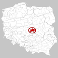
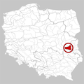
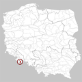
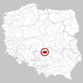
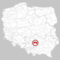
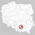
 341.12 Garb Tarnogórski.png 750 × 750; 198 KB
-
 341.13 Wyżyna Katowicka.png 750 × 750; 197 KB
-
 341.14 Pagóry Jaworznickie.png 750 × 750; 196 KB
-
 341.21 Wyżyna Wieluńska.png 750 × 750; 198 KB
-
 341.22 Obniżenie Liswarty.png 750 × 750; 199 KB
-
 341.23 Próg Woźnicki.png 750 × 750; 199 KB
-
 341.24 Próg Herbski.png 750 × 750; 198 KB
-
 341.25 Obniżenie Górnej Warty.png 750 × 750; 197 KB
-
 341.26 Obniżenie Krzepickie.png 750 × 750; 196 KB
-
 341.31 Wyżyna Częstochowska.png 750 × 750; 198 KB
-
 341.32 Wyżyna Olkuska.png 750 × 750; 196 KB
-
 341.33 Rów Krzeszowicki.png 750 × 750; 196 KB
-
 341.34 Garb Tenczyński.png 750 × 750; 196 KB
-
 342.11 Wzgórza Radomszczańskie.png 750 × 750; 197 KB
-
 342.12 Wzgórza Opoczyńskie.png 750 × 750; 198 KB
-
 342.13 Próg Lelowski.png 750 × 750; 196 KB
-
 342.14 Niecka Włoszczowska.png 750 × 750; 199 KB
-
 342.15 Pasmo Przedborsko-Małogoskie.png 750 × 750; 197 KB
-
 342.16 Wzgórza Łopuszańskie.png 750 × 750; 197 KB
-
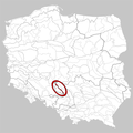
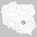
 342.21 Płaskowyż Jędrzejowski.png 750 × 750; 197 KB
-
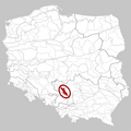
 342.22 Wyżyna Miechowska.png 750 × 750; 197 KB
-
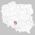
 342.23 Płaskowyż Proszowicki.png 750 × 750; 197 KB
-
 342.24 Garb Wodzisławski.png 750 × 750; 197 KB
-
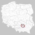
 342.25 Dolina Nidy.png 750 × 750; 198 KB
-
 342.26 Niecka Solecka.png 750 × 750; 196 KB
-
 342.27 Garb Pińczowski.png 750 × 750; 197 KB
-
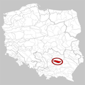 342.28 Niecka Połaniecka.png 750 × 750; 197 KB
-
 342.31 Płaskowyż Suchedniowski.png 750 × 750; 197 KB
-
 342.32 Garb Gielniowski.png 750 × 750; 197 KB
-
 342.33 Przedgórze Iłżeckie.png 750 × 750; 199 KB
-
 342.34-5 Góry Świętokrzyskie.png 750 × 750; 198 KB
-
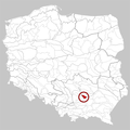
 342.36 Wyżyna Sandomierska.png 750 × 750; 198 KB
-
 342.37 Pogórze Szydłowskie.png 750 × 750; 197 KB
-
 343.11 Małopolski Przełom Wisły.png 750 × 750; 197 KB
-
 343.12 Płaskowyż Nałęczowski.png 750 × 750; 197 KB
-
 343.13 Równina Bełżycka.png 750 × 750; 196 KB
-
 343.14 Kotlina Chodelska.png 750 × 750; 197 KB
-
 343.15 Wzniesienia Urzędowskie.png 750 × 750; 199 KB
-
 343.16 Płaskowyż Świdnicki.png 750 × 750; 197 KB
-
 343.17 Wyniosłość Giełczewska.png 750 × 750; 197 KB
-
 343.18 Działy Grabowieckie.png 750 × 750; 198 KB
-
 343.19 Padół Zamojski.png 750 × 750; 198 KB
-
 343.21 Roztocze Zachodnie.png 750 × 750; 198 KB
-
 343.22 Roztocze Środkowe.png 750 × 750; 197 KB
-
 343.23 Roztocze Wschodnie.png 750 × 750; 196 KB
-
 512.11 Wysoczyzna Kończycka.png 750 × 750; 196 KB
-
 512.21 Równina Pszczyńska.png 750 × 750; 196 KB
-
 512.22 Dolina Górnej Wisły.png 750 × 750; 196 KB


