Category:Mesa Ranger District
Jump to navigation
Jump to search
Tonto National Forest, Arizona.
Subcategories
This category has the following 14 subcategories, out of 14 total.
B
C
F
G
- Goldfield Mountains (6 F)
- Gonzales Pass (3 F)
L
M
- Mormon Flat Bridge (2 F)
- Mt. Pinter (55 F)
P
- Pinter's Point (25 F)
S
- Slate Creek Pass (2 F)
- Sunflower Ranger Station (7 F)
T
Media in category "Mesa Ranger District"
The following 26 files are in this category, out of 26 total.
-
 2010 in Photos (4485573815).png 1,581 × 2,376; 8.25 MB
-
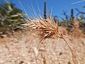
 Aristida (34467184880).jpg 4,608 × 3,456; 3.46 MB
-
 Bromus rubens in the Sonoran Desert (34010498814).jpg 4,608 × 3,456; 3.39 MB
-
 Bromus rubens in the Sonoran Desert (34010500074).jpg 4,608 × 3,456; 3.39 MB
-
 Bromus rubens in the Sonoran Desert (34467185180).jpg 4,608 × 3,456; 3.21 MB
-
 Bromus rubens in the Sonoran Desert (34467185320).jpg 4,608 × 3,456; 3.29 MB
-
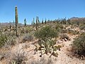
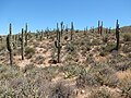
 Cactus, III, Tonto National Forest, January 2016 - panoramio.jpg 5,785 × 3,254; 8.05 MB
-
 EJ Peak, Tonto National Forest, January 2015 - panoramio.jpg 11,792 × 2,714; 19.29 MB
-
 Jeep Trail, Tonto National Forest, July 2015 - panoramio.jpg 5,934 × 2,600; 3.07 MB
-
 Krameria erecta (34043264173).jpg 4,608 × 3,456; 3.44 MB
-
 Krameria erecta (34467184380).jpg 4,608 × 3,456; 3.33 MB
-
 Krameria erecta (34467184480).jpg 4,608 × 3,456; 3.48 MB
-
 Krameria erecta (34853338145).jpg 4,608 × 3,456; 3.5 MB
-
 Lower Salt Sunset, Tonto National Forest, March 2014 - panoramio.jpg 10,094 × 5,383; 23.35 MB
-
 Moon Rise, Pebble Beach, March 2013 - panoramio.jpg 4,320 × 3,240; 1.32 MB
-
 Peralta Canyon camp.JPG 3,298 × 1,935; 5.32 MB
-
 Rise, Tonto National Forest, July 2015 - panoramio.jpg 5,997 × 3,631; 6.6 MB
-
 Rolling Hills, Tonto National Forest, March 2014 - panoramio.jpg 5,947 × 3,501; 8.02 MB
-
 Salt River Valley, Tonto National Forest, May 2015 - panoramio.jpg 6,016 × 2,527; 10.73 MB
-
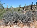
 Simmondsia chinensis (34010498414).jpg 4,608 × 3,456; 3.43 MB
-
 Simmondsia chinensis (34467184570).jpg 4,608 × 3,456; 3.51 MB
-
 Stormy Weather, Tonto National Forest, 2015 - panoramio.jpg 5,557 × 4,294; 13.34 MB
-
 Sycamore Creek.jpg 4,608 × 3,456; 6.01 MB
-
 Tonto National Forest, Cloudy Day, May 2015 - panoramio.jpg 4,016 × 6,016; 12.94 MB
-
 View of site of Reymert, Arizona from US-60.jpg 3,648 × 2,736; 3.67 MB
-
 View W, US 60, Gila River Valley - panoramio.jpg 6,000 × 4,000; 8.09 MB
.png)
.jpg)
.jpg)
.jpg)
.jpg)
.jpg)


.jpg)
.jpg)
.jpg)
.jpg)


.jpg)
.jpg)


