Category:Merk 18 (Workum)
Jump to navigation
Jump to search
| Object location | | View all coordinates using: OpenStreetMap |
|---|
 | |||||
| Upload media | |||||
| Instance of |
| ||||
|---|---|---|---|---|---|
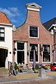
| Location | Workum, Súdwest-Fryslân, Friesland, Netherlands | ||||
| Located on street | |||||
| Heritage designation |
| ||||
 | |||||
|
This is a category about rijksmonument number 39462
|
| Address |
|
Media in category "Merk 18 (Workum)"
The following 5 files are in this category, out of 5 total.
-
 8711 Workum, Netherlands - panoramio (2).jpg 2,048 × 1,375; 560 KB
-
 Gevels - Workum - 20217233 - RCE.jpg 1,200 × 1,199; 235 KB
-
 Merk18 Workum.jpg 2,360 × 3,544; 840 KB
-
 Met pomp - Workum - 20217231 - RCE.jpg 1,200 × 1,200; 373 KB
-
 Voorgevels - Workum - 20217232 - RCE.jpg 1,200 × 1,200; 231 KB
.jpg)


