Category:Meramec Basin Project
Jump to navigation
Jump to search
The Meramec Basin Project was intended to create several dams on the Meramec River and its tributaries for the purpose of flood control and recreation. The project was deauthorized by an act of Congress in 1981, and none of the dams were built, though excavation for the main dam at Sullivan had already begun.
Media in category "Meramec Basin Project"
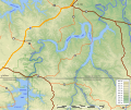
The following 11 files are in this category, out of 11 total.
-
 Irondale Lake (proposed) approximate extent.svg 992 × 785; 1.18 MB
-
 Meramec basin plan200.jpg 1,304 × 1,407; 320 KB
-
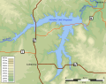
 Meramec Lake (cancelled).png 1,206 × 866; 296 KB
-
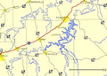
 Meramec Lake exent topomap.jpg 640 × 638; 97 KB
-
 Meramec Lake v3.svg 513 × 525; 604 KB
-
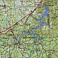
 Meramec Park Lake propose v4.svg 1,064 × 1,083; 2.68 MB
-
 Pine Ford Lake proposed 171m v1a.svg 651 × 843; 1.46 MB
-
 Pine Ford Lake proposed 171m v2.png 634 × 823; 973 KB
-
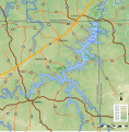
 Salem Lake proposed 301m v1.svg 1,156 × 1,090; 904 KB
-
 Union Lake proposed v1.svg 1,427 × 1,069; 3.22 MB
-
 Virgina Mines Lake proposed v1.svg 1,300 × 1,090; 2.1 MB
_approximate_extent.svg)

.png)


