Category:Melverley
Jump to navigation
Jump to search
Cymraeg: Pentref bychan yn Swydd Amwythig, Loegr ger y ffin â Powys, Cymru yw Melverley. Gorwedd y pentref ar gymer Afon Efyrnwy ag Afon Hafren. Gorwedd pentref bychan Melverley Green fymryn i'r gogledd o Melverley ei hun.
English: Melverley is a village in Shropshire, England, situated on the River Severn and the River Vyrnwy, near the Powys hills and the border with Wales. The village, and the large rural area that surrounds it, is famous for flooding from the nearby rivers.
village in Shropshire, United Kingdom  | |||||
| Upload media | |||||
| Instance of | |||||
|---|---|---|---|---|---|
| Location | Shropshire, West Midlands, England | ||||
| Population |
| ||||
 | |||||
Subcategories
This category has only the following subcategory.
P
Media in category "Melverley"
The following 62 files are in this category, out of 62 total.
-
 A view from the bridge - geograph.org.uk - 462449.jpg 640 × 480; 81 KB
-
 Banks of the River Severn - geograph.org.uk - 1937841.jpg 2,816 × 2,112; 2.85 MB
-
 Border crossing - geograph.org.uk - 758393.jpg 640 × 480; 84 KB
-
 Bridge near Crewgreen (1) - geograph.org.uk - 2486811.jpg 640 × 412; 225 KB
-
 Bridge near Crewgreen (2) - geograph.org.uk - 2486835.jpg 640 × 423; 212 KB
-
 Bridge over the River Severn - geograph.org.uk - 160285.jpg 640 × 480; 269 KB
-
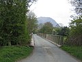 Bridge over the River Severn - geograph.org.uk - 160287.jpg 640 × 480; 303 KB
-
 Bridge over the River Severn - geograph.org.uk - 5393102.jpg 3,628 × 2,724; 2.91 MB
-
 Bridge over the Severn - geograph.org.uk - 462436.jpg 640 × 491; 108 KB
-

-

-
 Cae Howel - geograph.org.uk - 651583.jpg 640 × 480; 59 KB
-
 Crosslanes road junction - geograph.org.uk - 2097271.jpg 640 × 480; 83 KB
-
 Drying out, Melverley Green - geograph.org.uk - 515741.jpg 480 × 640; 133 KB
-
 Entrance to the camp site - geograph.org.uk - 758383.jpg 640 × 480; 108 KB
-
 Fields at end of drive - geograph.org.uk - 2097251.jpg 640 × 480; 61 KB
-
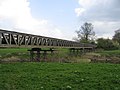
 Former railway bridge at Melverley - geograph.org.uk - 6318539.jpg 4,896 × 3,264; 5.89 MB
-
 Hay making complete - geograph.org.uk - 6545143.jpg 5,184 × 3,888; 3.64 MB
-

-
 Horses in Red - geograph.org.uk - 884451.jpg 640 × 457; 95 KB
-
 Low water in the river Severn - geograph.org.uk - 690141.jpg 640 × 480; 92 KB
-
 Melverley Hall Farm entrance - geograph.org.uk - 2097270.jpg 640 × 480; 150 KB
-
 Melverley Methodist Church - geograph.org.uk - 801346.jpg 640 × 480; 104 KB
-
 Melverley Village Hall - geograph.org.uk - 2097258.jpg 640 × 480; 67 KB
-

-
 Melverley, The River Vyrnwy from St. Peter's Church - geograph.org.uk - 5739585.jpg 6,638 × 4,430; 7.57 MB
-
 National boundary - geograph.org.uk - 6545150.jpg 5,184 × 3,888; 3.53 MB
-
 Old Barn near Melverley Church - geograph.org.uk - 351073.jpg 639 × 448; 75 KB
-

-
 River Cottage - geograph.org.uk - 2097247.jpg 640 × 480; 66 KB
-
 River Severn in flood (June 2007) - geograph.org.uk - 721508.jpg 640 × 426; 76 KB
-
 River Severn-Vyrnwy confluence - geograph.org.uk - 347928.jpg 640 × 480; 93 KB
-
 River Vyrnwy at Melverley - geograph.org.uk - 5394014.jpg 1,600 × 1,201; 752 KB
-

-
 Road to Crosslanes from Village Hall - geograph.org.uk - 2097259.jpg 640 × 480; 69 KB
-
 Road to Ponthen - geograph.org.uk - 2097262.jpg 640 × 480; 85 KB
-
 Royal Hill - geograph.org.uk - 462362.jpg 640 × 491; 103 KB
-
 Severn bank - geograph.org.uk - 651620.jpg 640 × 480; 47 KB
-
-
 Summer meadow - geograph.org.uk - 6545137.jpg 5,184 × 3,888; 5.11 MB
-
 The Haim near Melverley - geograph.org.uk - 1921346.jpg 1,600 × 1,200; 496 KB
-
 The River Severn in spate - geograph.org.uk - 5727698.jpg 3,325 × 1,984; 1.1 MB
-
 The Severn at Royal Hill - geograph.org.uk - 462385.jpg 640 × 480; 101 KB
-
 The Severn Way - geograph.org.uk - 582917.jpg 480 × 640; 73 KB
-
 The Tontine Inn, Melverley - geograph.org.uk - 651608.jpg 640 × 480; 62 KB
-
 The Vyrnwy from the church - geograph.org.uk - 2097243.jpg 640 × 480; 68 KB
-
 Tontine Inn Melverley - geograph.org.uk - 1507931.jpg 640 × 480; 65 KB
-

-
 Willows on the banks of the Severn - geograph.org.uk - 462341.jpg 640 × 480; 182 KB
-
 Border Crossing - geograph.org.uk - 600669.jpg 640 × 480; 71 KB
-
 Breidden Hill from Pritchard's Hill - geograph.org.uk - 206266.jpg 640 × 480; 118 KB
-
 Bridge near Crewgreen - geograph.org.uk - 462421.jpg 640 × 480; 96 KB
-
 Byway from Melverley to Edgerley - geograph.org.uk - 651585.jpg 640 × 480; 92 KB
-

-
 Drying out - geograph.org.uk - 515725.jpg 640 × 480; 103 KB
-
 Elms Cottage and barn in Haimwood - geograph.org.uk - 611147.jpg 640 × 480; 108 KB
-
 Footpath at Bausley - geograph.org.uk - 204764.jpg 480 × 640; 131 KB
-
 Gateway to the river bank - geograph.org.uk - 758388.jpg 640 × 480; 85 KB
-
 Kempster's Hill from Pritchard's Hill - geograph.org.uk - 204765.jpg 640 × 480; 96 KB
-
 Melverley Green - geograph.org.uk - 515736.jpg 640 × 480; 68 KB
-
 Severn pastures - geograph.org.uk - 651602.jpg 640 × 480; 65 KB
-
 Severn valley at Crewgreen - geograph.org.uk - 204763.jpg 640 × 480; 110 KB


_-_geograph.org.uk_-_2486811.jpg)
_-_geograph.org.uk_-_2486835.jpg)


_-_geograph.org.uk_-_721508.jpg)


