Category:Melton, Suffolk
Jump to navigation
Jump to search
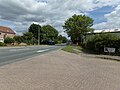
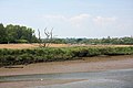
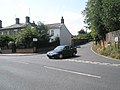
English: Melton is a village in Suffolk, England, located approximately one mile north east of Woodbridge. Melton was in the Domesday Book . The village is served by Melton railway station on the Ipswich-Lowestoft East Suffolk Line.
village and civil parish in Suffolk, England  | |||||
| Upload media | |||||
| Instance of | |||||
|---|---|---|---|---|---|
| Location |
| ||||
| Population |
| ||||
 | |||||
Subcategories
This category has the following 11 subcategories, out of 11 total.
A
C
- Coach and Horses, Melton (1 F)
H
M
- Melton Methodist Chapel (5 F)
- Melton railway station (16 F)
P
- Post boxes in Melton (33 F)
S
- St Audry's Hospital (2 F)
V
W
- The Wilford Bridge (3 F)
Media in category "Melton, Suffolk"
The following 200 files are in this category, out of 444 total.
(previous page) (next page)-
 A landing stage on the River Deben - geograph.org.uk - 6009424.jpg 1,024 × 768; 790 KB
-
 A summer stroll in Dock Lane - geograph.org.uk - 2193054.jpg 640 × 480; 93 KB
-
 A1152 approaches entrance to The Wilford Bridge - geograph.org.uk - 3549840.jpg 3,549 × 2,678; 1.55 MB
-
 A1152 approaches junction with B1438 - geograph.org.uk - 3549834.jpg 3,648 × 2,736; 1.52 MB
-
 A1152 Wilford Bridge Road - geograph.org.uk - 2424173.jpg 3,072 × 2,304; 1.39 MB
-
 A1152 Wilford Bridge Road - geograph.org.uk - 2424175.jpg 3,072 × 2,304; 1.43 MB
-
 A1152 Wilford Bridge Road - geograph.org.uk - 2597550.jpg 3,072 × 2,304; 1.39 MB
-
 A1152 Wilford Bridge Road, Melton - geograph.org.uk - 5876283.jpg 4,608 × 3,456; 3.8 MB
-
 A1152 Woods Lane - geograph.org.uk - 2294186.jpg 3,072 × 2,304; 1.44 MB
-
 A1152 Woods Lane ^ bridleway to Valley Farm Road - geograph.org.uk - 2294197.jpg 3,072 × 2,304; 1.51 MB
-
 A1152 Woods Lane, Melton - geograph.org.uk - 2928201.jpg 3,072 × 2,304; 1.46 MB
-
 A1152 Woods Lane, Melton - geograph.org.uk - 2928388.jpg 3,072 × 2,304; 1.45 MB
-
 A1152 Woods Lane, Melton - geograph.org.uk - 5768769.jpg 4,608 × 3,072; 1.83 MB
-
 A1152 Woods Lane, Melton - geograph.org.uk - 5768775.jpg 4,608 × 3,072; 1.75 MB
-
 A12 near Woodbridge - geograph.org.uk - 2963094.jpg 3,264 × 2,448; 2.83 MB
-
 A12 near Woodbridge - geograph.org.uk - 2963096.jpg 3,264 × 2,448; 2.69 MB
-
 A12 North of Woodbridge - geograph.org.uk - 3861885.jpg 640 × 480; 301 KB
-
 Across the Deben on Christmas morning - geograph.org.uk - 6009628.jpg 1,024 × 768; 826 KB
-
 Air sea rescue launch - geograph.org.uk - 729022.jpg 640 × 480; 79 KB
-
 An entrance to Melton Lodge Estate - geograph.org.uk - 5864940.jpg 5,765 × 3,843; 4.79 MB
-

-

-

-

-

-

-

-

-

-

-

-
 Arkray in Dock Lane - geograph.org.uk - 2193010.jpg 640 × 480; 106 KB
-
 August in Church View Close - geograph.org.uk - 2214812.jpg 640 × 480; 109 KB
-
 August in Melton Hill - geograph.org.uk - 2183093.jpg 640 × 480; 77 KB
-
 August in Pytches Road - geograph.org.uk - 2214832.jpg 640 × 480; 92 KB
-

-
 B1438 Yarmouth Road - geograph.org.uk - 1020239.jpg 3,072 × 2,304; 1.48 MB
-
 B1438-A1152 crossroads at Melton - geograph.org.uk - 2199821.jpg 640 × 480; 84 KB
-
 Bank of the River Deben - geograph.org.uk - 816073.jpg 640 × 427; 62 KB
-
 Benchmark on Wilford Bridge, Woodbridge - geograph.org.uk - 6836605.jpg 3,456 × 2,592; 3.84 MB
-
 Blake's Close - geograph.org.uk - 2214763.jpg 640 × 480; 90 KB
-
 Boat yard, Melton - geograph.org.uk - 4730041.jpg 640 × 405; 43 KB
-

-
 Boydell ^ Brewer Ltd sign - geograph.org.uk - 3202934.jpg 2,277 × 3,039; 1.4 MB
-
 Bredfield Road - geograph.org.uk - 2460090.jpg 3,648 × 2,736; 2.9 MB
-
 Bredfield Road sign - geograph.org.uk - 2294190.jpg 2,304 × 3,072; 1.63 MB
-
 Bredfield Road sign - geograph.org.uk - 2598818.jpg 3,072 × 2,304; 1.52 MB
-
 Bredfield Road, Melton - geograph.org.uk - 2294188.jpg 3,072 × 2,304; 1.33 MB
-
 Bredfield Road, Melton - geograph.org.uk - 2294191.jpg 3,072 × 2,304; 1.39 MB
-
 Bredfield Road, Woodbridge - geograph.org.uk - 7086215.jpg 1,600 × 1,064; 273 KB
-
 Brick Kiln Lane - geograph.org.uk - 2597323.jpg 3,072 × 2,304; 1.63 MB
-
 Brick Kiln Lane - geograph.org.uk - 2597328.jpg 3,072 × 2,304; 1.64 MB
-
 Brick Kiln Lane - geograph.org.uk - 2597509.jpg 2,304 × 3,072; 1.38 MB
-
 Brick Kiln Lane - geograph.org.uk - 2597511.jpg 3,072 × 2,304; 1.21 MB
-
 Brick Kiln Lane ^ Bridleway - geograph.org.uk - 2597248.jpg 2,304 × 3,072; 1.5 MB
-
 Brick Kiln ^ Waterhead Lane sign - geograph.org.uk - 2597246.jpg 3,072 × 2,304; 1.67 MB
-
 Bridge carrying the East Suffolk Line over the River Deben - geograph.org.uk - 6183366.jpg 6,000 × 4,000; 6.22 MB
-
 Bridleway and Sign - geograph.org.uk - 3921966.jpg 1,024 × 768; 387 KB
-
 Bridleway to the A1152 Woods Lane - geograph.org.uk - 2779699.jpg 3,072 × 2,304; 1.63 MB
-
 Bridleway to the A1152 Woods Lane - geograph.org.uk - 2779706.jpg 2,304 × 3,072; 1.64 MB
-
 Bridleway to the A1152 Woods Lane - geograph.org.uk - 2928191.jpg 2,304 × 3,072; 1.67 MB
-
 Bridleway to the A1152 Woods Lane - geograph.org.uk - 2928396.jpg 3,072 × 2,304; 1.68 MB
-
 Bridleway to the A1152 Woods Lane - geograph.org.uk - 3835913.jpg 3,072 × 2,304; 2.05 MB
-
 Bridleway to the A1152 Woods Lane - geograph.org.uk - 3835917.jpg 3,072 × 2,304; 1.58 MB
-
 Bridleway to the A1152 Woods Lane - geograph.org.uk - 3835921.jpg 2,304 × 3,072; 1.39 MB
-
 Bridleway to the A1152 Woods Lane - geograph.org.uk - 3835930.jpg 2,304 × 3,072; 1.87 MB
-
 Bridleway to the A12 - geograph.org.uk - 2779741.jpg 3,072 × 2,304; 1.68 MB
-
 Bridleway to the A12 - geograph.org.uk - 2779751.jpg 2,304 × 3,072; 1.54 MB
-
 Bridleway to the A12 Melton Bypass - geograph.org.uk - 2294178.jpg 3,072 × 2,304; 1.49 MB
-
 Bridleway to the A12 Melton Bypass - geograph.org.uk - 2294181.jpg 3,072 × 2,304; 1.66 MB
-
 Bridleway to the A12 Melton Bypass - geograph.org.uk - 2294182.jpg 2,304 × 3,072; 1.63 MB
-
 Bridleway to the A12 Melton Bypass - geograph.org.uk - 2354129.jpg 2,304 × 3,072; 1.67 MB
-
 Bridleway to the A12 Melton Bypass - geograph.org.uk - 3835934.jpg 2,304 × 3,072; 1.27 MB
-
 Bridleway to the A12 Melton Bypass - geograph.org.uk - 3835937.jpg 3,072 × 2,304; 1.64 MB
-
 Bridleway to the B1438 Yarmouth Road - geograph.org.uk - 2431142.jpg 3,072 × 2,304; 1.45 MB
-
 Bridleway to Valley Farm Road - geograph.org.uk - 2294196.jpg 3,072 × 2,304; 1.6 MB
-

-
 Bungalow in Station Road - geograph.org.uk - 2207678.jpg 640 × 480; 92 KB
-
 Bungalows in River View - geograph.org.uk - 2193036.jpg 640 × 480; 85 KB
-
 Bury Hill sign - geograph.org.uk - 2602611.jpg 3,072 × 2,304; 1.47 MB
-
 Bus shelter in The Street - geograph.org.uk - 2199890.jpg 640 × 480; 79 KB
-
-
 Car on Melton Hill - geograph.org.uk - 2182979.jpg 640 × 480; 77 KB
-
 Car park at Cogent, Dock Lane - geograph.org.uk - 2193012.jpg 640 × 480; 77 KB
-
 Car park at Melton Playing Field - geograph.org.uk - 2192982.jpg 640 × 480; 83 KB
-
 Church View Close sign - geograph.org.uk - 5876293.jpg 4,608 × 3,456; 3.78 MB
-
 Church View Close, Melton - geograph.org.uk - 5876287.jpg 4,000 × 2,911; 3.92 MB
-
 Cogent in Dock Lane - geograph.org.uk - 2193011.jpg 640 × 480; 67 KB
-
 Corner of Melton Playing Fields - geograph.org.uk - 3509135.jpg 800 × 600; 145 KB
-
 Crossroads of the A1152 and the B1438 - geograph.org.uk - 2214815.jpg 640 × 480; 113 KB
-
 Deben Community Farm - geograph.org.uk - 5864932.jpg 6,000 × 4,000; 6.01 MB
-
 Deben Register Office - geograph.org.uk - 1020248.jpg 3,072 × 2,304; 1.43 MB
-
 Deben Way Sign - geograph.org.uk - 2628564.jpg 2,304 × 3,072; 1.37 MB
-
 Decoy Studios - geograph.org.uk - 5603624.jpg 1,280 × 960; 206 KB
-
 Derelict boat - geograph.org.uk - 6989289.jpg 1,024 × 768; 152 KB
-
 Detached house in Melton Hill - geograph.org.uk - 2199789.jpg 640 × 480; 131 KB
-
 Development Site off the A1152 Woods Lane - geograph.org.uk - 5768795.jpg 4,608 × 3,072; 1.89 MB
-
 Development Site off the A1152 Woods Lane - geograph.org.uk - 5768798.jpg 4,608 × 3,072; 1.85 MB
-
 Disabled fishing stand at Wilford Bridge Fishing Lake - geograph.org.uk - 2597278.jpg 3,072 × 2,304; 1.66 MB
-
 Dock Lane housing - geograph.org.uk - 2193007.jpg 640 × 480; 76 KB
-
 Down the Deben - geograph.org.uk - 6009634.jpg 1,024 × 768; 694 KB
-
 Drainage by Saddlemakers Lane - geograph.org.uk - 5864928.jpg 6,000 × 4,000; 7.44 MB
-
 Dredging at Melton Dock - geograph.org.uk - 6784263.jpg 4,000 × 3,000; 4.71 MB
-
 Empty pub car park in Station Road - geograph.org.uk - 2207622.jpg 640 × 480; 59 KB
-
 Entrance to Melton C.P. School - geograph.org.uk - 2199797.jpg 640 × 480; 132 KB
-
 Entrance to Melton Playing Fields - geograph.org.uk - 2192983.jpg 640 × 480; 97 KB
-
 Far end of Dock Lane - geograph.org.uk - 2193049.jpg 640 × 480; 60 KB
-
 Field for grazing sheep - geograph.org.uk - 5864908.jpg 6,000 × 4,000; 4.62 MB
-
 Field Of Rape - geograph.org.uk - 3921970.jpg 1,024 × 768; 270 KB
-
 Field off Lodge Farm Lane - geograph.org.uk - 7188857.jpg 1,600 × 1,064; 256 KB
-
 Fine tree in winter garb - geograph.org.uk - 5864916.jpg 6,000 × 4,000; 7.81 MB
-
 Flats just off Melton Hill - geograph.org.uk - 2182988.jpg 640 × 480; 114 KB
-

-

-
 Flush Bracket OSBM G1579 Melton Parish Room - geograph.org.uk - 5690024.jpg 2,231 × 2,231; 2.92 MB
-
 Flush Bracket OSBM S8106 Melton School - geograph.org.uk - 5690010.jpg 2,231 × 2,231; 2.1 MB
-
 Footbridge on farm path at Foxborough Farm - geograph.org.uk - 2779417.jpg 2,304 × 3,072; 1.71 MB
-
 Footbridge ^ Stile on footpath next to Hospital Grove - geograph.org.uk - 2270405.jpg 2,304 × 3,072; 1.67 MB
-
 Footpath along to A1152 Wilford Bridge Road - geograph.org.uk - 2597531.jpg 2,304 × 3,072; 1.45 MB
-
 Footpath by River Deben at a Sluice - geograph.org.uk - 3680254.jpg 1,024 × 768; 192 KB
-
 Footpath heading south at Hospital Grove - geograph.org.uk - 7188861.jpg 1,064 × 1,600; 438 KB
-
 Footpath next to Hospital Grove - geograph.org.uk - 2270392.jpg 2,304 × 3,072; 1.42 MB
-
 Footpath off the B1438 Yarmouth Road - geograph.org.uk - 2294208.jpg 3,072 × 2,304; 1.62 MB
-
 Footpath off the B1438 Yarmouth Road - geograph.org.uk - 2294210.jpg 3,072 × 2,304; 1.65 MB
-
 Footpath to Boulge Road - geograph.org.uk - 2294154.jpg 3,072 × 2,304; 1.46 MB
-
 Footpath to Long Wood, Melton - geograph.org.uk - 2707854.jpg 640 × 480; 203 KB
-
 Footpath to Lower Road - geograph.org.uk - 2760919.jpg 3,072 × 2,304; 1.55 MB
-
 Footpath to Lower Road - geograph.org.uk - 2760921.jpg 2,304 × 3,072; 1.39 MB
-
 Footpath to Lower Road - geograph.org.uk - 2761663.jpg 3,072 × 2,304; 1.38 MB
-
 Footpath to Lower Road - geograph.org.uk - 2761671.jpg 3,072 × 2,304; 1.46 MB
-
 Footpath to New Road - geograph.org.uk - 2928180.jpg 3,072 × 2,304; 1.53 MB
-
 Footpath to the B1438 Melton Road - geograph.org.uk - 2424171.jpg 3,072 × 2,304; 1.41 MB
-
 Footpath to the B1438 Yarmouth Road - geograph.org.uk - 3336079.jpg 3,072 × 2,304; 1.69 MB
-
 Footpath to Turnpike Lane on Leeks Hill - geograph.org.uk - 2294163.jpg 3,072 × 2,304; 1.45 MB
-
 Footpath to Valley Farm - geograph.org.uk - 2354127.jpg 2,304 × 3,072; 1.65 MB
-
 Footpath to Waterhead Lane - geograph.org.uk - 2157730.jpg 3,072 × 2,304; 1.48 MB
-
 Former Hospital Building at St. Audrys Park - geograph.org.uk - 3336103.jpg 2,966 × 2,090; 1.47 MB
-
 Former RAF launch on the River Deben - geograph.org.uk - 6784252.jpg 3,000 × 4,000; 4.66 MB
-
 Former RAF launch on the River Deben - geograph.org.uk - 6789147.jpg 4,000 × 3,000; 4.78 MB
-
 Former school in The Street - geograph.org.uk - 2199853.jpg 640 × 480; 73 KB
-
 Former watermill at Melton - geograph.org.uk - 6841128.jpg 3,456 × 2,592; 2.62 MB
-
 Former watermill at Melton - geograph.org.uk - 6841132.jpg 3,456 × 2,592; 3.93 MB
-
 Found in a boat yard - geograph.org.uk - 729027.jpg 640 × 480; 65 KB
-
 Foxborough Hall Lodge - geograph.org.uk - 2779692.jpg 2,304 × 3,072; 1.41 MB
-
 Friars Court in August - geograph.org.uk - 2214809.jpg 640 × 480; 106 KB
-
 Fynn Valley Walk - geograph.org.uk - 2597540.jpg 2,304 × 3,072; 1.67 MB
-
 Fynn Valley Walk - geograph.org.uk - 2597546.jpg 3,072 × 2,304; 1.65 MB
-
 Fynn Valley Walk ^ the A1152 Wilford Bridge Road - geograph.org.uk - 2597592.jpg 2,304 × 3,072; 1.41 MB
-
 Garage in Melton Hill - geograph.org.uk - 2183099.jpg 640 × 480; 71 KB
-

-
 Gate in Dock Lane - geograph.org.uk - 2193006.jpg 640 × 480; 109 KB
-
 Gatepost and lodge of Melton Park - geograph.org.uk - 4068051.jpg 1,536 × 1,156; 1.19 MB
-
 Godfreys Wood sign - geograph.org.uk - 2598079.jpg 3,072 × 2,304; 1.49 MB
-
 Godfreys Wood sign - geograph.org.uk - 2598085.jpg 3,072 × 2,304; 1.52 MB
-
 Godfreys Wood, Melton - geograph.org.uk - 2598083.jpg 3,072 × 2,304; 1.49 MB
-
 Godfreys Wood, Melton - geograph.org.uk - 2598088.jpg 3,072 × 2,304; 1.67 MB
-
 Grange Park Drive sign - geograph.org.uk - 2597937.jpg 3,072 × 2,304; 1.47 MB
-
 Grange Park Drive, Melton - geograph.org.uk - 2597936.jpg 3,072 × 2,304; 1.4 MB
-
 Hackney Road - geograph.org.uk - 2183091.jpg 640 × 480; 99 KB
-
 Hairdressers in The Street - geograph.org.uk - 2199839.jpg 640 × 480; 73 KB
-
 Hall Farm Road - geograph.org.uk - 2435720.jpg 3,648 × 2,736; 2.41 MB
-

-
 HMS Vale, restaurant ship - 2x 01.jpg 3,287 × 2,190; 1.92 MB
-
 HMS Vale, restaurant ship - 2x 02.jpg 3,785 × 2,449; 1.54 MB
-
 House by the river - geograph.org.uk - 4182716.jpg 640 × 480; 137 KB
-
 House for sale in Melton Hill - geograph.org.uk - 2182989.jpg 480 × 640; 69 KB
-
 House for sale in The Street - geograph.org.uk - 2199836.jpg 640 × 480; 80 KB
-
 House in Station Road - geograph.org.uk - 2212701.jpg 640 × 480; 96 KB
-
 Houseboat on the Deben - geograph.org.uk - 6009147.jpg 1,024 × 768; 857 KB
-
 Houses in Melton village centre - geograph.org.uk - 2207608.jpg 640 × 480; 102 KB
-
 Houses in Station Road - geograph.org.uk - 2207624.jpg 640 × 480; 62 KB
-
 Houses in The Street - geograph.org.uk - 2199824.jpg 640 × 480; 113 KB
-
 Industrial Estate Level Crossing - geograph.org.uk - 2597640.jpg 3,072 × 2,304; 1.43 MB
-
 Jew's Lane - geograph.org.uk - 5721685.jpg 6,000 × 4,000; 6.04 MB
-
 Jew's Lane footpath to Lodge Farm Lane - geograph.org.uk - 3203706.jpg 2,304 × 3,072; 1.51 MB
-
 Jew's Lane footpath to Lodge Farm Lane - geograph.org.uk - 3203709.jpg 2,304 × 3,072; 1.64 MB
-
 Jewson in Thoroughfare - geograph.org.uk - 2182811.jpg 640 × 480; 71 KB
-

-

-
 Junction of Dock Lane and Melton Hill - geograph.org.uk - 2192991.jpg 640 × 480; 102 KB
-
 Junction of Dock Lane and River View - geograph.org.uk - 2193042.jpg 640 × 480; 91 KB
-
 Junction of Melton Hill and Dock Lane - geograph.org.uk - 2193051.jpg 640 × 480; 104 KB
-

-
 Junction of River View and Dock Lane - geograph.org.uk - 2193023.jpg 640 × 480; 77 KB
-

-

-
 Junction of Wood Lane ^ Melton Road - geograph.org.uk - 2552030.jpg 3,098 × 2,025; 2.69 MB
-
 Junction with The Street, Melton - geograph.org.uk - 5532673.jpg 640 × 640; 65 KB
-
 Kissing Gate of the footpath to Lower Road - geograph.org.uk - 2760926.jpg 3,072 × 2,304; 1.43 MB
-
 Kissing Gate of the footpath to Lower Road - geograph.org.uk - 2761667.jpg 2,304 × 3,072; 1.47 MB
-
 Lake at St. Audrys Park - geograph.org.uk - 3336112.jpg 3,072 × 2,304; 1.55 MB
-
 Lamppost in Station Road - geograph.org.uk - 2207667.jpg 480 × 640; 103 KB
-
 Lamppost in The Debenside - geograph.org.uk - 2212735.jpg 640 × 480; 77 KB
-
 Lamppost in The Street - geograph.org.uk - 2199829.jpg 640 × 480; 59 KB
-
 Lamppost on Melton Hill - geograph.org.uk - 2182980.jpg 480 × 640; 67 KB
-
 Lamppost on the A1152 - geograph.org.uk - 2212774.jpg 640 × 480; 92 KB
-
 Lampposts in River View - geograph.org.uk - 2193034.jpg 640 × 480; 81 KB
-

-
 Layby on the A12 North of Woodbridge - geograph.org.uk - 3861889.jpg 640 × 480; 263 KB
-
 Leek's Hill, Melton - geograph.org.uk - 2928393.jpg 3,072 × 2,304; 1.42 MB


