Category:Melplash
Jump to navigation
Jump to search
village in Dorset, United Kingdom  | |||||
| Upload media | |||||
| Instance of | |||||
|---|---|---|---|---|---|
| Location | Netherbury, Dorset, South West England, England | ||||
 | |||||
English: Melplash is a village in the West Dorset district of Dorset in South West England 3 miles to the north of the town of Bridport and 2 south of the town of Beaminster on the A3066 road.
Subcategories
This category has only the following subcategory.
C
Media in category "Melplash"
The following 37 files are in this category, out of 37 total.
-
 A3066 approaching Melplash - geograph.org.uk - 5314475.jpg 2,600 × 1,815; 918 KB
-
 Barn near Melplash - geograph.org.uk - 1022551.jpg 640 × 426; 79 KB
-
 Barn near Melplash Court - geograph.org.uk - 3017634.jpg 640 × 480; 73 KB
-
 Beautiful Demoiselles mating - geograph.org.uk - 890683.jpg 640 × 426; 53 KB
-
 Buildings at Melplash (geograph 5314229).jpg 1,948 × 1,224; 538 KB
-
 Bus shelter in Melplash - geograph.org.uk - 3082926.jpg 856 × 1,280; 286 KB
-
 Bus stop in Melplash - geograph.org.uk - 3839439.jpg 640 × 480; 70 KB
-
 Cottage at Melplash - geograph.org.uk - 5314692.jpg 1,241 × 1,577; 522 KB
-
 Cottages in Melplash - geograph.org.uk - 1032843.jpg 640 × 426; 69 KB
-
 Crooked Oak Hill Road, Melplash - geograph.org.uk - 4983494.jpg 1,600 × 1,065; 526 KB
-
 Entrance to Melplash Court - geograph.org.uk - 462561.jpg 640 × 480; 200 KB
-
 Field, Melplash - geograph.org.uk - 5314732.jpg 3,072 × 2,048; 1.61 MB
-
 Former Melplash School - geograph.org.uk - 4987915.jpg 1,600 × 1,065; 605 KB
-
 Gravestone, Melplash - geograph.org.uk - 5314310.jpg 1,533 × 2,050; 968 KB
-
 Half Moon, Melplash - geograph.org.uk - 4987918.jpg 1,600 × 1,065; 551 KB
-
 Half Moon, Melplash - geograph.org.uk - 4987921.jpg 1,331 × 1,600; 472 KB
-
 Hill above Melplash - geograph.org.uk - 5315202.jpg 2,934 × 1,699; 1.2 MB
-
 Hillside at Loscombe - geograph.org.uk - 560892.jpg 640 × 480; 145 KB
-

-
 Loscombe Ford - geograph.org.uk - 1007743.jpg 640 × 426; 171 KB
-
 Loscombe, waterfall and no through road - geograph.org.uk - 550547.jpg 480 × 640; 134 KB
-
 Mapperton Lane, Melplash - geograph.org.uk - 5654682.jpg 1,024 × 683; 558 KB
-
 Meadow and woodland, Melplash - geograph.org.uk - 3497775.jpg 640 × 480; 95 KB
-

-

-
 Melplash, postbox No. DT6 61 - geograph.org.uk - 1383073.jpg 480 × 640; 73 KB
-

-

-
 Outskirts of Melplash - geograph.org.uk - 1022548.jpg 640 × 426; 64 KB
-
 Primary school in Melplash - geograph.org.uk - 3839441.jpg 480 × 640; 90 KB
-
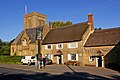
 Pub in Melplash - geograph.org.uk - 3839440.jpg 640 × 480; 72 KB
-
 The Half Moon, Melplash - geograph.org.uk - 1021843.jpg 640 × 426; 94 KB
-
 The Half Moon, Melplash - geograph.org.uk - 3082923.jpg 1,280 × 856; 268 KB
-
 Twinways Lane, Melplash - geograph.org.uk - 5314703.jpg 2,911 × 1,777; 1.05 MB
-
 West Loscombe Farm - geograph.org.uk - 1034585.jpg 640 × 426; 107 KB
-
 Ancient oak near Parnham - geograph.org.uk - 848810.jpg 640 × 480; 159 KB
-
 Coombe Down Hill - geograph.org.uk - 340925.jpg 640 × 480; 45 KB


.jpg)


