Category:Mehrteiliges Mehrfamilienhaus (Lindenhofstrasse 26–34, Worblaufen)
Jump to navigation
Jump to search
| Object location | | View all coordinates using: OpenStreetMap |
|---|
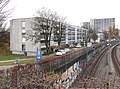
3-storey apartment building in Worblaufen in the canton of Bern, Switzerland  | |||||
| Upload media | |||||
| Instance of | |||||
|---|---|---|---|---|---|
| Part of | |||||
| Made from material | |||||
| Location | Worblaufen, Ittigen, Bern-Mittelland administrative district, Bernese Mittelland administrative region, Bern, Switzerland | ||||
| Street address |
| ||||
| Architect | |||||
| Heritage designation |
| ||||
| Inception |
| ||||
 | |||||
Media in category "Mehrteiliges Mehrfamilienhaus (Lindenhofstrasse 26–34, Worblaufen)"
This category contains only the following file.
-
 Lindenhofstr 26-34 Ittigen.jpg 1,974 × 1,470; 3.49 MB