Category:Meaux, East Riding of Yorkshire
Jump to navigation
Jump to search
English: Meaux is a hamlet in the East Riding of Yorkshire, England in the civil parish of Wawne. It is about 6.5 miles (10.5 km) north of Hull city centre and 3.5 miles (5.6 km) east of Beverley. The area was the site of an abbey "Meaux Abbey" before the dissolution of the monasteries by King Henry VIII in the 16th century
village in the United Kingdom  | |||||
| Upload media | |||||
| Instance of | |||||
|---|---|---|---|---|---|
| Location | Wawne, East Riding of Yorkshire, Yorkshire and the Humber, England | ||||
 | |||||
Subcategories
This category has the following 2 subcategories, out of 2 total.
Media in category "Meaux, East Riding of Yorkshire"
The following 49 files are in this category, out of 49 total.
-
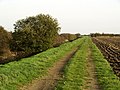
 A Stone Carr Field - geograph.org.uk - 603555.jpg 640 × 480; 90 KB
-
 Abbey Cottages - geograph.org.uk - 26271.jpg 640 × 480; 124 KB
-
 Access road to Stud Farm (geograph 4998774).jpg 3,775 × 2,787; 3.16 MB
-
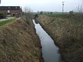 Arnold and Riston Drain (geograph 4348494).jpg 640 × 480; 80 KB
-
 Arnold West Carr Drain (geograph 4348484).jpg 640 × 480; 66 KB
-
 Arnold West Carr Drain (geograph 6274829).jpg 1,024 × 768; 164 KB
-
 Arnold West Carr Drain - geograph.org.uk - 170648.jpg 640 × 466; 89 KB
-
 Deep Ditch - Wawne Common - geograph.org.uk - 34890.jpg 480 × 640; 132 KB
-
 Drain beside farm track (geograph 4348900).jpg 640 × 480; 64 KB
-
 Drewery's Large Bridge (geograph 4348465).jpg 640 × 480; 81 KB
-
 Drewery's Large Bridge (geograph 6274841).jpg 1,024 × 768; 183 KB
-
 Drewery's Sock Dike and Drewery's Large Bridge (geograph 3327152).jpg 1,024 × 768; 161 KB
-
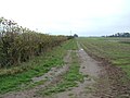
 Farm Track - geograph.org.uk - 338052.jpg 640 × 480; 137 KB
-
 Farm track and drain (geograph 6353443).jpg 1,024 × 768; 134 KB
-
 Farm Track at Holderness Drain side - geograph.org.uk - 603558.jpg 640 × 480; 102 KB
-
 Farm Track, Stone Carr - geograph.org.uk - 1552158.jpg 640 × 480; 76 KB
-
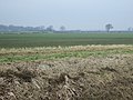
 Farmland towards Bridge Farm (geograph 4348498).jpg 640 × 480; 62 KB
-
 Farmland west of Arnold West Carr Drain (geograph 4348487).jpg 640 × 480; 90 KB
-
 Field edge - geograph.org.uk - 603552.jpg 640 × 480; 92 KB
-
 Fields by the Arnold West Carr Drain (geograph 6274837).jpg 1,024 × 768; 216 KB
-
 Heading west towards Meaux Bridge (geograph 4353833).jpg 640 × 480; 56 KB
-
 Holderness Drain (geograph 4348500).jpg 640 × 480; 68 KB
-
 Holderness Drain - geograph.org.uk - 1527954.jpg 640 × 480; 114 KB
-
 Holderness Drain - geograph.org.uk - 1552159.jpg 640 × 480; 81 KB
-
 Holderness Drain - geograph.org.uk - 722865.jpg 427 × 640; 90 KB
-
 Holderness Drain from Meaux Bridge (geograph 4474252).jpg 3,400 × 4,566; 6.76 MB
-
 Holderness Drain near Meaux - geograph.org.uk - 603550.jpg 640 × 480; 73 KB
-
 Holderness Drain near Meaux - geograph.org.uk - 785907.jpg 640 × 479; 202 KB
-
 Kidhill Lane near Meaux Bridge (geograph 6290173).jpg 1,024 × 768; 123 KB
-
 Meaux Bridge - geograph.org.uk - 803900.jpg 640 × 255; 125 KB
-
 Meaux Lane near Bridge Farm (geograph 7110200).jpg 1,024 × 683; 359 KB
-
 Meaux Lane near North Grange (geograph 7110198).jpg 1,024 × 683; 221 KB
-
 Meaux Road - geograph.org.uk - 803902.jpg 640 × 427; 149 KB
-
 Meaux Road from Meaux Bridge (geograph 4474257).jpg 4,608 × 3,456; 5.94 MB
-
 Minor Road Towards Meaux - geograph.org.uk - 1527953.jpg 640 × 480; 57 KB
-
 Minor Road Towards Meaux - geograph.org.uk - 1527955.jpg 640 × 480; 58 KB
-
 Minor road towards Meaux bridge (geograph 4355246).jpg 640 × 480; 52 KB
-
 Minor Road Towards Routh - geograph.org.uk - 1552168.jpg 640 × 480; 41 KB
-
 North Grange Meaux - geograph.org.uk - 1161495.jpg 446 × 640; 124 KB
-

-
 Routh Carrs - geograph.org.uk - 1552169.jpg 640 × 480; 86 KB
-
 Routh Carrs - geograph.org.uk - 337869.jpg 640 × 480; 141 KB
-
 Stud Farm Cottages Meaux.jpg 640 × 421; 79 KB
-
 The Holderness Drain from Meaux Bridge - geograph.org.uk - 803907.jpg 427 × 640; 185 KB
-
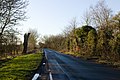
 The road near Meaux - geograph.org.uk - 603585.jpg 480 × 640; 113 KB
-
 Towards North Grange Meaux - geograph.org.uk - 722876.jpg 640 × 447; 157 KB
-
 Track beside Arnold West Carr Drain (geograph 4348480).jpg 640 × 480; 84 KB
-
 View towards Bridge Farm (geograph 5283602).jpg 1,024 × 768; 154 KB
-
 View towards Meaux Decoy Farm (geograph 4707395).jpg 1,024 × 768; 151 KB


.jpg)
.jpg)
.jpg)
.jpg)


.jpg)
.jpg)
.jpg)
.jpg)

.jpg)


.jpg)
.jpg)

.jpg)
.jpg)
.jpg)


.jpg)


.jpg)
.jpg)
.jpg)

.jpg)


.jpg)


.jpg)
.jpg)
.jpg)