Category:Meanwood Valley Trail
Jump to navigation
Jump to search
walking route in Leeds, England  | |||||
| Upload media | |||||
| Instance of | |||||
|---|---|---|---|---|---|
| Location | Leeds, West Yorkshire, Yorkshire and the Humber, England | ||||
 | |||||
Subcategories
This category has the following 2 subcategories, out of 2 total.
S
- Scotland Mill, Adel (16 F)
- Seven Arches Aqueduct (15 F)
Media in category "Meanwood Valley Trail"
The following 27 files are in this category, out of 27 total.
-
 (Remains of) The Blue Lagoon - geograph.org.uk - 2775847.jpg 3,872 × 2,592; 4.69 MB
-
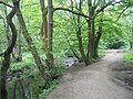
 A clearing on the Meanwood Valley Trail - geograph.org.uk - 2093324.jpg 800 × 600; 331 KB
-
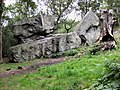 AdelCrag2269a.jpg 3,264 × 2,448; 2.74 MB
-
 Bridge at dam head, Golden Acre Park - geograph.org.uk - 2783793.jpg 3,872 × 2,592; 1.88 MB
-
 Bridge for Bridlepath - geograph.org.uk - 2783792.jpg 3,872 × 2,592; 2.23 MB
-
 Bridge over a dry stream - geograph.org.uk - 5129210.jpg 1,024 × 768; 388 KB
-
 Dales Way by Adel Beck - geograph.org.uk - 2759188.jpg 480 × 640; 130 KB
-
 Follow the yellow arrows (2719767929).jpg 1,635 × 2,454; 4.51 MB
-
 Gate to nowhere (3029971677).jpg 1,688 × 2,560; 5.13 MB
-
 Meanwood Beck - geograph.org.uk - 686526.jpg 640 × 480; 125 KB
-
 Meanwood Trail Sign2.jpg 2,048 × 1,536; 2.34 MB
-
 Meanwood Valley Trail - bridge over Meanwood Beck 02.jpg 2,048 × 1,536; 2.48 MB
-

-
 Meanwood Valley Trail - geograph.org.uk - 98650.jpg 480 × 640; 126 KB
-
 Meanwood Valley Trail - Mill Pond Lane - geograph.org.uk - 1137474.jpg 640 × 428; 252 KB
-
 Meanwood Valley Trail - Monk Bridge Road - geograph.org.uk - 1137963.jpg 480 × 640; 257 KB
-
 Meanwood Valley Trail - Monk Bridge Road - geograph.org.uk - 5806903.jpg 768 × 1,024; 205 KB
-
 Meanwood Valley Trail and Meanwood Beck 01.jpg 2,048 × 1,536; 2.87 MB
-
 Meanwood Valley Trail at the ring road - geograph.org.uk - 5129179.jpg 1,024 × 768; 410 KB
-

-
 Path along the crest of Golden Acre dam - geograph.org.uk - 5783504.jpg 768 × 1,024; 413 KB
-
 The Dales Way and Meanwood Beck at Weetwood - geograph.org.uk - 4414964.jpg 1,600 × 1,200; 1.04 MB
-
 The Dales Way Link - geograph.org.uk - 2093898.jpg 800 × 600; 357 KB
-
 The Dales Way Link through Leeds - geograph.org.uk - 2093364.jpg 800 × 600; 342 KB
-
 The Dales Way Link Walk - geograph.org.uk - 2093915.jpg 800 × 600; 324 KB
-
 Under the Ring Road (2720598366).jpg 1,920 × 2,560; 5.49 MB
-
 Weir on Meanwood Beck - geograph.org.uk - 686520.jpg 640 × 480; 107 KB
_The_Blue_Lagoon_-_geograph.org.uk_-_2775847.jpg)


.jpg)
.jpg)


.jpg)
