Category:Meall nan Eun
Jump to navigation
Jump to search
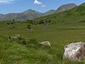
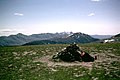
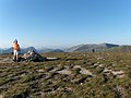
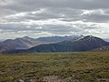
Meall nan Eun is a mountain in Argyll and Bute, Scotland. It is located between Loch Etive and Loch Tulla, and to the north of Glen Kinglass and Loch Dochard. It is 928 m high, and listed as a Munro and a Marilyn.
mountain in Argyll and Bute, Scotland, UK  | |||||
| Upload media | |||||
| Instance of | |||||
|---|---|---|---|---|---|
| Location | Argyll and Bute, Scotland | ||||
| Mountain range | |||||
| Topographic prominence |
| ||||
 | |||||
Media in category "Meall nan Eun"
The following 15 files are in this category, out of 15 total.
-
 Below Loch Dochard - geograph.org.uk - 204048.jpg 640 × 478; 129 KB
-
 Coirean Riabhach - geograph.org.uk - 639613.jpg 800 × 600; 214 KB
-
 Descending from Meall nan Eun - geograph.org.uk - 204708.jpg 640 × 488; 93 KB
-
 Falls, Abhainn Shira - geograph.org.uk - 927619.jpg 640 × 359; 48 KB
-
 Field exit, Glen Ceitlein - geograph.org.uk - 737010.jpg 1,000 × 671; 423 KB
-
 Highland Splendour - geograph.org.uk - 278864.jpg 640 × 458; 86 KB
-
 Meall nan Eun - geograph.org.uk - 1221192.jpg 640 × 427; 98 KB
-
 Meall nan Eun - geograph.org.uk - 203391.jpg 640 × 478; 124 KB
-
 Meall nan Eun - geograph.org.uk - 928085.jpg 640 × 359; 30 KB
-
 Old sheep fold, Glen Ceitlein - geograph.org.uk - 534558.jpg 800 × 543; 229 KB
-
 The summit of Meall nan Eun - geograph.org.uk - 534562.jpg 800 × 600; 237 KB
-
 View east from Meall nan Eun - geograph.org.uk - 639618.jpg 800 × 600; 166 KB
-
 View north northwest from Meall nan Eun - geograph.org.uk - 639748.jpg 800 × 600; 212 KB
-
 View southwest from Meall nan Eun - geograph.org.uk - 1006185.jpg 800 × 600; 182 KB
-


