Category:Meall Glas, Stirling
Jump to navigation
Jump to search

959m high mountain in Stirling, Scotland, UK  | |||||
| Upload media | |||||
| Instance of | |||||
|---|---|---|---|---|---|
| Location | Stirling, Scotland | ||||
| Mountain range | |||||
| Topographic prominence |
| ||||
| Elevation above sea level |
| ||||
| Parent peak | |||||
 | |||||
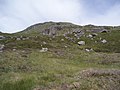
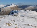
Meall Glas is a mountain situated in the southern highlands of Scotland, it stands on the northern border of the Loch Lomond and the Trossachs National Park, some 8.5 kilometres north east of Crianlarich.
Media in category "Meall Glas, Stirling"
The following 17 files are in this category, out of 17 total.
-
 Ben Cheathaich - geograph.org.uk - 202994.jpg 640 × 480; 154 KB
-
 Bridge at Badour - geograph.org.uk - 1281798.jpg 640 × 480; 62 KB
-

-
 Glen Lochay - geograph.org.uk - 36838.jpg 640 × 419; 72 KB
-
 High wind on Meall Glas - geograph.org.uk - 1230652.jpg 640 × 480; 80 KB
-
 Ledcharrie geograph-3490488-by-Ben-Brooksbank.jpg 2,368 × 1,605; 3.33 MB
-
 Meall Glas - geograph.org.uk - 202990.jpg 640 × 480; 136 KB
-
 Meall Glas - geograph.org.uk - 297775.jpg 640 × 423; 81 KB
-
 Meall Glas - geograph.org.uk - 561632.jpg 640 × 417; 87 KB
-
 Meall Glas group from the SW.jpg 1,653 × 1,176; 248 KB
-
 Upper Glen Lochay - geograph.org.uk - 561415.jpg 640 × 425; 57 KB
-

-
 Allt Riobain - geograph.org.uk - 202977.jpg 640 × 480; 151 KB
-
 East side of Beinn nan Imirean - geograph.org.uk - 561630.jpg 640 × 364; 70 KB
-
 Mamlorn peat - geograph.org.uk - 28763.jpg 640 × 480; 198 KB
-
 Meall Glas Bheag - geograph.org.uk - 202988.jpg 640 × 480; 158 KB
-
 Sail Dhubh. - geograph.org.uk - 131971.jpg 640 × 488; 98 KB


