Category:Meall Corranaich
Jump to navigation
Jump to search
1069m high mountain in Perth and Kinross, Scotland, UK  | |||||
| Upload media | |||||
| Instance of | |||||
|---|---|---|---|---|---|
| Location | Perth and Kinross, Scotland | ||||
| Mountain range | |||||
| Topographic prominence |
| ||||
| Elevation above sea level |
| ||||
 | |||||
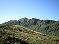
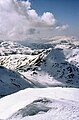
Meall Corranaich is a mountain in the southern Highlands of Scotland. It lies to the north Loch Tay, at the western end of the Ben Lawers ridge. It is 1069 m high, and listed as a Munro and a Marilyn.
Media in category "Meall Corranaich"
The following 38 files are in this category, out of 38 total.
-
 An Stuc - Summit Cairn - geograph.org.uk - 475972.jpg 640 × 447; 103 KB
-
 Approaching the summit - geograph.org.uk - 360721.jpg 640 × 480; 100 KB
-
 Beinn Ghlas from Meall Corranaich - geograph.org.uk - 123059.jpg 640 × 480; 86 KB
-
 Ben Lawers 014.jpg 1,496 × 1,122; 377 KB
-

-
 Eastern side of Meall Corranaich - geograph.org.uk - 921639.jpg 640 × 480; 77 KB
-
 Eyeing Meall Corranaich (20842122882).jpg 4,272 × 2,848; 5.68 MB
-
 Final ascent of Meall Corranaich - geograph.org.uk - 3987334.jpg 480 × 640; 66 KB
-

-
 Looking north from Meall Corranaich 980415.jpg 640 × 480; 60 KB
-
 Meall a' Choire Leith from the south - geograph.org.uk - 980430.jpg 640 × 480; 62 KB
-
 Meall Corranaich , Munro No 68 - geograph.org.uk - 70263.jpg 640 × 480; 207 KB
-
 Meall Corranaich - geograph.org.uk - 2243203.jpg 640 × 480; 135 KB
-
 Meall Corranaich - geograph.org.uk - 2898392.jpg 640 × 421; 218 KB
-
 Meall Corranaich - geograph.org.uk - 3584564.jpg 1,941 × 1,893; 559 KB
-
 Meall Corranaich - geograph.org.uk - 36679.jpg 640 × 480; 78 KB
-
 Meall Corranaich - geograph.org.uk - 3693565.jpg 4,608 × 3,456; 4.65 MB
-
 Meall Corranaich Summit Cairn - geograph.org.uk - 67656.jpg 640 × 480; 203 KB
-
 Meall Corranaich, Scottish Highlands, Scotland 02.jpg 13,957 × 4,966; 45.18 MB
-
-
 Metamorphic Folds (20663638550).jpg 4,272 × 2,848; 8.11 MB
-
 North ridge of Meall Corranaich - geograph.org.uk - 1555583.jpg 640 × 436; 85 KB
-
 North ridge of Meall Corranaich - geograph.org.uk - 980425.jpg 640 × 480; 60 KB
-

-
 Path towards Meall Corranaich - geograph.org.uk - 3693562.jpg 4,608 × 3,456; 5.11 MB
-

-
 Ridge of Meall Corranaich, Scottish Highlands, Scotland.jpg 5,464 × 3,618; 14 MB
-
 SW ridge of Meall Corranaich - geograph.org.uk - 980401.jpg 640 × 480; 61 KB
-
 The Beinn Ghlas Bypass Path - geograph.org.uk - 1417114.jpg 640 × 480; 89 KB
-
 The Lawers range from the north - geograph.org.uk - 874531.jpg 640 × 291; 42 KB
-

-
 View from Carn Gorm - geograph.org.uk - 1309320.jpg 640 × 447; 132 KB
-

-

-
 View southwest from Ben Lawers, Scottish Highlands, Scotland.jpg 20,791 × 5,092; 60.79 MB
-
 West from Ben Lawers summit - geograph.org.uk - 872431.jpg 421 × 640; 70 KB
-
 Western slopes of Meall Corranaich - geograph.org.uk - 506219.jpg 640 × 427; 71 KB
-


.jpg)


.jpg)


_P_SCO_Panorama.jpg)