Category:Meadows in Wiltshire
Jump to navigation
Jump to search
Ceremonial counties of England: Bedfordshire · Berkshire · Buckinghamshire · Cambridgeshire · Cornwall · Cumbria · Devon · Dorset · Durham · East Riding of Yorkshire · East Sussex · Essex · Gloucestershire · Greater London · Greater Manchester · Hampshire · Herefordshire · Hertfordshire · Isle of Wight · Kent · Lancashire · Leicestershire · Lincolnshire · Merseyside · Norfolk · North Yorkshire · Northamptonshire · Northumberland · Oxfordshire · Shropshire · Somerset · Staffordshire · Suffolk · Surrey · Warwickshire · West Sussex · West Yorkshire · Wiltshire · Worcestershire
City-counties:
Former historic counties:
Other former counties:
City-counties:
Former historic counties:
Other former counties:
Wikimedia category | |||||
| Upload media | |||||
| Instance of | |||||
|---|---|---|---|---|---|
| Category combines topics | |||||
| Wiltshire | |||||
ceremonial county of England (use Q21694746 for administrative unitary authority)  Cavall de Cherhill, a Calne.    | |||||
| Instance of |
| ||||
| Location | South West England, England | ||||
| Capital | |||||
| Population |
| ||||
| Area |
| ||||
| Different from | |||||
| Said to be the same as | Wiltshire (historic county of England, ceremonial county of England, 1844) | ||||
| official website | |||||
 | |||||
A meadow is a field habitat colonised primarily by grass and other non-woody plants. Meadows may be naturally occurring or artificially created from cleared shrub or woodland. As well as standard meadows they may occur on uplands, near the coast or in wetland or riverside areas. This category is for meadows situated in the County of Wiltshire
Media in category "Meadows in Wiltshire"
The following 192 files are in this category, out of 192 total.
-
 Empty Meadow - geograph.org.uk - 487791.jpg 640 × 480; 140 KB
-
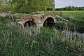 Farm bridge over the Thames - geograph.org.uk - 2390996.jpg 1,024 × 680; 272 KB
-
 Farmland behind Park House - geograph.org.uk - 391668.jpg 640 × 430; 100 KB
-

-
 Flooded Meadow - geograph.org.uk - 301125.jpg 640 × 480; 88 KB
-
 Flooded Meadows at Odstock - geograph.org.uk - 318381.jpg 640 × 480; 89 KB
-
 Footpath across meadow, Moor Farm - geograph.org.uk - 460612.jpg 640 × 480; 69 KB
-
 Grassland - geograph.org.uk - 438583.jpg 640 × 480; 110 KB
-
 Grazing horses - geograph.org.uk - 326933.jpg 640 × 426; 56 KB
-
 Info Board at Middle Street Meadows.jpg 4,000 × 2,248; 2.45 MB
-
 Looking east on the Dinton Mill acess road.jpg 2,992 × 2,992; 2.02 MB
-
 Meadow by Clink Lane - geograph.org.uk - 1343406.jpg 640 × 417; 75 KB
-
 Meadow by Pudding Brook - geograph.org.uk - 1337101.jpg 640 × 480; 123 KB
-
 Meadow by the Avon - geograph.org.uk - 1346190.jpg 640 × 444; 85 KB
-
 Meadow east of Box - geograph.org.uk - 802180.jpg 640 × 484; 125 KB
-
 Meadow east of Poulshot Road - geograph.org.uk - 1440502.jpg 640 × 427; 141 KB
-
 Meadow near Black Dog Farm - geograph.org.uk - 1278574.jpg 640 × 502; 153 KB
-
 Meadow near Bowden Hill - geograph.org.uk - 1340588.jpg 640 × 480; 77 KB
-
 Meadow near Pinnell's Mill - geograph.org.uk - 1336866.jpg 640 × 480; 69 KB
-
 Meadow near Scott's Mill - geograph.org.uk - 1545500.jpg 640 × 480; 105 KB
-
 Meadow near the River Marden - geograph.org.uk - 1545491.jpg 640 × 480; 99 KB
-
 Meadow north of Middle Farm - geograph.org.uk - 1545267.jpg 640 × 480; 116 KB
-
 Meadow, Donhead St Andrew - geograph.org.uk - 830133.jpg 640 × 480; 132 KB
-
 Meadow, Spirthill - geograph.org.uk - 900089.jpg 640 × 395; 50 KB
-
 Meadows near Chippenham - geograph.org.uk - 1337207.jpg 640 × 480; 120 KB
-
 Meadows, Broad Town - geograph.org.uk - 838311.jpg 640 × 480; 160 KB
-
 Medieval village of Yarnfield (site of) - geograph.org.uk - 1625470.jpg 640 × 480; 111 KB
-
 Mere Down Farm - geograph.org.uk - 909686.jpg 640 × 480; 140 KB
-
 Middle Street Meadow, West Harnham - geograph.org.uk - 152416.jpg 640 × 480; 316 KB
-
 Middle Street Meadows 2, Harnham, Salisbury.jpg 4,000 × 2,248; 2.72 MB
-
 Middle Street Meadows by the river.jpg 4,000 × 2,248; 2.55 MB
-
 Middle Street Meadows Info board.jpg 4,000 × 2,248; 2.04 MB
-
 Middle Street Meadows looking west.jpg 4,000 × 2,248; 2.32 MB
-
 Middle Street Meadows uncut.jpg 4,000 × 2,248; 2.44 MB
-
 More pasture near Housecroft Farm - geograph.org.uk - 1056399.jpg 640 × 495; 164 KB
-
 Mown grass by the Avon - geograph.org.uk - 1337011.jpg 640 × 480; 95 KB
-
 Near the end of the byway, Wilsford Down - geograph.org.uk - 1260831.jpg 640 × 480; 157 KB
-
 Near Wing Farm looking south - geograph.org.uk - 1373173.jpg 640 × 461; 106 KB
-

-
 North east from Stoke Hill - geograph.org.uk - 1304026.jpg 640 × 468; 119 KB
-
 North east from the B390 - geograph.org.uk - 1426021.jpg 640 × 494; 132 KB
-
 North east from White Hill - geograph.org.uk - 1316430.jpg 640 × 505; 154 KB
-
 North east near Parsonage Farm - geograph.org.uk - 1263911.jpg 640 × 513; 170 KB
-
 North from Naish Hill (2) - geograph.org.uk - 1180876.jpg 640 × 555; 139 KB
-
 North from Naish Hill - geograph.org.uk - 1180868.jpg 640 × 512; 172 KB
-
 North from Spout Lane - geograph.org.uk - 1620240.jpg 640 × 462; 164 KB
-
 North of west on Charlcutt Lane - geograph.org.uk - 1520916.jpg 640 × 473; 118 KB
-
 North west from Durlett Road - geograph.org.uk - 1136752.jpg 640 × 469; 195 KB
-
 North Wilts Canal - geograph.org.uk - 1048209.jpg 640 × 480; 56 KB
-
 North Wiltshire pasture land - geograph.org.uk - 876866.jpg 640 × 480; 103 KB
-
 Not Mud Lane, Restrop, near Purton - geograph.org.uk - 893020.jpg 640 × 480; 106 KB
-
 Not so reassuring sign - geograph.org.uk - 642894.jpg 640 × 430; 140 KB
-
 Oilseed rape near Fonthill Bishop - geograph.org.uk - 792194.jpg 640 × 480; 85 KB
-
 Old log in a field near Redstocks. - geograph.org.uk - 1129815.jpg 640 × 494; 213 KB
-
 One in two-and-a-half - geograph.org.uk - 1366095.jpg 640 × 480; 238 KB
-
 Over a pasture near Spiers Piece Farm - geograph.org.uk - 1233031.jpg 640 × 504; 156 KB
-
 Over the field to Chippenham north - geograph.org.uk - 1510664.jpg 640 × 505; 133 KB
-
 Part of a small field north of Malmesbury - geograph.org.uk - 914920.jpg 640 × 480; 127 KB
-
 Part of Semley Common - geograph.org.uk - 1061999.jpg 640 × 383; 60 KB
-
 Pasture and a rusting farm vehicle - geograph.org.uk - 1460379.jpg 640 × 462; 130 KB
-
 Pasture and cattle, The Fox - geograph.org.uk - 797533.jpg 640 × 480; 155 KB
-
 Pasture and cottages east of Bowerhill - geograph.org.uk - 1619955.jpg 640 × 510; 165 KB
-
 Pasture and Cottages, Coulston - geograph.org.uk - 1057443.jpg 640 × 481; 187 KB
-

-
 Pasture and hedge - geograph.org.uk - 861811.jpg 640 × 480; 85 KB
-
 Pasture and house, Lye's Green - geograph.org.uk - 1124173.jpg 640 × 518; 199 KB
-
 Pasture and houses, Milton Lilbourne - geograph.org.uk - 1419289.jpg 640 × 480; 124 KB
-
 Pasture at Lye's Green - geograph.org.uk - 1120495.jpg 640 × 450; 166 KB
-
 Pasture at the end of Butts Lane - geograph.org.uk - 1077591.jpg 640 × 527; 206 KB
-
 Pasture between Tockenham and Bushton - geograph.org.uk - 1187637.jpg 640 × 479; 194 KB
-
 Pasture by a minor road - geograph.org.uk - 1461516.jpg 640 × 538; 129 KB
-
 Pasture Cuckold's Green - geograph.org.uk - 1264043.jpg 640 × 511; 130 KB
-
 Pasture east of Durlett Road - geograph.org.uk - 1129872.jpg 640 × 507; 204 KB
-
 Pasture east of Kington Lane - geograph.org.uk - 1381217.jpg 640 × 427; 117 KB
-
 Pasture land near Lower Studley - geograph.org.uk - 802548.jpg 640 × 432; 75 KB
-
 Pasture land off Grove Lane - geograph.org.uk - 1397750.jpg 640 × 472; 124 KB
-
 Pasture land west of Bromham - geograph.org.uk - 1115453.jpg 640 × 470; 160 KB
-
 Pasture near Easton Piercy - geograph.org.uk - 1394775.jpg 640 × 541; 166 KB
-
 Pasture near Housecroft Farm again - geograph.org.uk - 1056414.jpg 640 × 518; 155 KB
-
 Pasture near Lower Wraxall - geograph.org.uk - 851597.jpg 640 × 471; 77 KB
-
 Pasture near Manor Farm - geograph.org.uk - 1477138.jpg 640 × 521; 127 KB
-
 Pasture near North Wraxall - geograph.org.uk - 1133839.jpg 640 × 474; 228 KB
-
 Pasture near Stowell Farm - geograph.org.uk - 1077369.jpg 640 × 475; 203 KB
-
 Pasture north east of Seend Bridge Farm - geograph.org.uk - 1063904.jpg 640 × 480; 183 KB
-
 Pasture off Durlett Road - geograph.org.uk - 1136738.jpg 640 × 479; 209 KB
-
 Pasture off New Road - geograph.org.uk - 1275783.jpg 640 × 445; 105 KB
-
 Pasture on Euridge Lane - geograph.org.uk - 1131088.jpg 640 × 511; 208 KB
-
 Pasture on the way to Truckle Hill - geograph.org.uk - 1133910.jpg 640 × 467; 142 KB
-
 Pasture south of Bratton Road - geograph.org.uk - 846652.jpg 640 × 493; 71 KB
-
 Pasture west of Hindon Road - geograph.org.uk - 1528041.jpg 640 × 512; 206 KB
-
 Pasture, Bishops Cannings - geograph.org.uk - 1564955.jpg 640 × 480; 149 KB
-
 Pasture, Witcha - geograph.org.uk - 988075.jpg 640 × 480; 147 KB
-
 Pastures, West Knoyle - geograph.org.uk - 975463.jpg 640 × 480; 88 KB
-
 Pastures, West Knoyle - geograph.org.uk - 975508.jpg 640 × 480; 110 KB
-
 Path across Spye Park (3) - geograph.org.uk - 1342299.jpg 640 × 413; 77 KB
-
 Path across Spye Park - geograph.org.uk - 1342256.jpg 640 × 480; 108 KB
-
 Patney, Footpath near Home Farm - geograph.org.uk - 1397249.jpg 640 × 480; 87 KB
-
 Pen Hill Barn - geograph.org.uk - 865654.jpg 640 × 472; 79 KB
-
 Picked Hill - geograph.org.uk - 842690.jpg 640 × 480; 148 KB
-
 Picnic area, Smallgrain Plantation - geograph.org.uk - 1345665.jpg 640 × 480; 103 KB
-
 Poppies near Salisbury District Hospital - geograph.org.uk - 862560.jpg 640 × 480; 123 KB
-

-
 Poultry Farm - geograph.org.uk - 811132.jpg 640 × 480; 85 KB
-
 Pylon and pasture - geograph.org.uk - 1133867.jpg 640 × 467; 168 KB
-
 Pylon shadow on farmland, Hook Street - geograph.org.uk - 1213081.jpg 640 × 444; 182 KB
-

-
 Richardson Village, Winterbourne Bassett - geograph.org.uk - 840213.jpg 640 × 480; 113 KB
-
 River Avon near Chippenham sewage works - geograph.org.uk - 1337031.jpg 640 × 480; 117 KB
-
 River Avon, near Upper Seagry - geograph.org.uk - 914352.jpg 640 × 480; 137 KB
-
 River Bourne in Brunton - geograph.org.uk - 1405305.jpg 640 × 480; 108 KB
-
 River Ebble near Odstock - geograph.org.uk - 1608478.jpg 640 × 480; 183 KB
-
 River Ebble near Odstock - geograph.org.uk - 719059.jpg 640 × 480; 104 KB
-
 River Ebble, Alvediston - geograph.org.uk - 749250.jpg 640 × 480; 139 KB
-
 River Kennet valley at Stitchcombe (1) - geograph.org.uk - 1407787.jpg 640 × 480; 109 KB
-
 River restoration of the River Cole - geograph.org.uk - 1210054.jpg 640 × 428; 80 KB
-
 River Wylye - geograph.org.uk - 1660741.jpg 640 × 480; 134 KB
-
 Roadside signage and Collins Lane, Purton - geograph.org.uk - 1735107.jpg 1,600 × 1,345; 1.01 MB
-
 Rodmead Farm - geograph.org.uk - 909691.jpg 640 × 480; 149 KB
-
 Rough grazing, Fovant Down - geograph.org.uk - 1452044.jpg 640 × 480; 193 KB
-
 Ruddlemoor Farm - geograph.org.uk - 915746.jpg 640 × 480; 116 KB
-
 Salisbury Plain - geograph.org.uk - 1390541.jpg 640 × 480; 61 KB
-
 Semington Brook - geograph.org.uk - 1263488.jpg 640 × 438; 123 KB
-
 Seven Fields, Greenmeadow, Swindon - geograph.org.uk - 800261.jpg 640 × 480; 119 KB
-
 Seven Fields, Greenmeadow, Swindon - geograph.org.uk - 800611.jpg 640 × 480; 158 KB
-
 Shallow Brook - geograph.org.uk - 1629272.jpg 640 × 426; 80 KB
-

-
 Sheep near Bowden Park - geograph.org.uk - 1340222.jpg 640 × 480; 102 KB
-
 Sheep near Manton - geograph.org.uk - 1318945.jpg 640 × 480; 174 KB
-
 Sheep near Pitton - geograph.org.uk - 980684.jpg 640 × 480; 115 KB
-
 Sheep near Tisbury - geograph.org.uk - 884426.jpg 640 × 480; 89 KB
-
 Sheep near Whiteparish - geograph.org.uk - 1052161.jpg 640 × 431; 99 KB
-
 Sheep pasture near Chippenham - geograph.org.uk - 991014.jpg 640 × 480; 67 KB
-
 Sheep pasture near Crossroads Farm - geograph.org.uk - 1053682.jpg 640 × 559; 168 KB
-
 Sheep pasture off the A3102 - geograph.org.uk - 1111787.jpg 640 × 469; 223 KB
-
 Sheep, Fisherton de la Mere - geograph.org.uk - 950586.jpg 640 × 480; 121 KB
-
 Sheepless Hill - geograph.org.uk - 1014665.jpg 640 × 480; 130 KB
-
 Small field north of Malmesbury - geograph.org.uk - 914907.jpg 640 × 480; 85 KB
-
 South east from Colerne - geograph.org.uk - 994474.jpg 640 × 451; 76 KB
-
 South of Nunton - geograph.org.uk - 1148618.jpg 640 × 427; 83 KB
-
 Stable block at King Edward's Place - geograph.org.uk - 1420956.jpg 640 × 480; 255 KB
-
 Stile on Church Path, Westbury - geograph.org.uk - 899028.jpg 640 × 480; 170 KB
-

-
 Stream near Brook End - geograph.org.uk - 1629270.jpg 640 × 406; 83 KB
-
 Sunset on the Avon pastures - geograph.org.uk - 1148869.jpg 640 × 426; 52 KB
-
 The Kennet and Avon Canal, Woodborough - geograph.org.uk - 844158.jpg 640 × 480; 139 KB
-
 The postman calls at Stokes Marsh Farm - geograph.org.uk - 1275663.jpg 640 × 494; 169 KB
-
 The River Nadder at Middle Street Meadows.jpg 4,000 × 2,248; 2.49 MB
-
 The River Thames looking upstream - geograph.org.uk - 1776014.jpg 1,500 × 1,000; 214 KB
-
-
 The Westbury to Portsmouth railway - geograph.org.uk - 1057597.jpg 640 × 530; 218 KB
-
 Towards Odstock church - geograph.org.uk - 1148616.jpg 640 × 427; 72 KB
-
 Track leading out of Dengrove Bottom - geograph.org.uk - 392176.jpg 640 × 430; 77 KB
-
 Track to White Lodge Farm - geograph.org.uk - 1238261.jpg 640 × 480; 132 KB
-
 Track towards Parsonage Down Clump - geograph.org.uk - 445803.jpg 640 × 430; 282 KB
-
 Track, Trafalgar Park - geograph.org.uk - 871252.jpg 640 × 480; 77 KB
-

-
 Train, Tisbury - geograph.org.uk - 1494080.jpg 640 × 480; 139 KB
-
 Tree stump and fungus, Cannon Hill Wood - geograph.org.uk - 738538.jpg 480 × 640; 138 KB
-
 Tree trunk, Marleycombe Hill - geograph.org.uk - 1014499.jpg 640 × 480; 131 KB
-
 Trees and a meadow in Spye Park - geograph.org.uk - 1342247.jpg 640 × 480; 112 KB
-
 Trees on Corton Hill - geograph.org.uk - 462092.jpg 640 × 427; 96 KB
-
 Triangulation Pillar, Summerslade Down - geograph.org.uk - 1401695.jpg 640 × 480; 122 KB
-
 Trow Lane Farm,Tockenham Wick - geograph.org.uk - 1209116.jpg 640 × 480; 137 KB
-
 Tuppers Field - geograph.org.uk - 1570256.jpg 640 × 437; 95 KB
-
 Upper Swinley Farm - geograph.org.uk - 1403982.jpg 640 × 548; 193 KB
-
 Valley at the end of Pottle Street - geograph.org.uk - 1371800.jpg 640 × 456; 152 KB
-
 Venerable tree, near Sopworth - geograph.org.uk - 392628.jpg 640 × 438; 57 KB
-
 View across field south of Pitton - geograph.org.uk - 1286488.jpg 640 × 480; 63 KB
-

-
 View east across a frosted field - geograph.org.uk - 1111411.jpg 640 × 480; 178 KB
-
 View from Cley Hill car park - geograph.org.uk - 931684.jpg 640 × 427; 53 KB
-
 View from the A36 - geograph.org.uk - 1416595.jpg 640 × 476; 131 KB
-
 View from the bridge - geograph.org.uk - 1302861.jpg 640 × 425; 155 KB
-

-
 View from the end of Sandridge Lane - geograph.org.uk - 188548.jpg 640 × 480; 71 KB
-
 View from Wadswick Lane - geograph.org.uk - 813693.jpg 640 × 483; 51 KB
-

-
 View of South Hill Copse - geograph.org.uk - 382825.jpg 640 × 430; 77 KB
-
 View of Woodminton Farm - geograph.org.uk - 642618.jpg 640 × 430; 76 KB
-
 Walking the dog, Bishopstone - geograph.org.uk - 1655998.jpg 640 × 482; 177 KB
-
 Water meadow by the Avon - geograph.org.uk - 1337044.jpg 640 × 480; 89 KB
-
 Water meadows beside the River Wylye - geograph.org.uk - 1238295.jpg 640 × 480; 89 KB
-
 Water meadows near Bishopstone - geograph.org.uk - 744537.jpg 640 × 480; 110 KB
-
 Water Meadows, Bishopstone - geograph.org.uk - 648630.jpg 640 × 480; 90 KB
-
 Watermeadows , Avon farm (geograph 2667582).jpg 640 × 445; 94 KB
-
 Watermeadows at Lechlade - geograph.org.uk - 1262665.jpg 640 × 480; 55 KB
-
 West End Farm, east of Cleverton - geograph.org.uk - 1221176.jpg 640 × 480; 144 KB
-
 Wet Meadow - geograph.org.uk - 745302.jpg 640 × 480; 63 KB
-

-
 Woodland near Barrow Street - geograph.org.uk - 1560127.jpg 640 × 480; 134 KB
-
 Wyck, Tisbury - geograph.org.uk - 1493917.jpg 640 × 480; 153 KB
-
 Wylye Valley from the A36 - geograph.org.uk - 1416860.jpg 640 × 518; 205 KB


_-_geograph.org.uk_-_1625470.jpg)


_-_geograph.org.uk_-_1180876.jpg)


_-_geograph.org.uk_-_1342299.jpg)


_-_geograph.org.uk_-_1407787.jpg)


.jpg)


