Category:Meadowfield
Jump to navigation
Jump to search
English: Meadowfield is a small village in County Durham in North East England, situated approximately 2 miles to the south-west of Durham on the A690. It is situated within the civil parish of Brandon and Byshottles.
village in County Durham, United Kingdom  | |||||
| Upload media | |||||
| Instance of | |||||
|---|---|---|---|---|---|
| Location | Brandon and Byshottles, County Durham, North East England, England | ||||
 | |||||
Subcategories
This category has only the following subcategory.
Media in category "Meadowfield"
The following 19 files are in this category, out of 19 total.
-
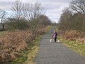
 'Waste ground' south of Meadowfield - geograph.org.uk - 4749703.jpg 1,500 × 1,001; 1.51 MB
-
 A690 entering Meadowfield - geograph.org.uk - 5554226.jpg 1,500 × 1,125; 1.34 MB
-
-
 Browney Primary School, Meadowfield - geograph.org.uk - 3068172.jpg 4,608 × 3,456; 5.39 MB
-

-

-
 Entering Meadowfield - geograph.org.uk - 4815842.jpg 640 × 480; 49 KB
-

-
 High Street (A690), Meadowfield - geograph.org.uk - 4815861.jpg 640 × 480; 81 KB
-
 John Street, Meadowfield - geograph.org.uk - 3068163.jpg 4,608 × 3,456; 5.8 MB
-
 M ^ M Pharmacy adjoining Meadowfield Surgery - geograph.org.uk - 3459478.jpg 3,648 × 2,736; 1.87 MB
-
 Meadowfield and District Social Club and Institute - geograph.org.uk - 3145303.jpg 3,648 × 2,736; 2.14 MB
-

-
 Service station, Meadowfield - geograph.org.uk - 4815843.jpg 640 × 480; 59 KB
-
 Shops and Housing in Meadowfield - geograph.org.uk - 6198448.jpg 3,069 × 2,592; 2.48 MB
-
 Smallholding near Meadowfield - geograph.org.uk - 3068205.jpg 4,608 × 3,456; 5.8 MB
-
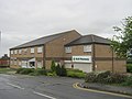
 St John's Road entrance to Meadowfield Industrial Estate - geograph.org.uk - 3145247.jpg 3,648 × 2,736; 2.12 MB
-
 St Patrick's Church at Meadowfield - geograph.org.uk - 4815858.jpg 640 × 484; 65 KB
-
 St Patricks RC Church - geograph.org.uk - 3832997.jpg 640 × 427; 494 KB


,_Meadowfield_-_geograph.org.uk_-_4815863.jpg)


,_Meadowfield_-_geograph.org.uk_-_4815861.jpg)


