Category:May 2009 in North Yorkshire
Jump to navigation
Jump to search
Ok
Deutsch: Bilder, die im Mai 2009 in North Yorkshire aufgenommen worden sind. Bitte beachten Sie, dass dies weder das Datum des Uploads noch das Datum des Scannens eines Fotos ist.
English: Images/pictures taken in North Yorkshire during May 2009. Note this is not the date of the upload, nor the date a photo was scanned.
Español: Fotografías o imágenes tomadas en North Yorkshire durante mayo 2009. No es la fecha de subida ni escaneo, sino la fecha en que las fotografías o imágenes se crearon.
Esperanto: Bildoj faritaj en North Yorkshire en majo 2009. Tio ne estas la dato, kiam la bildoj estis alŝutitaj aŭ skanitaj.
Français : Photographies ou images prises en North Yorkshire durant mai 2009. Ce n'est pas la date du téléchargement ou du scan.
Galego: Fotografías ou imaxes tomadas en North Yorkshire durante maio 2009. Non é a data de subida nin escaneamento, senón a data na que se crearon as fotografías ou imaxes.
Italiano: Fotografie o immagini scattate a North Yorkshire nel maggio 2009. Nota bene: la data non si riferisce né a quella di upload né a quella in cui la foto è stata digitalizzata.
Norsk bokmål: Bilder tatt i North Yorkshire i løpet av mai 2009. Merk at dette ikke er datoen for opplasting, eller når et bilde har blitt skannet.
Norsk nynorsk: Bilete teke i North Yorkshire i løpet av mai 2009. Merk at dette ikkje er datoen for opplasting, eller når eit bilete har vorte skanna.
Русский: Изображения, сделанные в North Yorkshire в течение май 2009 (не дата загрузки изображения).
Українська: Зображення, зроблені в North Yorkshire протягом травень 2009. Зауважте, що це не дата завантаження чи дата сканування фотографії.
| May 2008 | ← | May 2009 | → | May 2010 | |||||||
| Jan | Feb | Mar | Apr | May | Jun | Jul | Aug | Sep | Oct | Nov | Dec |
| 102 | 131 | 133 | 160 | 279 | 264 | 181 | 133 | 126 | 110 | 109 | 159 |
|---|---|---|---|---|---|---|---|---|---|---|---|
Subcategories
This category has only the following subcategory.
Y
Media in category "May 2009 in North Yorkshire"
The following 200 files are in this category, out of 278 total.
(previous page) (next page)-
 Friars Wynd, Richmond - geograph.org.uk - 1318316.jpg 480 × 640; 120 KB
-
 New Road, Richmond - geograph.org.uk - 1316721.jpg 640 × 480; 136 KB
-
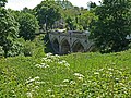
 Richmond Bridge - geograph.org.uk - 1318312.jpg 480 × 640; 117 KB
-
 Cattle Grid at Tor Dyke - geograph.org.uk - 1344054.jpg 640 × 480; 109 KB
-
 Fleet Moss and district boundary - geograph.org.uk - 1343587.jpg 640 × 480; 109 KB
-
 Barden Bridge - geograph.org.uk - 1343056.jpg 640 × 480; 111 KB
-
 Richmond Bridge - geograph.org.uk - 1724034.jpg 2,736 × 3,648; 5.38 MB
-
 Richmond Rooftops - geograph.org.uk - 1724030.jpg 2,736 × 3,648; 5.41 MB
-
 Richmond Bridge - geograph.org.uk - 1335791.jpg 640 × 480; 101 KB
-

-
 Richmond Lower.jpg 640 × 476; 120 KB
-
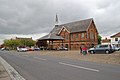
 St Marys Richmond North Yorks 001.jpg 480 × 640; 123 KB
-
 View towards Mercury Bridge - geograph.org.uk - 1390418.jpg 640 × 480; 201 KB
-
 Market Place, Richmond - geograph.org.uk - 1364053.jpg 640 × 480; 84 KB
-
 Maison Dieu, Richmond - geograph.org.uk - 1334218.jpg 640 × 475; 92 KB
-

-
 A1 southbound - geograph.org.uk - 1324316.jpg 640 × 480; 44 KB
-
 A1 southbound - geograph.org.uk - 1324325.jpg 640 × 480; 35 KB
-
 A1 southbound - geograph.org.uk - 1324337.jpg 640 × 480; 51 KB
-
 A1039 towards Flixton - geograph.org.uk - 1309854.jpg 640 × 480; 67 KB
-
 A645 Camblesforth - geograph.org.uk - 1287437.jpg 640 × 480; 49 KB
-
 Addinall's Yard, Finkle Street - geograph.org.uk - 1317050.jpg 369 × 640; 222 KB
-
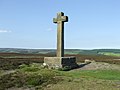 Ana Cross - geograph.org.uk - 1330594.jpg 640 × 480; 60 KB
-
 Ana Cross - geograph.org.uk - 1331870.jpg 480 × 640; 21 KB
-

-

-

-

-

-

-
 Arriva bus 1920 DAF SB120 Wrights W81 PRG in Middlesbrough bus station 5 May 2009.JPG 2,059 × 1,350; 1.32 MB
-
 Arriva bus 278 Scania L113 East Lancs P278 VRG in Middlesbrough bus station 5 May 2009.JPG 2,131 × 1,748; 1.79 MB
-
 Arriva bus 278 Scania L113 East Lancs P278 VRG in Stockton 5 May 2009.JPG 3,648 × 2,736; 2.56 MB
-
 Arriva bus 285 Scania L113 East Lancs N285 NCN in Middlesbrough bus station 5 May 2009.JPG 1,830 × 1,217; 1.07 MB
-
 Arriva bus 290 Scania L113 East Lancs N290 NCN in Middlesbrough bus station 5 May 2009.JPG 3,648 × 2,736; 2.56 MB
-

-

-

-

-

-

-

-
 Arriva bus 4649 Scania N94 NK05 GXC in Middlesbrough bus station 5 May 2009.JPG 1,589 × 1,314; 969 KB
-

-

-
 Arriva bus 4662 Scania N94 NK07 FZE in Middlesbrough bus station 5 May 2009.JPG 2,736 × 3,648; 2.56 MB
-

-

-

-
-
 Arriva bus 902 Optare Metrorider P902 DRG in Stockton 5 May 2009.JPG 2,403 × 1,426; 1.67 MB
-
 Arriva bus 9966 Optare Metrorider P612 FHN in Stockton 5 May 2009.JPG 3,648 × 2,736; 2.55 MB
-

-
 Arriva bus in Middlesbrough bus station route 63 branding 5 May 2009.JPG 2,589 × 1,133; 1.4 MB
-
 Arriva bus Mercedes Benz O405 Optare N518 XVN in Middlesbrough bus station 5 May 2009.JPG 2,540 × 2,024; 2.05 MB
-

-

-
 Arriva buses in Middlesbrough bus station 5 may 2009 pic 1.JPG 3,648 × 2,736; 2.61 MB
-
 Arriva buses in Middlesbrough bus station 5 may 2009 pic 2.JPG 3,648 × 2,736; 2.58 MB
-
 Arriva buses in Middlesbrough bus station 5 may 2009 pic 3.JPG 3,648 × 2,736; 2.54 MB
-
 Arriva buses in Middlesbrough bus station 5 may 2009 pic 4.JPG 3,648 × 2,736; 2.58 MB
-
 Arriva coach DAF Plaxton V207 DJR in Middlesbrough bus station 5 May 2009.JPG 867 × 1,217; 442 KB
-
 Arriva Plaxton coach in Middlesbrough bus station route 93 branding 5 May 2009.JPG 2,601 × 1,217; 1.24 MB
-
 Bandstand in Whitby - geograph.org.uk - 1423392.jpg 640 × 480; 61 KB
-
 Barclays, Grassington - geograph.org.uk - 1329693.jpg 640 × 480; 75 KB
-
 Billiegoat Farm - geograph.org.uk - 1287265.jpg 640 × 480; 61 KB
-
 Black Horse Hotel - geograph.org.uk - 1329687.jpg 640 × 480; 88 KB
-
 Boats on the Derwent at Elvington - geograph.org.uk - 1384488.jpg 640 × 480; 150 KB
-
 Bolton Abbey Font - geograph.org.uk - 1335969.jpg 480 × 640; 72 KB
-
 Bolton Abbey Windows - geograph.org.uk - 1335967.jpg 480 × 640; 103 KB
-
 Bridge over the River Aire - geograph.org.uk - 1287205.jpg 640 × 480; 28 KB
-
 Bridge over the River Aire - geograph.org.uk - 1287214.jpg 640 × 480; 55 KB
-
 Cansdale Farm - geograph.org.uk - 1283214.jpg 640 × 480; 100 KB
-
 Cayton School - geograph.org.uk - 1310040.jpg 640 × 480; 60 KB
-

-
 Church of St Thomas, Gristhorpe - geograph.org.uk - 1310388.jpg 640 × 480; 70 KB
-
 Claymoor Farm from Runswick Bay - geograph.org.uk - 1306449.jpg 640 × 480; 60 KB
-
 Common Lane across a wheat field - geograph.org.uk - 1377533.jpg 640 × 480; 139 KB
-

-
 Cottage near Broken Brae Farm - geograph.org.uk - 1332052.jpg 640 × 404; 119 KB
-

-
 Countryside, Swaledale - geograph.org.uk - 1391795.jpg 640 × 480; 81 KB
-
 Countryside, Wensleydale - geograph.org.uk - 1391781.jpg 640 × 480; 84 KB
-
 Cover Bridge - geograph.org.uk - 1344056.jpg 640 × 480; 159 KB
-
 Craven Court - geograph.org.uk - 1341679.jpg 640 × 480; 118 KB
-
 Craven Court Shopping Centre - geograph.org.uk - 1341690.jpg 480 × 640; 119 KB
-
 Cricketers Arms - Gowthorpe - geograph.org.uk - 1317915.jpg 406 × 640; 158 KB
-
 Crop Field, Binnington Carr - geograph.org.uk - 1331041.jpg 640 × 480; 104 KB
-
 Crop Field, Prior Moor - geograph.org.uk - 1330329.jpg 640 × 480; 53 KB
-
 Cropped Silage Field - geograph.org.uk - 1348116.jpg 640 × 480; 86 KB
-
 Dalesman, Skipton - geograph.org.uk - 1342979.jpg 640 × 480; 89 KB
-
 Dishy Terraced Housing - geograph.org.uk - 1329704.jpg 640 × 480; 95 KB
-
 Down Worm Dale - geograph.org.uk - 1319196.jpg 640 × 427; 360 KB
-
 Easingwold Town Hall - geograph.org.uk - 1308210.jpg 640 × 426; 55 KB
-
 Edgerton Close - Inholmes Lane - geograph.org.uk - 1299113.jpg 640 × 480; 264 KB
-
 Edgerton Court - Edgerton Drive - geograph.org.uk - 1299106.jpg 640 × 480; 254 KB
-
 Edgerton Drive - Inholmes Lane - geograph.org.uk - 1299110.jpg 640 × 480; 280 KB
-
 Edgerton Drive - Station Road - geograph.org.uk - 1299103.jpg 640 × 490; 202 KB
-
 Edgerton Garth - Edgerton Drive - geograph.org.uk - 1299107.jpg 640 × 480; 269 KB
-
 Entering Newland - geograph.org.uk - 1287256.jpg 640 × 480; 45 KB
-
 ER VII Postbox - geograph.org.uk - 1326060.jpg 368 × 640; 69 KB
-
 Falling Foss (3555071606).jpg 1,864 × 2,920; 523 KB
-
 Falls in Swinner Gill - geograph.org.uk - 1288902.jpg 506 × 640; 112 KB
-
 Farm Building near Speeton Moor - geograph.org.uk - 1310441.jpg 640 × 480; 47 KB
-
 Farm Track to Cotton Dale - geograph.org.uk - 1331022.jpg 640 × 480; 125 KB
-
 Farmland North of the River Hertford - geograph.org.uk - 1309976.jpg 640 × 480; 80 KB
-
 Farmland North of the River Hertford - geograph.org.uk - 1310406.jpg 640 × 480; 105 KB
-
-
 Farmland, Cans Dale - geograph.org.uk - 1330217.jpg 640 × 480; 123 KB
-
 Farmland, Cotton Dale - geograph.org.uk - 1330360.jpg 640 × 480; 83 KB
-
 Field and Hedgerow - geograph.org.uk - 1349555.jpg 640 × 406; 99 KB
-
 Field and Overgrown Stream, Kiplin - geograph.org.uk - 1349577.jpg 640 × 460; 114 KB
-
 Field Boundary - geograph.org.uk - 1330320.jpg 640 × 480; 79 KB
-

-
 Field Drain, Seamer Carr - geograph.org.uk - 1331037.jpg 640 × 480; 91 KB
-
 Field with two Oak trees - geograph.org.uk - 1388240.jpg 640 × 426; 76 KB
-

-
 Fleet Moss - geograph.org.uk - 1343665.jpg 640 × 480; 112 KB
-

-
 Footpath in Arncliffe Wood - geograph.org.uk - 1289572.jpg 640 × 427; 110 KB
-
 Footpath in Arncliffe Wood - geograph.org.uk - 1289581.jpg 427 × 640; 89 KB
-
 Footpath through Greystones Roundabout - geograph.org.uk - 1280370.jpg 640 × 480; 124 KB
-
 Footpath to Newgate Bank - geograph.org.uk - 1331689.jpg 482 × 640; 530 KB
-
 Footpath to the Jeffry Bog Plantation - geograph.org.uk - 1292238.jpg 640 × 427; 404 KB
-
 Forestry access road, Newgate Bank - geograph.org.uk - 1331698.jpg 433 × 640; 449 KB
-
 Former Co-op - Micklegate - geograph.org.uk - 1316842.jpg 640 × 479; 233 KB
-
 Foston Bridge - geograph.org.uk - 1330140.jpg 640 × 480; 87 KB
-
 Grassington Methodist Church - geograph.org.uk - 1317202.jpg 640 × 480; 110 KB
-
 Grave Sign - geograph.org.uk - 1331911.jpg 640 × 480; 136 KB
-
 Green Telephone Box - geograph.org.uk - 1329446.jpg 480 × 640; 128 KB
-
 Hall Garth - geograph.org.uk - 1310363.jpg 640 × 449; 128 KB
-

-
 Hawsker Lane, Whitby - geograph.org.uk - 1423492.jpg 640 × 480; 74 KB
-
 Hob Cross and Tidkinhow Farm - geograph.org.uk - 1603838.jpg 640 × 480; 78 KB
-
 Holy Trinity - geograph.org.uk - 1341717.jpg 640 × 480; 86 KB
-
 Holy Trinity Font - geograph.org.uk - 1341728.jpg 480 × 640; 81 KB
-
 Holy Trinity, Skipton - geograph.org.uk - 1341723.jpg 480 × 640; 96 KB
-

-
 HSBC Bank - geograph.org.uk - 1319632.jpg 640 × 560; 245 KB
-
 HSBC Bank - geograph.org.uk - 1319635.jpg 640 × 574; 266 KB
-
 Interior, Thoralby pinfold - geograph.org.uk - 1320827.jpg 640 × 480; 132 KB
-
 Irish Bridge at Wharram Station - geograph.org.uk - 1330673.jpg 480 × 640; 121 KB
-
 Italian Gardens, Scarborough (3562831143).jpg 3,008 × 2,000; 1.26 MB
-
 Italian Gardens, Scarborough (3562890653).jpg 3,008 × 2,000; 2.06 MB
-
 James Street - Market Place - geograph.org.uk - 1317009.jpg 640 × 491; 214 KB
-
 Kirby Hill Milestone - geograph.org.uk - 1300906.jpg 640 × 480; 71 KB
-
 Launderette, Knaresborough - geograph.org.uk - 1398592.jpg 640 × 435; 73 KB
-
 Leeds Road - viewed from Station Road - geograph.org.uk - 1299488.jpg 640 × 455; 203 KB
-
 Leeds Road - viewed from Station Road - geograph.org.uk - 1299491.jpg 640 × 480; 334 KB
-
 Limestone and gritstone - geograph.org.uk - 1285077.jpg 640 × 328; 48 KB
-
 Looking across to Dodd Fell - geograph.org.uk - 1343446.jpg 640 × 478; 126 KB
-
 Looking uphill towards the Durham Ox - geograph.org.uk - 1308239.jpg 640 × 426; 67 KB
-
 Loskey Beck - geograph.org.uk - 1308311.jpg 640 × 426; 85 KB
-
 Low Lane Bridge, Westow - geograph.org.uk - 1330343.jpg 559 × 640; 144 KB
-
 Low Tide - geograph.org.uk - 1333915.jpg 640 × 480; 61 KB
-
 Majestic ruin of Rievaulx Abbey - geograph.org.uk - 1344103.jpg 480 × 640; 84 KB
-
 Malo Cross, near Blakey Topping (3553214873).jpg 2,000 × 2,736; 4.49 MB
-
 Market Cross, Northallerton - geograph.org.uk - 1346083.jpg 472 × 640; 90 KB
-
 Market Day, Skipton - geograph.org.uk - 1341705.jpg 640 × 480; 123 KB
-

-
 Mill Bridge - geograph.org.uk - 1330633.jpg 480 × 640; 126 KB
-
 Mill Bridge - geograph.org.uk - 1341738.jpg 640 × 480; 79 KB
-
 Millennium Stone Danby High Moor - geograph.org.uk - 1328663.jpg 640 × 480; 65 KB
-
 Millgate, Richmond - geograph.org.uk - 1318308.jpg 640 × 480; 123 KB
-
 Minor Road Towards Burton Fleming - geograph.org.uk - 1282129.jpg 640 × 480; 52 KB
-
 Minor Road Towards Burton Fleming - geograph.org.uk - 1282143.jpg 640 × 480; 73 KB
-
 Minor Road Towards Fordon - geograph.org.uk - 1283097.jpg 640 × 480; 61 KB
-
 Minor Road Towards Fordon - geograph.org.uk - 1283104.jpg 640 × 480; 72 KB
-
 Minor Road Towards Fordon - geograph.org.uk - 1283110.jpg 640 × 480; 86 KB
-
 Minor Road Towards Fordon - geograph.org.uk - 1283208.jpg 640 × 480; 72 KB
-
 Minor Road Towards Fordon - geograph.org.uk - 1331075.jpg 640 × 480; 83 KB
-
 Minor Road Towards Willerby Wold - geograph.org.uk - 1330374.jpg 640 × 480; 65 KB
-
 Moorland path and wall - geograph.org.uk - 1285143.jpg 640 × 480; 76 KB
-
 Narrowboat Colour - geograph.org.uk - 1342957.jpg 640 × 480; 119 KB
-
 Narrowboats, Skipton - geograph.org.uk - 1342966.jpg 480 × 640; 110 KB
-
 Newland Junction - geograph.org.uk - 1287216.jpg 640 × 480; 43 KB
-
 Northallerton - geograph.org.uk - 1346077.jpg 640 × 480; 118 KB
-
 Observation platform, Newgate Bank - geograph.org.uk - 1331683.jpg 640 × 412; 501 KB
-
 Otley Street - geograph.org.uk - 1341698.jpg 640 × 480; 109 KB
-
 Ousegate - viewed from Water Hill Lane - geograph.org.uk - 1316986.jpg 640 × 480; 240 KB
-
 Outhouses, Hasty Bank Farm - geograph.org.uk - 1338924.jpg 640 × 427; 407 KB
-

-
 Parish Church of St. Agatha, Easby - geograph.org.uk - 1389737.jpg 640 × 564; 126 KB
-
 Pond near Stape - geograph.org.uk - 1328335.jpg 640 × 480; 104 KB
-
 Post Office - Micklegate - geograph.org.uk - 1316844.jpg 640 × 400; 192 KB
-
 Quakers Causeway on High Moor - geograph.org.uk - 1602852.jpg 640 × 480; 86 KB
-
 Ray Dale and the sycamore by the gate - geograph.org.uk - 1319061.jpg 640 × 427; 320 KB
-
 Reeth Bridge - geograph.org.uk - 1390627.jpg 640 × 480; 92 KB
-
 Returning to Whitby harbour - geograph.org.uk - 1586810.jpg 640 × 480; 52 KB
-
 Rievaulx Abbey - geograph.org.uk - 1329401.jpg 640 × 480; 100 KB
-
 Rievaulx Abbey - geograph.org.uk - 1331879.jpg 640 × 480; 85 KB
-
 Rievaulx Abbey - geograph.org.uk - 1331894.jpg 640 × 480; 80 KB
-
 Rievaulx Abbey - geograph.org.uk - 1331907.jpg 480 × 640; 83 KB
-
 Rievaulx Abbey - geograph.org.uk - 1331951.jpg 640 × 480; 128 KB
-
 Ripon Cathedral - geograph.org.uk - 1401146.jpg 640 × 485; 124 KB
-
 River Cover - geograph.org.uk - 1344057.jpg 640 × 480; 146 KB
-
 River Wharfe - Bridge Street - geograph.org.uk - 1299053.jpg 640 × 480; 249 KB
-
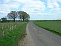
 Roadside Copse - geograph.org.uk - 1317988.jpg 640 × 480; 168 KB
-
 Roadside Trees - geograph.org.uk - 1317991.jpg 480 × 640; 149 KB
-
 Rosemary Row - Wighill Lane - geograph.org.uk - 1298029.jpg 640 × 480; 247 KB


.jpg)


.jpg)
.jpg)


.jpg)


