Category:May 2009 in Dorset
Jump to navigation
Jump to search
Deutsch: Bilder, die im Mai 2009 in Dorset aufgenommen worden sind. Bitte beachten Sie, dass dies weder das Datum des Uploads noch das Datum des Scannens eines Fotos ist.
English: Images/pictures taken in Dorset during May 2009. Note this is not the date of the upload, nor the date a photo was scanned.
Español: Fotografías o imágenes tomadas en Dorset durante mayo 2009. No es la fecha de subida ni escaneo, sino la fecha en que las fotografías o imágenes se crearon.
Esperanto: Bildoj faritaj en Dorset en majo 2009. Tio ne estas la dato, kiam la bildoj estis alŝutitaj aŭ skanitaj.
Français : Photographies ou images prises en Dorset durant mai 2009. Ce n'est pas la date du téléchargement ou du scan.
Galego: Fotografías ou imaxes tomadas en Dorset durante maio 2009. Non é a data de subida nin escaneamento, senón a data na que se crearon as fotografías ou imaxes.
Italiano: Fotografie o immagini scattate a Dorset nel maggio 2009. Nota bene: la data non si riferisce né a quella di upload né a quella in cui la foto è stata digitalizzata.
Norsk bokmål: Bilder tatt i Dorset i løpet av mai 2009. Merk at dette ikke er datoen for opplasting, eller når et bilde har blitt skannet.
Norsk nynorsk: Bilete teke i Dorset i løpet av mai 2009. Merk at dette ikkje er datoen for opplasting, eller når eit bilete har vorte skanna.
Русский: Изображения, сделанные в Dorset в течение май 2009 (не дата загрузки изображения).
Українська: Зображення, зроблені в Dorset протягом травень 2009. Зауважте, що це не дата завантаження чи дата сканування фотографії.
| May 2008 | ← | May 2009 | → | May 2010 | |||||||
| Jan | Feb | Mar | Apr | May | Jun | Jul | Aug | Sep | Oct | Nov | Dec |
| 108 | 196 | 141 | 121 | 170 | 268 | 261 | 198 | 156 | 138 | 70 | 85 |
|---|---|---|---|---|---|---|---|---|---|---|---|
Subcategories
This category has only the following subcategory.
S
- 2009 Swanage Railway Diesel Gala (44 F)
Media in category "May 2009 in Dorset"
The following 169 files are in this category, out of 169 total.
-
 "Falling Man" - geograph.org.uk - 1316559.jpg 480 × 640; 119 KB
-
 'Tangmere' at Holton Heath - geograph.org.uk - 1281785.jpg 640 × 496; 85 KB
-
 A 354 Portland beach Road - geograph.org.uk - 1331789.jpg 640 × 480; 41 KB
-
 A354 Westwey Road - geograph.org.uk - 1329577.jpg 640 × 480; 81 KB
-
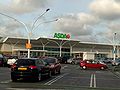 Asda at Castlepoint.jpg 2,592 × 1,944; 845 KB
-

-

-
 Beaminster, Dorset P.O. (3592764834).jpg 3,072 × 2,304; 2.78 MB
-
 Bloxworth, postbox No. BH20 204 - geograph.org.uk - 1318846.jpg 480 × 640; 72 KB
-
 Boat on the Fleet - geograph.org.uk - 1290675.jpg 640 × 465; 79 KB
-

-

-

-
 Branksome Railway Hotel - geograph.org.uk - 1326116.jpg 640 × 480; 69 KB
-
 Branksome, Commerce Centre - geograph.org.uk - 1324671.jpg 640 × 480; 63 KB
-
 Branksome, old level crossing gate - geograph.org.uk - 1324659.jpg 640 × 480; 99 KB
-

-
 Bridleway, Monkton up Wimborne - geograph.org.uk - 1285642.jpg 640 × 480; 158 KB
-

-

-
 Burton Campbell Road Chestnut Way bus stop.JPG 2,088 × 3,712; 1.45 MB
-
 Burton Campbell Road Stony Lane bus stop 2.JPG 2,088 × 3,712; 3.19 MB
-
 Burton Campbell Road Stony Lane bus stop 3.JPG 2,088 × 3,712; 3.4 MB
-
 Burton Campbell Road Stony Lane bus stop flag.JPG 2,478 × 2,088; 964 KB
-
 Burton Campbell Road Stony Lane bus stop.JPG 3,712 × 2,088; 2.92 MB
-
 Burton Martins Hill Lane Gordon Way bus stop flag.JPG 3,712 × 2,088; 2.99 MB
-
 Burton Martins Hill Lane The Oak Inn bus stop 2.JPG 3,712 × 2,088; 3.15 MB
-
 Burton Moorcroft Avenue Heathlands Close bus stop flag.JPG 2,049 × 2,088; 544 KB
-
 Burton Moorcroft Avenue Heathlands Close bus stop.JPG 3,712 × 2,088; 3.11 MB
-
 Burton Pittmore Road Barlands Close bus stop.JPG 2,088 × 3,712; 3.21 MB
-
 Burton Salisbury Road Burton Green bus stop 2.JPG 3,712 × 2,088; 3.23 MB
-
 Burton Salisbury Road Burton Green bus stop flag.JPG 2,176 × 2,088; 574 KB
-
 Burton Salisbury Road Burton Green bus stop.JPG 2,088 × 3,712; 3.24 MB
-
 Burton Salisbury Road Burton Green bus stops.JPG 3,712 × 2,088; 3.13 MB
-
 Burton Salisbury Road Burton Hall Place bus stop 2.JPG 3,712 × 2,088; 3.3 MB
-
 Burton Salisbury Road Burton Hall Place bus stop 3.JPG 2,088 × 3,712; 3.31 MB
-
 Burton Salisbury Road Burton Hall Place bus stop.JPG 3,712 × 2,088; 3.1 MB
-
 Burton Salisbury Road Campbell Road bus stop 2.JPG 2,088 × 3,712; 3.3 MB
-
 Burton Salisbury Road Campbell Road bus stop.JPG 3,712 × 2,088; 3.41 MB
-
 Burton Stony Lane Burnham Road bus stop.JPG 2,088 × 3,712; 3.18 MB
-

-

-
 Cattle among the buttercups - geograph.org.uk - 1295747.jpg 640 × 480; 122 KB
-
 Chesil Beach car park - geograph.org.uk - 1312457.jpg 640 × 480; 232 KB
-
 Christchurch Food and Wine Festival - geograph.org.uk - 1295297.jpg 640 × 480; 80 KB
-
 Christchurch Harbour - geograph.org.uk - 1358785.jpg 640 × 425; 82 KB
-
 Christchurch Harbour, Mudeford - geograph.org.uk - 1358779.jpg 640 × 425; 71 KB
-
 Christchurch Harbour, Mudeford - geograph.org.uk - 1358782.jpg 640 × 426; 116 KB
-

-
 Clarks at Castlepoint.jpg 2,592 × 1,944; 896 KB
-
 Commercial Road, Weymouth - geograph.org.uk - 1299748.jpg 640 × 480; 72 KB
-
 Common Spotted Orchid - Pen Wood - geograph.org.uk - 1321611.jpg 480 × 640; 90 KB
-
 Complementary Colours - geograph.org.uk - 1317337.jpg 427 × 640; 69 KB
-
 Corfe Castle, Village and Church - geograph.org.uk - 1319201.jpg 427 × 640; 134 KB
-
 Countryside near Yetminster - geograph.org.uk - 1313966.jpg 640 × 480; 60 KB
-
 Cranborne, fingerpost - geograph.org.uk - 1330767.jpg 640 × 480; 125 KB
-
 Cranborne, post office - geograph.org.uk - 1330820.jpg 640 × 480; 84 KB
-
 Cranborne, Sheaf of Arrows - geograph.org.uk - 1330734.jpg 640 × 480; 60 KB
-
 Cranborne, The Square - geograph.org.uk - 1330748.jpg 640 × 480; 71 KB
-
 Crop Spraying - geograph.org.uk - 1318863.jpg 640 × 412; 54 KB
-
 Dewlands Common, footpath - geograph.org.uk - 1320562.jpg 640 × 480; 101 KB
-
 Durweston, postbox No. DT11 124 - geograph.org.uk - 1318579.jpg 640 × 480; 84 KB
-
 Edmondsham Pinnocks Moor, fingerpost - geograph.org.uk - 1329877.jpg 480 × 640; 88 KB
-
 Edmondsham The Stocks fingerpost - geograph.org.uk - 1329804.jpg 480 × 640; 100 KB
-
 Edmondsham, bridleway - geograph.org.uk - 1329834.jpg 640 × 480; 122 KB
-
 Edmondsham, stile - geograph.org.uk - 1329821.jpg 640 × 480; 117 KB
-
 Edmondsham, village pump - geograph.org.uk - 1329791.jpg 480 × 640; 88 KB
-
 Field south of Warmwell - geograph.org.uk - 1328523.jpg 640 × 386; 48 KB
-
 Fields at Folly - geograph.org.uk - 1322618.jpg 640 × 480; 55 KB
-
 Fontmell Magna - geograph.org.uk - 1297705.jpg 640 × 480; 108 KB
-
 Footpath to Hooke Park - geograph.org.uk - 1284418.jpg 640 × 480; 147 KB
-
 Footpath, Witchampton - geograph.org.uk - 1285739.jpg 480 × 640; 154 KB
-

-
 Fortuneswell, Portland - geograph.org.uk - 1290804.jpg 640 × 480; 92 KB
-

-

-
 Fountain, Witchampton - geograph.org.uk - 1285762.jpg 640 × 481; 218 KB
-
 Furniture Clearance - geograph.org.uk - 1300778.jpg 640 × 480; 58 KB
-
 Gloucester Mews, Weymouth - geograph.org.uk - 1329561.jpg 640 × 519; 90 KB
-
 Gulls on the Slipway - geograph.org.uk - 1316884.jpg 640 × 427; 67 KB
-
 High Street Fortuneswell - geograph.org.uk - 1345637.jpg 640 × 507; 82 KB
-

-
 Holly Road, Weymouth - geograph.org.uk - 1312198.jpg 640 × 480; 199 KB
-
 Horton, fingerpost - geograph.org.uk - 1330855.jpg 640 × 480; 101 KB
-
 Horton, village pump - geograph.org.uk - 1330843.jpg 640 × 480; 71 KB
-

-

-

-

-

-
 Looking over Fortuneswell - geograph.org.uk - 1332075.jpg 640 × 480; 169 KB
-
 Lydlinch, postbox No. DT10 97 - geograph.org.uk - 1318543.jpg 640 × 480; 83 KB
-
 Lyme regis War Memorial - geograph.org.uk - 1316991.jpg 640 × 427; 98 KB
-
 Marks & Spencer at Castlepoint.jpg 2,592 × 1,944; 873 KB
-
 Merley, The Lantern church - geograph.org.uk - 1324997.jpg 640 × 480; 88 KB
-

-

-
 Morden, Cock and Bottle and signpost - geograph.org.uk - 1318911.jpg 480 × 640; 69 KB
-
 Mudeford Quay - geograph.org.uk - 1358771.jpg 640 × 426; 64 KB
-
 Mudeford Quay - geograph.org.uk - 1358797.jpg 640 × 425; 51 KB
-
 Pokesdown Station, renamed - geograph.org.uk - 1317588.jpg 640 × 480; 62 KB
-
 Poole Rd Branksome - geograph.org.uk - 1300777.jpg 640 × 480; 62 KB
-
 Portman Rd Boscombe - geograph.org.uk - 1300775.jpg 640 × 480; 69 KB
-
 Railway Track at Southbourne - geograph.org.uk - 1727472.jpg 640 × 425; 83 KB
-
 Recycling area, Witchampton - geograph.org.uk - 1285746.jpg 640 × 480; 104 KB
-
 Roofs of Fortuneswell - geograph.org.uk - 1334352.jpg 640 × 348; 116 KB
-
 San Remo Towers, Boscombe - geograph.org.uk - 1297149.jpg 1,024 × 700; 245 KB
-
 Semi Detached Houses on Ashley Rd - geograph.org.uk - 1300776.jpg 640 × 480; 78 KB
-

-

-
 St Nicholas Hall - geograph.org.uk - 1575413.jpg 640 × 480; 103 KB
-
 Stile and footpath near Witchampton - geograph.org.uk - 1285806.jpg 640 × 481; 131 KB
-

-
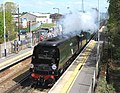
 Swanage 2009 - panoramio.jpg 3,648 × 2,736; 939 KB
-

-
 Tesco superstore, Fleetsbridge - geograph.org.uk - 1326848.jpg 640 × 480; 72 KB
-

-
 The Rodwell Trail - Weymouth To Portland- Rodwell Station. (3561770779).jpg 4,000 × 3,000; 2.66 MB
-
 The Rodwell Trail - Weymouth To Portland- Sandsfoot Castle Halt. (3561770803).jpg 4,000 × 3,000; 2.78 MB
-
 The Rodwell Trail - Weymouth To Portland- Westham Halt. (3561770771).jpg 4,000 × 3,000; 3.16 MB
-
 The Rodwell Trail - Weymouth To Portland- Wyke Regis Halt. (3561886043).jpg 1,333 × 1,117; 646 KB
-
 The Spirit of Portland - geograph.org.uk - 1331993.jpg 640 × 556; 74 KB
-
 Thornford Halt - geograph.org.uk - 1313069.jpg 640 × 462; 98 KB
-
 Three Legged Cross, The Woodcutters - geograph.org.uk - 1319414.jpg 640 × 480; 66 KB
-
 Tractor and Debris , Chesil Beach - geograph.org.uk - 1290659.jpg 640 × 480; 131 KB
-
 Transdev Yellow Bus in Bournemouth, Dorset 27 May, 2009.jpg 640 × 480; 56 KB
-
 Transdev Yellow Buses 12 2.JPG 2,478 × 1,237; 496 KB
-
 Transdev Yellow Buses 12 3.JPG 3,188 × 1,450; 860 KB
-
 Transdev Yellow Buses 12 and Somerford Roundabout.JPG 3,712 × 2,088; 3.11 MB
-
 Transdev Yellow Buses 12 rear 2.JPG 2,801 × 1,586; 854 KB
-
 Transdev Yellow Buses 12 rear.JPG 1,902 × 1,340; 609 KB
-
 Transdev Yellow Buses 12.JPG 1,702 × 1,179; 534 KB
-
 Transdev Yellow Buses 180 and Somerford Roundabout.JPG 2,793 × 1,642; 907 KB
-
 Transdev Yellow Buses 180.JPG 3,712 × 2,088; 3.06 MB
-
 Transdev Yellow Buses 22 rear.JPG 2,184 × 1,506; 634 KB
-
 Transdev Yellow Buses 22.JPG 1,519 × 1,270; 439 KB
-
 Transdev Yellow Buses 23 2.JPG 2,561 × 1,393; 625 KB
-
 Transdev Yellow Buses 23 3.JPG 1,544 × 1,312; 465 KB
-
 Transdev Yellow Buses 23 branding.JPG 3,712 × 2,088; 3.13 MB
-
 Transdev Yellow Buses 23 legal lettering.JPG 3,712 × 2,088; 3.33 MB
-
 Transdev Yellow Buses 23 rear 2.JPG 2,428 × 1,393; 696 KB
-
 Transdev Yellow Buses 23 rear 3.JPG 2,579 × 1,601; 761 KB
-
 Transdev Yellow Buses 23 rear.JPG 2,548 × 1,353; 684 KB
-
 Transdev Yellow Buses 23 roof.JPG 3,712 × 2,088; 3.16 MB
-
 Transdev Yellow Buses 23.JPG 2,927 × 1,393; 869 KB
-
 Transdev Yellow Buses 24.JPG 1,804 × 1,085; 493 KB
-
 Transdev Yellow Buses 25 rear.JPG 2,582 × 1,557; 783 KB
-
 Transdev Yellow Buses 25.JPG 2,363 × 1,392; 711 KB
-
 Transdev Yellow Buses 27 2.JPG 2,692 × 1,413; 815 KB
-
 Transdev Yellow Buses 27.JPG 3,443 × 1,924; 1.3 MB
-
 Transdev Yellow Buses 7 2.JPG 2,212 × 1,579; 682 KB
-
 Transdev Yellow Buses 7 3.JPG 2,886 × 1,392; 727 KB
-
 Transdev Yellow Buses 7 rear.JPG 2,019 × 1,282; 494 KB
-
 Transdev Yellow Buses 7.JPG 3,712 × 2,088; 3.18 MB
-

-
 Verwood, bog - geograph.org.uk - 1319585.jpg 480 × 640; 150 KB
-
 Verwood, cutting - geograph.org.uk - 1319603.jpg 640 × 480; 147 KB
-
 Verwood, old railway - geograph.org.uk - 1319654.jpg 480 × 640; 134 KB
-
 Verwood, railway bridge - geograph.org.uk - 1320483.jpg 640 × 480; 129 KB
-
 Verwood, railway trackbed - geograph.org.uk - 1319644.jpg 480 × 640; 143 KB
-
 Victorian post box - geograph.org.uk - 1305380.jpg 480 × 640; 93 KB
-
 View of Fortuneswell - geograph.org.uk - 1289188.jpg 640 × 480; 132 KB
-
 View of Fortuneswell - geograph.org.uk - 1332151.jpg 640 × 480; 156 KB
-
 Watercress beds, Wimborne St Giles - geograph.org.uk - 1285656.jpg 640 × 480; 135 KB
-
 Weymouth Esplanade - geograph.org.uk - 1329550.jpg 640 × 480; 69 KB
-
 Weymouth Harbour - geograph.org.uk - 1302193.jpg 640 × 480; 76 KB
-
 Weymouth Harbour - geograph.org.uk - 1302196.jpg 640 × 480; 64 KB
-
 Weymouth Harbour - geograph.org.uk - 1329589.jpg 640 × 348; 65 KB
-
 Weymouth Railway Station - geograph.org.uk - 1299739.jpg 640 × 480; 58 KB


.jpg)


.jpg)
.jpg)
.jpg)
.jpg)
.jpg)


