Category:May 2006 in Scotland
Jump to navigation
Jump to search
Deutsch: Bilder, die im Mai 2006 in Scotland aufgenommen worden sind. Bitte beachten Sie, dass dies weder das Datum des Uploads noch das Datum des Scannens eines Fotos ist.
English: Images/pictures taken in Scotland during May 2006. Note this is not the date of the upload, nor the date a photo was scanned.
Español: Fotografías o imágenes tomadas en Scotland durante mayo 2006. No es la fecha de subida ni escaneo, sino la fecha en que las fotografías o imágenes se crearon.
Esperanto: Bildoj faritaj en Scotland en majo 2006. Tio ne estas la dato, kiam la bildoj estis alŝutitaj aŭ skanitaj.
Français : Photographies ou images prises en Scotland durant mai 2006. Ce n'est pas la date du téléchargement ou du scan.
Galego: Fotografías ou imaxes tomadas en Scotland durante maio 2006. Non é a data de subida nin escaneamento, senón a data na que se crearon as fotografías ou imaxes.
Italiano: Fotografie o immagini scattate a Scotland nel maggio 2006. Nota bene: la data non si riferisce né a quella di upload né a quella in cui la foto è stata digitalizzata.
Norsk bokmål: Bilder tatt i Scotland i løpet av mai 2006. Merk at dette ikke er datoen for opplasting, eller når et bilde har blitt skannet.
Norsk nynorsk: Bilete teke i Scotland i løpet av mai 2006. Merk at dette ikkje er datoen for opplasting, eller når eit bilete har vorte skanna.
Русский: Изображения, сделанные в Scotland в течение май 2006 (не дата загрузки изображения).
Українська: Зображення, зроблені в Scotland протягом травень 2006. Зауважте, що це не дата завантаження чи дата сканування фотографії.
| May 2005 | ← | May 2006 | → | May 2007 | |||||||
| Jan | Feb | Mar | Apr | May | Jun | Jul | Aug | Sep | Oct | Nov | Dec |
| 5 | 39 | 85 | 70 | 48 | 63 | 68 | 143 | 87 | 58 | 51 | 11 |
|---|---|---|---|---|---|---|---|---|---|---|---|
Subcategories
This category has the following 3 subcategories, out of 3 total.
Media in category "May 2006 in Scotland"
The following 45 files are in this category, out of 45 total.
-
Halfway up The Devils Staircase - geograph.org.uk - 389253.jpg 360 × 640; 74 KB
-
Kinlochleven from West Highland Way - geograph.org.uk - 389204.jpg 640 × 360; 55 KB
-
Marlefield Farm - geograph.org.uk - 171304.jpg 640 × 480; 54 KB
-
Meikle Obney - geograph.org.uk - 166799.jpg 640 × 480; 42 KB
-
Memorial at Chapel Point, Skateraw - geograph.org.uk - 171242.jpg 480 × 640; 110 KB
-
Merriness Farm - geograph.org.uk - 171297.jpg 640 × 480; 58 KB
-
Motte Biggar.jpg 640 × 480; 88 KB
-
Muirside of Melgund - geograph.org.uk - 195949.jpg 640 × 194; 80 KB
-
North Collafirth - geograph.org.uk - 181415.jpg 640 × 256; 116 KB
-
Old railway bridge in Strathmore - geograph.org.uk - 177262.jpg 640 × 480; 85 KB
-
Old station building - geograph.org.uk - 174827.jpg 640 × 480; 88 KB
-
Oldhaamuseum.jpg 640 × 457; 97 KB
-
On the West Highland Way - geograph.org.uk - 389288.jpg 640 × 360; 48 KB
-
Orbliston Station - geograph.org.uk - 182904.jpg 579 × 412; 196 KB
-
Otter Hadd - geograph.org.uk - 181419.jpg 640 × 444; 220 KB
-
Paphle Farm - geograph.org.uk - 164185.jpg 640 × 480; 75 KB
-
Park Church.jpg 640 × 479; 105 KB
-
Prestonpans in 2006.jpg 640 × 480; 82 KB
-
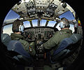
RAF Pilot Training in Cockpit of Nimrod Aircraft MOD 45152088.jpg 2,400 × 2,000; 678 KB
-
Railway path near Newtyle - geograph.org.uk - 177253.jpg 480 × 640; 101 KB
-
Rape fields on the Carse of Gowrie - geograph.org.uk - 192464.jpg 640 × 457; 121 KB
-
Rocks at Chapel Point, Skateraw - geograph.org.uk - 171208.jpg 640 × 480; 106 KB
-
Rocks at Chapel Point, Skateraw - geograph.org.uk - 173738.jpg 640 × 480; 87 KB
-
Ruin at Chapel Point, Skateraw - geograph.org.uk - 171220.jpg 640 × 480; 119 KB
-
Sgurr a'Choire Ghlais.jpg 480 × 640; 61 KB
-
Shingle Beach, Skateraw - geograph.org.uk - 170809.jpg 640 × 480; 105 KB
-
Sidlaws from Meikle Kilmundie - geograph.org.uk - 172829.jpg 640 × 427; 144 KB
-
Simprim Farm, near Meigle - geograph.org.uk - 177294.jpg 640 × 480; 88 KB
-
Sinclairston - geograph.org.uk - 178837.jpg 640 × 480; 64 KB
-
Sound Of Sanda Ferry off Gourock - geograph.org.uk - 166524.jpg 640 × 480; 65 KB
-
Stromness Harbour - geograph.org.uk - 223172.jpg 640 × 480; 87 KB
-
The bridge is out. - geograph.org.uk - 161874.jpg 640 × 480; 84 KB
-
The Crannog Restaurant - geograph.org.uk - 389189.jpg 640 × 360; 58 KB
-
The old railway line on Howkwood Rig. - geograph.org.uk - 334355.jpg 640 × 480; 113 KB
-
Tighnan Cailleachan Dubha - geograph.org.uk - 267065.jpg 640 × 244; 83 KB
-
Towards Dunbarrow Hill - geograph.org.uk - 172796.jpg 640 × 480; 108 KB
-
View from a bridge - geograph.org.uk - 161923.jpg 480 × 640; 119 KB
-
West Highland Way Alongside the A82 - geograph.org.uk - 389261.jpg 640 × 360; 73 KB
-
West Inch Farm - geograph.org.uk - 168017.jpg 640 × 427; 80 KB
-
Catacol Bay. - geograph.org.uk - 185645.jpg 640 × 480; 94 KB
-
Telephone box at Hill Head - geograph.org.uk - 165888.jpg 640 × 480; 87 KB


