Category:Maxstoke
Jump to navigation
Jump to search
village in Warwickshire, England, UK  | |||||
| Upload media | |||||
| Instance of | |||||
|---|---|---|---|---|---|
| Location | North Warwickshire, Warwickshire, West Midlands, England | ||||
| Population |
| ||||
| Area |
| ||||
 | |||||
English: Maxstoke is a hamlet in the North Warwickshire district of the county of Warwickshire, England.
Subcategories
This category has the following 5 subcategories, out of 5 total.
Media in category "Maxstoke"
The following 126 files are in this category, out of 126 total.
-
 "Keep Out" of The Heart of England Way - geograph.org.uk - 111709.jpg 453 × 640; 158 KB
-
 Access to the River Blythe - geograph.org.uk - 5311338.jpg 1,600 × 901; 703 KB
-
 Approaching Maxstoke Lane T junction - geograph.org.uk - 5311342.jpg 1,600 × 901; 753 KB
-
 Arnold's Lane - geograph.org.uk - 5311335.jpg 1,600 × 901; 625 KB
-
 Arnold's Lane and New End Road - geograph.org.uk - 5311319.jpg 1,600 × 901; 647 KB
-
 Arnold's Lane near Maxstoke - geograph.org.uk - 5446780.jpg 1,469 × 1,102; 931 KB
-
 Arnold's Lane towards Coleshill direction - geograph.org.uk - 5446788.jpg 1,469 × 1,102; 731 KB
-
 Arnolds Lane - geograph.org.uk - 5963400.jpg 1,600 × 900; 477 KB
-
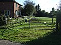
 Barn by the road - geograph.org.uk - 2387353.jpg 950 × 553; 348 KB
-
 Bentley Lane - geograph.org.uk - 3168385.jpg 640 × 480; 91 KB
-
 Bentley Lane - geograph.org.uk - 3168399.jpg 640 × 480; 87 KB
-
 Bentley Lane - geograph.org.uk - 5963414.jpg 1,600 × 900; 402 KB
-
 Castle Lane by the entrance to Maxstoke Castle - geograph.org.uk - 6127959.jpg 1,632 × 1,224; 1.05 MB
-
 Castle Lane towards Shustoke - geograph.org.uk - 2387365.jpg 950 × 713; 479 KB
-
 Church Lane, Maxstoke - geograph.org.uk - 5311211.jpg 1,600 × 901; 601 KB
-
 Cocksparrow Hall, Maxstoke - geograph.org.uk - 5445803.jpg 1,469 × 1,102; 650 KB
-
 Coleshill Road - geograph.org.uk - 5311348.jpg 1,600 × 901; 642 KB
-
 Coleshill Road at Duke End - geograph.org.uk - 5445755.jpg 1,469 × 1,102; 637 KB
-
 Cottages at Duke End - geograph.org.uk - 5286159.jpg 1,600 × 901; 652 KB
-
 Cut Tree Cottage at Maxstoke - geograph.org.uk - 5445823.jpg 1,469 × 1,102; 827 KB
-
 Dairy Farm Cottages - geograph.org.uk - 5445837.jpg 1,469 × 1,102; 727 KB
-
 East along Arnold's Lane - geograph.org.uk - 5445828.jpg 1,306 × 979; 756 KB
-
 Entering Maxstoke - geograph.org.uk - 3168356.jpg 640 × 480; 70 KB
-
 Entering the hamlet - geograph.org.uk - 5445769.jpg 1,469 × 1,102; 565 KB
-
 Entrance to Maxstoke Farm - geograph.org.uk - 316410.jpg 640 × 428; 112 KB
-
 Farm building, Forest House - geograph.org.uk - 3168394.jpg 640 × 480; 81 KB
-
 Farm track off Bentley Lane - geograph.org.uk - 3168382.jpg 640 × 480; 109 KB
-
 Farmhouse at Maxstoke School Farm - geograph.org.uk - 5445813.jpg 1,469 × 1,102; 497 KB
-
 Farmland near Maxstoke - geograph.org.uk - 3168365.jpg 640 × 480; 88 KB
-
 Farmland towards Shawbury Wood - geograph.org.uk - 3168409.jpg 640 × 480; 73 KB
-
 Field and trees by Castle Lane - geograph.org.uk - 2387373.jpg 950 × 713; 435 KB
-
 Field between Squire's Wood and Heach Wood - geograph.org.uk - 5451844.jpg 1,469 × 1,102; 626 KB
-
 Field edge near Hill Farm - geograph.org.uk - 2387344.jpg 950 × 713; 403 KB
-
 Field edge, flat arable land - geograph.org.uk - 5311364.jpg 1,600 × 901; 592 KB
-
 Field entrance, Westways - geograph.org.uk - 3168402.jpg 640 × 480; 115 KB
-
 Field north of Fillongley Road - geograph.org.uk - 5451849.jpg 1,469 × 1,102; 631 KB
-
 Field of wheat NW of Maxstoke - geograph.org.uk - 5446786.jpg 1,469 × 1,102; 603 KB
-
 Fields towards Hill Plantation - geograph.org.uk - 2387269.jpg 950 × 632; 386 KB
-
 Fillongley Road - geograph.org.uk - 3168406.jpg 640 × 480; 134 KB
-
 Fillongley Road - geograph.org.uk - 5311377.jpg 1,600 × 901; 728 KB
-
 Fillongley Road, looking west - geograph.org.uk - 2387349.jpg 950 × 713; 437 KB
-
 Fillongley Road, looking west - geograph.org.uk - 5311380.jpg 1,600 × 901; 667 KB
-
 Grass triangle at the junction with Bentley Lane - geograph.org.uk - 5446793.jpg 1,469 × 1,102; 634 KB
-
 Green End Road east of Maxstoke - geograph.org.uk - 2387302.jpg 950 × 713; 417 KB
-
 Green fields and trees on the skyline - geograph.org.uk - 2387337.jpg 950 × 462; 254 KB
-
 Heading down to Shawbury lane - geograph.org.uk - 6128461.jpg 1,224 × 1,632; 763 KB
-
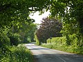
 Heading towards Fillongley - geograph.org.uk - 5286152.jpg 1,600 × 901; 713 KB
-
 Hill Plantation from the roadside - geograph.org.uk - 6127962.jpg 1,632 × 1,224; 857 KB
-
 In Butler's Wood - geograph.org.uk - 5451841.jpg 1,102 × 1,469; 897 KB
-
 Lane climbing away from Maxstoke Hall Farm - geograph.org.uk - 6127960.jpg 1,632 × 1,224; 685 KB
-
 Lane heading north - geograph.org.uk - 3168412.jpg 640 × 480; 83 KB
-
 Lane junction near Dove House Farm - geograph.org.uk - 2387264.jpg 899 × 625; 364 KB
-
 Lane to Whitacre - geograph.org.uk - 5311368.jpg 1,600 × 901; 720 KB
-
 Listed barn at Maxstoke School Farm - geograph.org.uk - 5445810.jpg 1,469 × 1,102; 629 KB
-
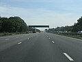
 M6 - M6 toll Gantry - geograph.org.uk - 344696.jpg 640 × 471; 50 KB
-
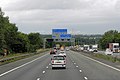
 M6 Approaching Junction 3A - geograph.org.uk - 3665179.jpg 640 × 427; 220 KB
-
 M6 approaching Junction 3A - geograph.org.uk - 4597228.jpg 2,256 × 1,496; 881 KB
-
 M6 climbing at Packington Lane - geograph.org.uk - 3574088.jpg 640 × 480; 119 KB
-
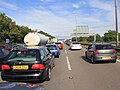 M6 motorway closure - geograph.org.uk - 2522179.jpg 2,000 × 1,500; 410 KB
-
 M6 Motorway, half mile to Junction 3A - geograph.org.uk - 4597218.jpg 2,204 × 1,461; 1.11 MB
-

-
 M6 Northbound - geograph.org.uk - 3665158.jpg 640 × 427; 200 KB
-
 M6 Northbound, Coleshill Interchange - geograph.org.uk - 3665191.jpg 640 × 427; 210 KB
-
 M6 towards Birmingham city centre - geograph.org.uk - 108113.jpg 640 × 390; 150 KB
-
 Maxstoke Church - geograph.org.uk - 6460368.jpg 1,024 × 768; 202 KB
-
 Maxstoke Church - geograph.org.uk - 6460376.jpg 1,024 × 891; 228 KB
-
 Maxstoke Golf Clubhouse - geograph.org.uk - 900417.jpg 640 × 480; 72 KB
-
 Maxstoke Golfing lake - geograph.org.uk - 900409.jpg 640 × 480; 85 KB
-
 Maxstoke Priory Gatehouse - geograph.org.uk - 6460362.jpg 768 × 1,024; 177 KB
-
 Maxstoke Priory Gatehouse - geograph.org.uk - 6460367.jpg 1,024 × 768; 172 KB
-
 Motocross park off Packington Lane - geograph.org.uk - 5257946.jpg 1,469 × 1,102; 661 KB
-
 Motorway bridge over Packington Lane - geograph.org.uk - 3168350.jpg 640 × 480; 83 KB
-
 Near Maxstoke School Farm - geograph.org.uk - 5311359.jpg 1,600 × 901; 694 KB
-
 New End Road - geograph.org.uk - 3168369.jpg 640 × 480; 59 KB
-
 New End Road - geograph.org.uk - 5311314.jpg 1,600 × 901; 743 KB
-
 New gantry - M6 northbound - geograph.org.uk - 6216768.jpg 812 × 1,024; 100 KB
-
 New gantry - M6 northbound - geograph.org.uk - 6216769.jpg 869 × 1,024; 110 KB
-
 New gantry - M6 northbound - geograph.org.uk - 6216770.jpg 768 × 1,024; 78 KB
-
 North Warwickshire , The M6 Motorway - geograph.org.uk - 2795291.jpg 4,288 × 2,848; 4.39 MB
-
 North Warwickshire , The M6 Motorway - geograph.org.uk - 2795364.jpg 4,288 × 2,848; 4.65 MB
-
 North Warwickshire , The M6 Motorway - geograph.org.uk - 2795365.jpg 2,848 × 4,288; 4.71 MB
-
 North Warwickshire countryside - geograph.org.uk - 5311374.jpg 1,600 × 901; 696 KB
-
 Old cutwater - geograph.org.uk - 5445752.jpg 1,469 × 1,102; 817 KB
-
 Old farm building, Forest House - geograph.org.uk - 3168392.jpg 640 × 480; 99 KB
-
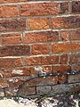
 Old OS benchmark, Maxstoke School Farm cottage - geograph.org.uk - 5445788.jpg 1,102 × 1,469; 956 KB
-
 Orchard Cottage, Arnold's Lane - geograph.org.uk - 5311326.jpg 1,600 × 901; 662 KB
-
 OS benchmark - Maxstoke, cottage on Fillongley Road - geograph.org.uk - 5451847.jpg 1,102 × 1,469; 942 KB
-
 OS benchmark - Maxstoke, former schoolhouse - geograph.org.uk - 5445818.jpg 1,102 × 1,469; 982 KB
-
 OS benchmark, no1 Coleshill Road - geograph.org.uk - 5445775.jpg 979 × 1,306; 672 KB
-
 Outside Woodlands Farm, Maxstoke - geograph.org.uk - 5447235.jpg 1,469 × 1,102; 725 KB
-
 Packington Lane south of Maxstoke - geograph.org.uk - 5257947.jpg 1,306 × 979; 664 KB
-
 Packington Lane under the M6 - geograph.org.uk - 5257944.jpg 1,306 × 979; 750 KB
-
 Pasture land south of Duke End Farm - geograph.org.uk - 5445826.jpg 1,469 × 1,102; 630 KB
-
 Private farm track - geograph.org.uk - 5285284.jpg 1,600 × 901; 697 KB
-
 Private farm track - geograph.org.uk - 5286155.jpg 1,600 × 901; 703 KB
-
 Road to Maxstoke - geograph.org.uk - 5286154.jpg 1,600 × 901; 684 KB
-
 Road towards Maxstoke outside The Knoll - geograph.org.uk - 5447240.jpg 1,469 × 1,102; 676 KB
-
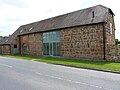
 Roadside barns at Church End Farm, Maxstoke - geograph.org.uk - 5257948.jpg 1,469 × 1,102; 656 KB
-
 Sharp right coming up - geograph.org.uk - 6127965.jpg 1,632 × 1,224; 649 KB
-
 Skye Cottage - geograph.org.uk - 292685.jpg 640 × 480; 52 KB
-
 Skye Cottage, Maxstoke - geograph.org.uk - 5451845.jpg 2,448 × 1,836; 1.72 MB
-
 Sunlit oak in an arable field - geograph.org.uk - 5282057.jpg 1,600 × 1,202; 1.13 MB
-
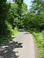
 The road towards Maxstoke - geograph.org.uk - 5963411.jpg 1,600 × 900; 550 KB
-
 Towards Hill Farm - geograph.org.uk - 6012057.jpg 1,600 × 900; 336 KB
-
 Towards Maxstoke - geograph.org.uk - 5446791.jpg 1,469 × 1,102; 865 KB
-
 Up the hill to Maxstoke - geograph.org.uk - 5963380.jpg 1,600 × 900; 224 KB
-
 Up the side of Heach Wood - geograph.org.uk - 5451842.jpg 1,469 × 1,102; 750 KB
-
 West of Maxstoke - geograph.org.uk - 5963389.jpg 1,600 × 900; 446 KB
-
 Wheat field north of The Dairy Farm - geograph.org.uk - 5445830.jpg 1,142 × 857; 438 KB
-
 Woodbine Cottage at Duke End - geograph.org.uk - 5445764.jpg 1,469 × 1,102; 665 KB
-

-
 Cottages near Duke End - geograph.org.uk - 316446.jpg 640 × 428; 98 KB
-
 Farmland east of Maxstoke - geograph.org.uk - 316401.jpg 640 × 428; 124 KB
-
 Farmland near Duke End - geograph.org.uk - 316427.jpg 640 × 428; 96 KB
-
 Farmland near Maxstoke - geograph.org.uk - 120390.jpg 640 × 480; 93 KB
-
 Farmland near Maxstoke - geograph.org.uk - 120396.jpg 640 × 480; 75 KB
-
 Forest of Arden Hotel and Country Club - geograph.org.uk - 316463.jpg 640 × 428; 103 KB
-
 Golf at Forest of Arden - geograph.org.uk - 316392.jpg 640 × 428; 83 KB
-
 Lake at Maxstoke Hall Farm - geograph.org.uk - 243233.jpg 640 × 480; 63 KB
-
 Maxstoke at sunset - geograph.org.uk - 120381.jpg 640 × 242; 33 KB
-
 Outwoods, Packington - geograph.org.uk - 232803.jpg 640 × 480; 117 KB
-
-
 Stile exiting Church Wood, Solihull - geograph.org.uk - 336248.jpg 640 × 480; 71 KB
-
 Sunset and moonrise near Maxstoke - geograph.org.uk - 120403.jpg 640 × 480; 53 KB
-
 Track to Daniels Wood - geograph.org.uk - 316383.jpg 640 × 428; 106 KB
-
 Trees in a field - geograph.org.uk - 120444.jpg 640 × 480; 87 KB


