Category:Matjulu hill
Jump to navigation
Jump to search
Afrikaans: Matjulu-heuwel is reg noord van Berg-en-Dal-ruskamp geleë, en bereik 'n hoogte van 627 meter bo seespieël. Die Boesman- en Wolhuterbasiskampe is na die westekant daarvan. Matjulu is 'n Bapedi-woord uit die vroeë 19de eeu wat "Plek van die Swazi's" beteken. Aan die suidekant van die heuwel loop Matjuluspruit, 'n sytak van die Krokodil.
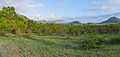
English: Matjulu hill is situated due north of Berg-en-Dal rest camp and reaches an altitude of 627 metres above sea level. The Boesman and Wolhuter base camps are situated to its west. Matjulu is the a Bapedi word from the early 19th century meaning "Place of the Swazi people". cf. Floors vd Wateren
Note: For the purposes of this category, "Matjulu hill" may include Matjulu Loop Road, Matjulu Waterhole, Matjulu Spruit (a tributary of the Crocodile River) or any nearby hills such as Khandzalive (839 m).
| Object location | | View all coordinates using: OpenStreetMap |
|---|
hill in Kruger National Park, Mpumalanga, South Africa .jpg) | |||||
| Upload media | |||||
| Instance of | |||||
|---|---|---|---|---|---|
| Location | Ehlanzeni District Municipality, Mpumalanga, Transvaal region | ||||
| Elevation above sea level |
| ||||
 | |||||
Media in category "Matjulu hill"
The following 14 files are in this category, out of 14 total.
-
 Kruger National Park, South Africa (8341007447).jpg 3,888 × 2,592; 3.58 MB
-
 A Kruger landscape.jpg 1,296 × 972; 232 KB
-

-
 Early Morning in Berg-en-Dal area (16471140595).jpg 4,048 × 1,920; 8.78 MB
-
 Golden-breasted Bunting (Emberiza flaviventris) (5984906518).jpg 4,320 × 2,592; 3.5 MB
-
 Hills and valleys (207920050).jpg 2,196 × 1,496; 760 KB
-
 Hills in the distance (196146237).jpg 3,264 × 2,448; 1.56 MB
-
 Matjulu Waterhole (16457308786).jpg 5,472 × 3,648; 17.53 MB
-
 On the Road to Matjulu Waterhole (16483270975).jpg 5,744 × 1,920; 12.36 MB
-
 Rhino (213467326).jpg 2,048 × 1,364; 723 KB
-
 Southern Ground Hornbill (Bucorvus leadbeateri), Kruger NP (5984338035).jpg 4,320 × 2,592; 3.64 MB
-
 Sundowner (2348983851).jpg 4,288 × 2,848; 997 KB
-
 Sunset in Storm Cloud ... - Flickr - berniedup.jpg 5,472 × 2,556; 5.29 MB
-
 Warthog group.jpg 3,648 × 2,736; 3.08 MB

_male_visiting_Pride-of-de-Kaap_(Bauhinia_galpinii)_flowers_..._(53307591542).jpg)
.jpg)
_(5984906518).jpg)
.jpg)
.jpg)
.jpg)
.jpg)
,_Kruger_NP_(5984338035).jpg)
.jpg)


.jpg)