Category:Mathern
Jump to navigation
Jump to search
village in Monmouthshire, Wales  Eglwys Sant Tewdrig, Matharn | |||||
| Upload media | |||||
| Pronunciation audio | |||||
|---|---|---|---|---|---|
| Instance of | |||||
| Location | Monmouthshire, Wales | ||||
| Population |
| ||||
 | |||||
Cymraeg: Pentref a chymuned yn Sir Fynwy yw Matharn (Saesneg: Mathern). Yr enw gwreiddiol oedd Merthyr Tewdrig. Saif tua pum milltir i'r de-orllewin o dref Cas-gwent, a ger y draffordd M48 (Cyfeirnod OS: ST522912). Roedd poblogaeth y gymuned yn 2001 yn 990.
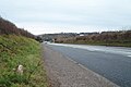
English: Mathern ( or Mateyrn) is a historic village in Monmouthshire, south east Wales, about 5 km south west of the town of Chepstow, close to the Severn estuary, the Bristol Channel and the M48 motorway. The village is designated as a Conservation Area. It is now bisected by the motorway, which passes over the road through the village, with the original village located to the south and the more recent development, known as Newton Green, to the north.
Subcategories
This category has the following 4 subcategories, out of 4 total.
Media in category "Mathern"
The following 200 files are in this category, out of 324 total.
(previous page) (next page)-

-

-
 2010 Wales Monmouthshire Community Mathern map.svg 512 × 682; 699 KB
-
 2024 Wales Monmouthshire Community Mathern map.svg 512 × 682; 603 KB
-
 A field of sunshine, near Chepstow - geograph.org.uk - 2911135.jpg 640 × 480; 108 KB
-
 A Mathern bus shelter - geograph.org.uk - 3130041.jpg 640 × 446; 67 KB
-

-

-
 A466 Wye Valley Link Road - geograph.org.uk - 3792923.jpg 640 × 482; 53 KB
-

-
 A48 at Chepstow Garden Centre - geograph.org.uk - 3274962.jpg 640 × 481; 42 KB
-
 A48 at Parkwall Hill - geograph.org.uk - 3274956.jpg 640 × 480; 95 KB
-
 A48 at Pwllmeyric village boundary - geograph.org.uk - 3274965.jpg 640 × 480; 57 KB
-
 A48 heads SW away from Chepstow - geograph.org.uk - 3917111.jpg 800 × 630; 178 KB
-
 A48 heads SW away from Pwllmeyric - geograph.org.uk - 2785552.jpg 640 × 469; 67 KB
-
 A48 towards Chepstow - geograph.org.uk - 6308390.jpg 800 × 600; 93 KB
-
 A48 towards Chepstow - geograph.org.uk - 6308413.jpg 800 × 565; 155 KB
-
 A48, Pwllmeurig - geograph.org.uk - 6311667.jpg 5,184 × 3,888; 5.2 MB
-

-
 Anglecot, Mathern - geograph.org.uk - 3486531.jpg 800 × 556; 118 KB
-

-
 Asda Distribution Centre, Newhouse Trading Estate - geograph.org.uk - 3901835.jpg 5,472 × 3,648; 2.43 MB
-

-
 B4235 near Wellhead Lodge - geograph.org.uk - 5810451.jpg 1,024 × 767; 160 KB
-
 Bailey's Hay, Mathern - geograph.org.uk - 2785225.jpg 640 × 576; 86 KB
-

-
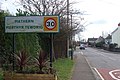 Biliungual place name, Mathern - geograph.org.uk - 1131123.jpg 640 × 427; 87 KB
-
 Birdwood Gardens, Mathern - geograph.org.uk - 3443834.jpg 800 × 546; 97 KB
-
 Bishops Mead, Mathern - geograph.org.uk - 3130067.jpg 640 × 480; 77 KB
-
 Bridge House, Pwllmeyric - geograph.org.uk - 2785431.jpg 640 × 443; 73 KB
-
 Bridge over Mathern Road - geograph.org.uk - 3430814.jpg 1,024 × 768; 128 KB
-
 Broadwell Farm, Runston - geograph.org.uk - 3119566.jpg 2,288 × 1,712; 1.22 MB
-
-
 Bus stop on the A48, Pwllmeyric - geograph.org.uk - 6308401.jpg 800 × 600; 119 KB
-
 Byway near New Hall, Pwllmeyric - geograph.org.uk - 3119513.jpg 2,288 × 1,712; 1.25 MB
-
 Chapel Close, Pwllmeyric - geograph.org.uk - 2785276.jpg 640 × 500; 66 KB
-
 Chepstow Garden Centre - geograph.org.uk - 1126415.jpg 640 × 404; 72 KB
-
 Chepstow Garden Centre - geograph.org.uk - 300748.jpg 640 × 427; 57 KB
-

-

-

-
 Church of St Tewdrig, Mathern - geograph.org.uk - 5401352.jpg 640 × 480; 95 KB
-
 Classic Stoves, Chepstow - geograph.org.uk - 5653444.jpg 800 × 575; 74 KB
-
 Clubhouse, Mathern Athletic Club - geograph.org.uk - 3443814.jpg 800 × 634; 109 KB
-
 Country lane near Willis Hill - geograph.org.uk - 3119537.jpg 2,288 × 1,712; 1.24 MB
-
 Crick Rd - geograph.org.uk - 2032841.jpg 1,600 × 1,067; 517 KB
-
 Double muddy field entrance, near Crick - geograph.org.uk - 2809817.jpg 640 × 480; 114 KB
-
 Drainage Ditch - geograph.org.uk - 5401524.jpg 640 × 480; 77 KB
-

-
 Elizabeth II postbox on the A48, Pwllmeurig - geograph.org.uk - 6311666.jpg 2,152 × 3,992; 2.13 MB
-

-
 Entrance to Chepstow Garden Centre - geograph.org.uk - 4175655.jpg 800 × 543; 66 KB
-
 Entrance to Chepstow Garden Centre - geograph.org.uk - 5653387.jpg 800 × 716; 110 KB
-
 Episcopal Palace at Mathem (1133897).jpg 1,000 × 711; 207 KB
-
 Episcopal Palace at Mathem.jpeg 750 × 576; 212 KB
-

-
 Farm buildings at Rhewl, near Mounton, Chepstow - geograph.org.uk - 2061930.jpg 1,600 × 1,200; 509 KB
-
 Farmland near Mathern - geograph.org.uk - 5401514.jpg 640 × 480; 74 KB
-
 February sunset near Mathern - geograph.org.uk - 3349355.jpg 1,600 × 1,200; 183 KB
-
-

-
 Field entrance off the A48 - geograph.org.uk - 6308408.jpg 800 × 600; 161 KB
-

-

-
 Footbridge over the M48 - geograph.org.uk - 3693789.jpg 640 × 430; 28 KB
-
 Footbridge over the M48 - geograph.org.uk - 3693790.jpg 640 × 430; 41 KB
-
 Footpath from Mathern Road - geograph.org.uk - 2925089.jpg 640 × 480; 131 KB
-
 Footpath from Mathern Road, Chepstow - geograph.org.uk - 2925121.jpg 640 × 480; 152 KB
-

-

-
 Gate house or lodge, Mathern Road - geograph.org.uk - 1131250.jpg 640 × 427; 102 KB
-

-

-

-
 Grade II listed Mathern Lodge, Mathern - geograph.org.uk - 3486659.jpg 800 × 549; 117 KB
-
 Grazing and woodland, Woodlands Grove - geograph.org.uk - 6308406.jpg 800 × 600; 135 KB
-
 Green green - geograph.org.uk - 5844322.jpg 1,600 × 902; 792 KB
-

-
 Halfway House, St Pierre, Monmouthshire - geograph.org.uk - 5837139.jpg 800 × 504; 104 KB
-
 Harvesting crops - geograph.org.uk - 2419652.jpg 1,024 × 768; 954 KB
-
 Hayesgate Lane from Crick Road - geograph.org.uk - 2032838.jpg 4,272 × 2,848; 2.29 MB
-
 Hayesgate Lane meets the A48 - geograph.org.uk - 2809842.jpg 640 × 480; 115 KB
-
 Holly Cottage, Pwllmeyric - geograph.org.uk - 2785321.jpg 640 × 518; 76 KB
-
 Houses near Mathern - geograph.org.uk - 1132365.jpg 640 × 427; 76 KB
-

-
 Houses on the A48, Pwllmeyric - geograph.org.uk - 6308403.jpg 800 × 489; 66 KB
-
 Innage Farm, Mathern - geograph.org.uk - 5401322.jpg 640 × 480; 66 KB
-
 Innage Farm, Mathern - geograph.org.uk - 5401329.jpg 640 × 480; 76 KB
-

-

-
 Lane from Pwllmeyric to Mathern - geograph.org.uk - 2785572.jpg 640 × 482; 84 KB
-

-

-
 Lane parallel to the M48, Crick - geograph.org.uk - 2809585.jpg 640 × 480; 91 KB
-
 Linnets Farm, Mounton - geograph.org.uk - 3119422.jpg 2,288 × 1,712; 1.2 MB
-

-
 Looking across the B4235 from Great Barnets Wood entrance - geograph.org.uk - 4238565.jpg 2,560 × 1,920; 2.15 MB
-
 Looking along Hayesgate Lane - geograph.org.uk - 1912233.jpg 4,288 × 2,848; 3.02 MB
-
 Looking along Mathern Road towards Mathern - geograph.org.uk - 1911986.jpg 4,288 × 2,848; 2.93 MB
-
 Looking down Hayesgate Lane towards M48 motorway - geograph.org.uk - 1912214.jpg 4,288 × 2,848; 3.07 MB
-
 Looking towards Pwllmeric - geograph.org.uk - 1912307.jpg 4,288 × 2,848; 3 MB
-
 Looking towards the entrance to Great Barnets Wood - geograph.org.uk - 4238556.jpg 2,560 × 1,920; 2.16 MB
-

-

-
 M48 approaching the A48 overbridge - geograph.org.uk - 3262371.jpg 640 × 480; 43 KB
-
 M48 as it passes over the A48 - geograph.org.uk - 3262402.jpg 640 × 480; 45 KB
-
 M48 at Mathern Merthyr Tewdrig - geograph.org.uk - 3262358.jpg 640 × 480; 44 KB
-
 M48 eastbound - geograph.org.uk - 3693784.jpg 640 × 430; 33 KB
-
 M48 from the lane to Moynes Court - geograph.org.uk - 1131207.jpg 640 × 427; 160 KB
-
 M48 Motorway - 1 mile to junction 2 - geograph.org.uk - 2059838.jpg 640 × 480; 60 KB
-

-

-

-

-
 M48 Motorway at Mathern - geograph.org.uk - 2059848.jpg 640 × 480; 63 KB
-
 M48 motorway bridge, Mathern - geograph.org.uk - 3444039.jpg 800 × 600; 128 KB
-
 M48 Motorway near Hayes Gate - geograph.org.uk - 2059827.jpg 640 × 480; 55 KB
-
 M48 near Broadwell - geograph.org.uk - 3792922.jpg 640 × 480; 50 KB
-
 M48 towards Cardiff - geograph.org.uk - 6308387.jpg 800 × 600; 86 KB
-
 Mathern , Footpath - geograph.org.uk - 6542077.jpg 6,000 × 4,000; 6.28 MB
-
 Mathern , Footpath - geograph.org.uk - 6542082.jpg 6,000 × 4,000; 6.98 MB
-
 Mathern , Footpath - geograph.org.uk - 6542094.jpg 6,000 × 4,000; 8 MB
-
 Mathern , Footpath - geograph.org.uk - 6542115.jpg 6,000 × 4,000; 7.55 MB
-
 Mathern , Grassy Field - geograph.org.uk - 6542066.jpg 6,000 × 4,000; 7.6 MB
-
 Mathern , Grassy Field - geograph.org.uk - 6542068.jpg 6,000 × 4,000; 7.73 MB
-
 Mathern , Grassy Field - geograph.org.uk - 6542071.jpg 6,000 × 4,000; 7.17 MB
-
 Mathern , Grassy Field - geograph.org.uk - 6542073.jpg 6,000 × 4,000; 7.01 MB
-
 Mathern , Grassy Field - geograph.org.uk - 6542085.jpg 6,000 × 4,000; 7.51 MB
-
 Mathern , Grassy Field - geograph.org.uk - 6542087.jpg 5,226 × 3,484; 5.86 MB
-
 Mathern , Grassy Field - geograph.org.uk - 6542088.jpg 6,000 × 4,000; 6.69 MB
-
 Mathern , Grassy Field - geograph.org.uk - 6542096.jpg 6,000 × 4,000; 6.6 MB
-
 Mathern , Grassy Field - geograph.org.uk - 6542098.jpg 6,000 × 4,000; 6.03 MB
-
 Mathern , Grassy Field - geograph.org.uk - 6542100.jpg 6,000 × 4,000; 5.94 MB
-
 Mathern , Grassy Field - geograph.org.uk - 6542102.jpg 6,000 × 4,000; 6.77 MB
-
 Mathern , Grassy Field - geograph.org.uk - 6542105.jpg 6,000 × 4,000; 5.8 MB
-
 Mathern , Grassy Field - geograph.org.uk - 6542106.jpg 6,000 × 4,000; 4.52 MB
-
 Mathern , Grassy Field - geograph.org.uk - 6542108.jpg 6,000 × 4,000; 5.49 MB
-
 Mathern , Grassy Field - geograph.org.uk - 6542111.jpg 6,000 × 4,000; 6.82 MB
-
 Mathern , Grassy Field - geograph.org.uk - 6542114.jpg 6,000 × 4,000; 6.23 MB
-
 Mathern , Railway Track - geograph.org.uk - 6542120.jpg 6,000 × 4,000; 5.83 MB
-
 Mathern , Railway Track - geograph.org.uk - 6542122.jpg 6,000 × 4,000; 7.56 MB
-
 Mathern , St. Pierre Country Club - geograph.org.uk - 6541940.jpg 6,000 × 4,000; 7.47 MB
-
 Mathern , St. Pierre Country Club - geograph.org.uk - 6541951.jpg 5,781 × 3,853; 4.62 MB
-
 Mathern , St. Pierre Country Club - geograph.org.uk - 6541955.jpg 6,000 × 4,000; 5.86 MB
-
 Mathern , St. Pierre Country Club - geograph.org.uk - 6541959.jpg 6,000 × 4,000; 6.45 MB
-
 Mathern , St. Pierre Country Club - geograph.org.uk - 6541962.jpg 6,000 × 4,000; 6.4 MB
-
 Mathern , St. Pierre Country Club - geograph.org.uk - 6541964.jpg 6,000 × 4,000; 5.77 MB
-
 Mathern , St. Pierre Country Club - geograph.org.uk - 6541967.jpg 6,000 × 4,000; 6.92 MB
-
 Mathern , St. Pierre Golf and Country Club - geograph.org.uk - 6541971.jpg 6,000 × 4,000; 7.64 MB
-
 Mathern , St. Pierre Golf and Country Club - geograph.org.uk - 6541973.jpg 6,000 × 4,000; 6.77 MB
-
 Mathern , St. Pierre Golf and Country Club - geograph.org.uk - 6541976.jpg 6,000 × 4,000; 7.06 MB
-
 Mathern , St. Pierre Golf and Country Club - geograph.org.uk - 6541979.jpg 6,000 × 4,000; 7.18 MB
-
 Mathern , St. Pierre Golf and Country Club - geograph.org.uk - 6541982.jpg 6,000 × 4,000; 7.26 MB
-
 Mathern , St. Pierre Golf and Country Club - geograph.org.uk - 6542018.jpg 6,000 × 4,000; 6.38 MB
-
 Mathern , St. Pierre Golf and Country Club - geograph.org.uk - 6542031.jpg 6,000 × 4,000; 7.07 MB
-
 Mathern , St. Pierre Golf and Country Club - geograph.org.uk - 6542032.jpg 6,000 × 4,000; 7.94 MB
-
 Mathern , St. Pierre Golf and Country Club - geograph.org.uk - 6542034.jpg 6,000 × 4,000; 7.02 MB
-
 Mathern , St. Pierre Golf and Country Club - geograph.org.uk - 6542044.jpg 6,000 × 4,000; 6.14 MB
-
 Mathern , St. Pierre Golf and Country Club - geograph.org.uk - 6542045.jpg 6,000 × 4,000; 6.95 MB
-
 Mathern , St. Pierre Golf and Country Club - geograph.org.uk - 6542047.jpg 6,000 × 4,000; 7.33 MB
-
 Mathern , St. Pierre Golf and Country Club - geograph.org.uk - 6542048.jpg 6,000 × 4,000; 7.26 MB
-
 Mathern , St. Pierre Golf and Country Club - geograph.org.uk - 6542051.jpg 6,000 × 4,000; 7.41 MB
-
 Mathern , St. Pierre Golf and Country Club - geograph.org.uk - 6542052.jpg 6,000 × 4,000; 6.8 MB
-
 Mathern , St. Pierre Golf and Country Club - geograph.org.uk - 6542053.jpg 6,000 × 4,000; 6.99 MB
-
 Mathern , St. Pierre Golf and Country Club - geograph.org.uk - 6542057.jpg 6,000 × 4,000; 5.69 MB
-
 Mathern , St. Pierre Golf and Country Club - geograph.org.uk - 6542059.jpg 6,000 × 4,000; 6.48 MB
-
 Mathern , St. Pierre Golf and Country Club - geograph.org.uk - 6542060.jpg 6,000 × 4,000; 7.86 MB
-
 Mathern , St. Pierre Golf and Country Club - geograph.org.uk - 6542064.jpg 6,000 × 4,000; 7.31 MB
-
 Mathern , St. Pierre Golf and Country Club - geograph.org.uk - 6542075.jpg 6,000 × 4,000; 6.58 MB
-
 Mathern , St. Pierre Golf and Country Club - geograph.org.uk - 6542079.jpg 6,000 × 4,000; 6.6 MB
-
 Mathern , St. Pierre Golf and Country Club - geograph.org.uk - 6542640.jpg 6,000 × 4,000; 5.75 MB
-
 Mathern - geograph.org.uk - 203337.jpg 640 × 480; 287 KB
-

-
 Mathern Crescent - geograph.org.uk - 1131137.jpg 640 × 427; 75 KB
-
 Mathern Crescent, Mathern - geograph.org.uk - 3130042.jpg 640 × 414; 69 KB
-
 Mathern Day Nursery - geograph.org.uk - 3131096.jpg 640 × 480; 61 KB
-
 Mathern direction and distance sign - geograph.org.uk - 5653385.jpg 800 × 704; 151 KB
-
 Mathern Jubilee Park - geograph.org.uk - 1131129.jpg 640 × 427; 118 KB
-
 Mathern Jubilee Park - geograph.org.uk - 3130054.jpg 640 × 479; 87 KB
-
 Mathern Jubilee Playground - geograph.org.uk - 3170778.jpg 1,200 × 676; 411 KB
-
 Mathern Road, Mathern - geograph.org.uk - 3444061.jpg 800 × 600; 109 KB
-
 Mathern Road, near Chepstow - geograph.org.uk - 2925154.jpg 640 × 480; 87 KB
-
 Mathern schoolhouse.jpg 3,264 × 2,448; 3.95 MB
-
 Mathern Vicarage, Mathern - geograph.org.uk - 3486841.jpg 800 × 673; 176 KB
-
 Mathern Village Hall - geograph.org.uk - 4241579.jpg 800 × 450; 172 KB
-
 Mathern village, 1 - geograph.org.uk - 4222566.jpg 800 × 451; 205 KB
-
 Mathern village, 2 - geograph.org.uk - 4222568.jpg 800 × 451; 203 KB
-
 Mathern War Memorial - geograph.org.uk - 2785223.jpg 640 × 471; 70 KB
-
 Mathern, from St. Pierre Pill, Monmouthshire.jpeg 700 × 489; 140 KB
-
 Mathern, St Tewdric - geograph.org.uk - 4501835.jpg 3,456 × 4,608; 4.12 MB
-
 McBurney Transport lorry in Chepstow - geograph.org.uk - 3779108.jpg 800 × 449; 112 KB
-

-
-
 Millers Arms Mathern 1jpg.jpg 3,264 × 2,448; 3.67 MB
-
 Millers Arms viewed from the NE, Mathern - geograph.org.uk - 3443856.jpg 800 × 638; 104 KB
-
 Model Cottages, Mathern - geograph.org.uk - 3131261.jpg 640 × 383; 63 KB
-
 Mounton Brook, Pwllmeyric - geograph.org.uk - 2785427.jpg 640 × 480; 147 KB
-
 Mounton Brook, Pwllmeyric - geograph.org.uk - 2785576.jpg 640 × 480; 114 KB
-
 Mounton Road - geograph.org.uk - 1929161.jpg 640 × 480; 249 KB
-


%27_(11238782515).jpg)


.jpg)


