Category:Matching, Essex
Jump to navigation
Jump to search
English: Matching is a civil parish, and a largely depopulated village, in the Epping Forest district of the county of Essex, England. Across the parish at the south are the settlements of Hobbs Cross, Harlow Tye, Housham Tye, Matching Tye, and, the largest, Matching Green. At the north of the parish, away from the settlements, sits the parish church of St Mary the Virgin, set within a few cottages, and a farm at its south. Matching village hall is at Matching Tye.

village and civil parish in Essex, England, UK  | |||||
| Upload media | |||||
| Instance of | |||||
|---|---|---|---|---|---|
| Location | Epping Forest, Essex, East of England, England | ||||
| Said to be the same as | Matching (Wikimedia duplicated page, civil parish) | ||||
 | |||||
Subcategories
This category has the following 13 subcategories, out of 13 total.
2
H
- Matching Hall (2 F)
- Hobbs Cross, Matching (6 F)
M
- The Marriage Feast Room (3 F)
N
- Newman's End (1 F)
P
R
- RAF Matching (5 F)
T
Media in category "Matching, Essex"
The following 82 files are in this category, out of 82 total.
-
 Faggoters Lane High Laver and Matching Essex England.jpg 3,878 × 3,102; 16.91 MB
-
 Fingerpost at High Laver and Matching Essex England.jpg 3,340 × 5,009; 20.57 MB
-
 Pincey Brook looking east from Matching Road, to Matching, Essex, England.jpg 2,333 × 3,500; 8.58 MB
-
 Lilypond Cottage fishing lodge and lake at Matching, Essex, England.jpg 3,000 × 2,250; 4.89 MB
-
 Fishing pond and sheep pens at Matching, Essex, England.jpg 3,000 × 2,250; 4.3 MB
-
 Lilypond Cottage fishing lodge and lake at Matching, Essex, England 01.jpg 3,000 × 2,250; 6.97 MB
-
 Lilypond Cottage fishing lodge and lake at Matching, Essex, England 02.jpg 3,000 × 2,250; 6.84 MB
-
 Lilypond Cottage fishing lodge and lake at Matching, Essex, England 03.jpg 2,250 × 3,000; 6.64 MB
-
 Lilypond Cottage fishing lodge and lake at Matching, Essex, England 04.jpg 3,000 × 2,250; 6.42 MB
-
 19th-century artificial fishing lake at Matching, Essex, England 01.jpg 3,000 × 2,250; 5.08 MB
-
 Access road from St Mary's Church, Matching, Essex England 01.jpg 3,000 × 2,250; 6.02 MB
-
 19th-century artificial fishing lake at Matching, Essex, England 02.jpg 4,347 × 3,259; 12.74 MB
-
 Access road to St Mary's Church, Matching, Essex England 02.jpg 3,000 × 2,250; 7.19 MB
-
 Access road to St Mary's Church, Matching, Essex England 03.jpg 3,000 × 2,250; 7.27 MB
-
 Access road from St Mary's Church, Matching, Essex England 02.jpg 2,250 × 3,000; 7.07 MB
-
 Access road from St Mary's Church, Matching, Essex England 03.jpg 3,000 × 2,250; 6.31 MB
-
 Access road to St Mary's Church, Matching, Essex England 01.jpg 3,000 × 2,250; 8.49 MB
-
 Roadside fishing pond barrier at Matching, Essex, England 01.jpg 2,250 × 3,000; 5.02 MB
-
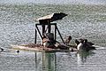
 Pond aerator waterbird platform at Matching, Essex, England 01.jpg 3,000 × 2,250; 6.25 MB
-
 Matching Pond fishing lake at Matching, Essex, England.jpg 3,000 × 2,250; 5.27 MB
-
 Matching Pond fishing lake embankment path at Matching, Essex, England.jpg 3,000 × 2,250; 7.73 MB
-
 Matching Pond embankment footpath at Matching, Essex, England.jpg 2,250 × 3,000; 7.33 MB
-
 Brick building at Matching Pond in Matching, Essex, England 01.jpg 3,000 × 2,250; 6.75 MB
-
 Brick building at Matching Pond in Matching, Essex, England 02.jpg 2,250 × 3,000; 8.08 MB
-
 Pond aerator waterbird platform at Matching, Essex, England 02.jpg 3,000 × 2,250; 6.63 MB
-
 Pond aerator waterbird platform at Matching, Essex, England 03.jpg 3,000 × 2,000; 6.13 MB
-
 Pond aerator waterbird platform at Matching, Essex, England 04.jpg 3,000 × 2,250; 6.59 MB
-
 Sheep pens sheepfold on a footpath at Matching, Essex, England.jpg 3,000 × 2,250; 7.17 MB
-
 Roadside fishing pond barrier at Matching, Essex, England 02.jpg 3,000 × 1,688; 5 MB
-
 Roadside fishing pond barrier at Matching, Essex, England 03.jpg 3,000 × 1,688; 4.79 MB
-
 A farm building close to Matching Tye - geograph.org.uk - 771346.jpg 640 × 480; 89 KB
-
 Barn at Matching Hall (geograph 2855365).jpg 640 × 480; 156 KB
-
 Boarded barn, Matching Hall (geograph 3536713).jpg 640 × 480; 120 KB
-
 Bridge - geograph.org.uk - 400988.jpg 640 × 480; 132 KB
-
 Bridleway approaching Newman's End - geograph.org.uk - 5913662.jpg 1,600 × 1,067; 413 KB
-
 Bridleway PROW 195 1 - geograph.org.uk - 6473598.jpg 1,024 × 683; 216 KB
-
 Bridleway PROW 198 28 - geograph.org.uk - 6473640.jpg 683 × 1,024; 273 KB
-
 Byway Approaching Parvilles - geograph.org.uk - 6473701.jpg 683 × 1,024; 286 KB
-
 Byway Near Gunnets Green - geograph.org.uk - 6473687.jpg 683 × 1,024; 290 KB
-
 Byway to Kingston's Farm - geograph.org.uk - 6473661.jpg 683 × 1,024; 294 KB
-
 Byway to Parvilles - geograph.org.uk - 6473684.jpg 683 × 1,024; 254 KB
-
 Byway to Peartree Green - geograph.org.uk - 6473676.jpg 1,024 × 683; 204 KB
-
 Cottage in Matching Green - geograph.org.uk - 6210046.jpg 1,920 × 1,280; 1.07 MB
-
 Cottages, Hobbs Cross - geograph.org.uk - 6214069.jpg 800 × 548; 85 KB
-
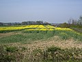 Crop Field - geograph.org.uk - 401004.jpg 640 × 480; 134 KB
-
 Crop Field - geograph.org.uk - 401071.jpg 640 × 480; 118 KB
-
 Crop Field - geograph.org.uk - 401099.jpg 640 × 480; 112 KB
-
 Experimental Radar at Former RAF Matching - geograph.org.uk - 6473613.jpg 1,024 × 683; 130 KB
-
 Farm Buildings - geograph.org.uk - 401115.jpg 640 × 480; 138 KB
-
 Farm Buildings at Parvilles - geograph.org.uk - 6473717.jpg 1,024 × 683; 155 KB
-
 Farm Reservoir Near Gunnets Green - geograph.org.uk - 6473691.jpg 1,024 × 683; 162 KB
-
 Footpath near Housham Hall - geograph.org.uk - 5913714.jpg 1,600 × 1,067; 392 KB
-
 Footpath to Harlow Road - geograph.org.uk - 5914214.jpg 1,600 × 1,067; 514 KB
-

-
 House, Hobbs Cross - geograph.org.uk - 6214066.jpg 800 × 568; 104 KB
-
 Houses, Threshers Bush - geograph.org.uk - 6214057.jpg 800 × 545; 79 KB
-
 Housham Tye - geograph.org.uk - 5914226.jpg 1,600 × 1,067; 476 KB
-
 Lascelles, Matching Green (geograph 4023725).jpg 4,320 × 3,240; 5.06 MB
-
 Luncheon Log by Potash Road - geograph.org.uk - 6473647.jpg 683 × 1,024; 212 KB
-
 M11 bridge over Hobbs Cross Road - geograph.org.uk - 6214072.jpg 800 × 600; 121 KB
-
 M11 Motorway - geograph.org.uk - 400967.jpg 640 × 480; 87 KB
-
 Matching Green - geograph.org.uk - 6210053.jpg 1,920 × 1,280; 1.05 MB
-
 Matching Pond, Matching Hall, Essex - geograph.org.uk - 742221.jpg 640 × 427; 53 KB
-
 Matching Road Bridge over the M11 - geograph.org.uk - 6240796.jpg 800 × 533; 533 KB
-
 Meadow and woodland - geograph.org.uk - 5913657.jpg 1,600 × 1,067; 559 KB
-
 Old grain silo at Carter's Green - geograph.org.uk - 5914234.jpg 1,600 × 1,067; 493 KB
-
 Outside The Chequers, Matching Green - geograph.org.uk - 6032919.jpg 1,600 × 1,067; 509 KB
-
 Pond on the village green - geograph.org.uk - 6032929.jpg 1,600 × 1,067; 403 KB
-
 Repairs to RAF Matching Relic - geograph.org.uk - 6473611.jpg 1,024 × 693; 122 KB
-
 Road entering Matching Green - geograph.org.uk - 6363747.jpg 1,920 × 1,280; 959 KB
-
 Road junction at Matching - geograph.org.uk - 5913619.jpg 1,600 × 1,067; 363 KB
-
 Southbound M11 at Driver Location B34.5 - geograph.org.uk - 6240799.jpg 800 × 533; 433 KB
-
 Thatched cottage, Threshers Bush - geograph.org.uk - 6214064.jpg 800 × 568; 73 KB
-
 The other Matching Pond (geograph 3535651).jpg 640 × 480; 94 KB
-

-
 The road to Matching Green - geograph.org.uk - 6363738.jpg 1,892 × 1,236; 1.45 MB
-
 Threshers Bush - geograph.org.uk - 6214062.jpg 800 × 600; 83 KB
-
 Threshers Bush, Hobbs Cross - geograph.org.uk - 6214067.jpg 800 × 600; 112 KB
-
 Towards Kingstons Farm - geograph.org.uk - 6473670.jpg 683 × 1,024; 306 KB
-
 Tree on Downhall Road, Matching - geograph.org.uk - 6212951.jpg 1,854 × 1,174; 1.31 MB
-
 Concrete platform near Kingstons Farm - geograph.org.uk - 421460.jpg 640 × 480; 95 KB
-
 Matching Pond, Matching, Essex - geograph.org.uk - 172071.jpg 640 × 480; 96 KB


.jpg)
.jpg)


.jpg)


.jpg)


