Category:Massif du Balaïtous
Appearance
| Camera location | | View all coordinates using: OpenStreetMap |
|---|
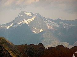
Català: Massís de Balaitús, als Pirineus centrals (Sallent de Gàllego - Aragó) (Alts Pirineus (França))
mountain in the Pyrenees | |||||
| Upload media | |||||
| Instance of | |||||
|---|---|---|---|---|---|
| Made from material | |||||
| Location |
| ||||
| Mountain range | |||||
| Highest point | |||||
| Elevation above sea level |
| ||||
 | |||||
Subcategories
This category has the following 19 subcategories, out of 19 total.
B
- Balaitús (40 F)
C
- Col d'Hospitalet (1 F)
F
L
- Lac d'Arrious (1 F)
- Lac d'Artouste (34 F)
- Lac de Batbielh (1 F)
- Lac de Migouélou (3 F)
- Lacs de Batboucou (1 F)
- Lacs de Batcrabère (2 F)
- Lacs de Carnau (1 F)
P
- Petit train d'Artouste (48 F)
- Pic Palas (6 F)
- Pico de Soques (2 F)
- Piques de l'Arriougrand (1 F)
- La Pourgadou (1 F)
R
- Lacs de Rémoulis (4 F)
S
- Lac de Suyen (19 F)
V
Media in category "Massif du Balaïtous"
The following 21 files are in this category, out of 21 total.
-
Arriel.jpg 1,298 × 930; 771 KB
-
Cascada del riu Aguas Limpias en una vessant amb alguns arbres.jpeg 559 × 768; 95 KB
-
Glacier de Las Néous 8 août 1905.png 1,097 × 1,540; 1.23 MB
-
L'ivó d'Arriel Alto.jpg 1,024 × 745; 110 KB
-
L'ivó d'Arriel Bajo voltat de cims.jpeg 1,024 × 743; 137 KB
-
L'ivó de Arriel Bajo amb muntanyes nevades.jpeg 562 × 768; 85 KB
-
L'ivó i pic de Tebarrai amb el Balaitús al fons.jpg 1,024 × 753; 111 KB
-
La vall de Tena amb boscos als vessants i una muntanya al fons.jpeg 1,024 × 750; 127 KB
-
Lac de Batbieilh.jpg 2,016 × 1,596; 2.51 MB
-
Massís de Balaitús a la vall de Tena.jpg 1,024 × 742; 166 KB
-
Massís del Balaitous des de la Gran Facha o Cúspide de Bachimaña.jpeg 1,024 × 464; 103 KB
-
Muga Falisse Grande Fache.jpg 2,048 × 1,536; 754 KB
-
Muntanyes al nord del Balaitous.jpeg 1,024 × 420; 55 KB
-
Muntanyes de la vall de Tena amb clapes de neu i a baix part d'un llac.jpeg 1,024 × 743; 153 KB
-
Piques de l'arriougrand et la Pourgadou.jpg 2,048 × 1,536; 444 KB
-
Randonnée au col d'Hospitalet.jpg 2,592 × 1,944; 1.39 MB
-
Reproducció d'una fotografia panoràmica del pic de Pondiellos.jpeg 1,024 × 736; 132 KB
-
Vista del Balaitús i de l'estany Tebarrai (cropped).jpeg 955 × 677; 100 KB
-
Vista del Balaitús i de l'estany Tebarrai.jpeg 1,024 × 740; 119 KB


