Category:Massachusetts Route 68
Jump to navigation
Jump to search
 | number: | (sixty-eight) |
|---|---|---|
| State highways in Massachusetts: | 49 · 53 · 56 · 57 · 58 · 60 · 62 · 63 · 66 · 67 · 68 · 70 · 71 · 75 · 78 · 79 · 80 · 81 · 83 · 85 · 88 |
State highway in Worcester County, Massachusetts, US   | |||||
| Upload media | |||||
| Instance of | |||||
|---|---|---|---|---|---|
| Location | Massachusetts | ||||
| Transport network |
| ||||
| Owned by | |||||
| Maintained by | |||||
| Length |
| ||||
| |||||
Media relating to Massachusetts Route 68.
Media in category "Massachusetts Route 68"
The following 10 files are in this category, out of 10 total.
-
 Central St, Baldwinville MA.jpg 3,072 × 2,304; 1.53 MB
-
 Corner of Elm and Central, Baldwinville MA.jpg 3,260 × 2,175; 1.28 MB
-
 MA Route 68 southbound entering Gardner MA.jpg 3,158 × 2,301; 1.57 MB
-
 MA Route 68 southbound, North Rutland MA.jpg 4,320 × 3,240; 3.75 MB
-
 MA Route 68.svg 601 × 601; 7 KB
-
 MA32 South - MA68 South Sign (42233103840).jpg 2,400 × 1,600; 2.34 MB
-
 Main Street, Gardner MA.jpg 5,472 × 3,648; 5.33 MB
-
 Main Street, Hubbardston MA.jpg 5,472 × 3,648; 6.21 MB
-
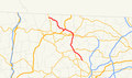 Massachusetts Route 68.png 1,088 × 640; 38 KB
-
 State Rd, Otter River MA.jpg 3,260 × 2,170; 1.38 MB


.jpg)


