Category:Maslandapur
Jump to navigation
Jump to search
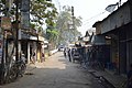
human settlement in North 24 Parganas district, Presidency division, West Bengal, India  | |||||
| Upload media | |||||
| Pronunciation audio | |||||
|---|---|---|---|---|---|
| Instance of | |||||
| Location | Habra I community development block, Barasat Sadar subdivision, North 24 Parganas district, Presidency division, West Bengal, India | ||||
| Population |
| ||||
| Area |
| ||||
 | |||||
Subcategories
This category has only the following subcategory.
M
Media in category "Maslandapur"
The following 8 files are in this category, out of 8 total.
-
 Feeder Road - Machlandapur - North 24 Parganas 2016-12-31 2313.JPG 6,016 × 4,000; 14.76 MB
-
 Feeder Road - Machlandapur - North 24 Parganas 2016-12-31 2315.JPG 4,000 × 6,016; 15.23 MB
-
 Level Crossing - Tetulia Road - SH 3 - Machlandapur - North 24 Parganas 2016-12-31 2426.JPG 6,016 × 4,000; 14.75 MB
-
 Level Crossing Area - Tetulia Road - SH 3 - Machlandapur - North 24 Parganas 2016-12-31 2311.JPG 6,016 × 4,000; 15.14 MB
-
 Level Crossing Area - Tetulia Road - SH 3 - Machlandapur - North 24 Parganas 2016-12-31 2312.JPG 6,016 × 4,000; 15.04 MB
-
 Level Crossing Area - Tetulia Road - SH 3 - Machlandapur - North 24 Parganas 2016-12-31 2427.JPG 6,016 × 4,000; 16.86 MB
-
 Tetulia Road - SH 3 - Machlandapur - North 24 Parganas 2016-12-31 2310.JPG 6,016 × 4,000; 14.5 MB
-
LL-Q9610 (ben)-Titodutta-মসলন্দপুর.wav 1.4 s; 131 KB


