Category:Martué
Jump to navigation
Jump to search
| Object location | | View all coordinates using: OpenStreetMap |
|---|
 | |||||
| Upload media | |||||
| Instance of | |||||
|---|---|---|---|---|---|
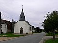
| Location | Florenville, Arrondissement of Virton, Luxembourg, Walloon Region, Belgium | ||||
 | |||||
Media in category "Martué"
The following 11 files are in this category, out of 11 total.
-
 Eglise Martué.jpg 1,800 × 1,350; 800 KB
-
 Martué 20181225 a.jpg 3,264 × 2,448; 3.17 MB
-
 Martué 20181225 b.jpg 2,631 × 2,448; 3.94 MB
-
 Martué 20181225 c.jpg 3,264 × 2,172; 3.75 MB
-
 Martué 20181225 d.jpg 2,794 × 2,448; 3.98 MB
-
 Martué 20181225 e.jpg 3,141 × 2,140; 3.17 MB
-
 Martué 20181225 f.jpg 3,264 × 2,448; 3.71 MB
-
 Martué 20181225 g.jpg 3,264 × 2,448; 3.86 MB
-
 Martué 20181225 h.jpg 3,264 × 2,448; 4.81 MB
-
 Martué 20181225 i.jpg 2,448 × 3,264; 4.31 MB
-
 Martué 20181225 j.jpg 3,264 × 2,448; 2.72 MB


