Category:Martin, North Kesteven
Jump to navigation
Jump to search
English: Martin is a small, ancient, village just north of Timberland, located on the a large flat Fen through which the River Witham Runs. To the east lies Woodhall Spa and to the west is Metheringham.
village and civil parish in Lincolnshire, UK  | |||||
| Upload media | |||||
| Instance of | |||||
|---|---|---|---|---|---|
| Location | North Kesteven, Lincolnshire, East Midlands, England | ||||
| Population |
| ||||
| Said to be the same as | Martin (Wikimedia duplicated page, civil parish) | ||||
 | |||||
Subcategories
This category has the following 5 subcategories, out of 5 total.
Media in category "Martin, North Kesteven"
The following 200 files are in this category, out of 203 total.
(previous page) (next page)-
 Approaching Martin - geograph.org.uk - 4649129.jpg 640 × 480; 67 KB
-
 Bend in Martin South Drove (B1191) - geograph.org.uk - 3382673.jpg 2,256 × 1,504; 1.52 MB
-
 Bend in Martin South Drove (B1191) - geograph.org.uk - 4649122.jpg 640 × 480; 62 KB
-
 Boat on the river Witham - geograph.org.uk - 3537625.jpg 2,256 × 1,504; 1.75 MB
-
 Bus stop on Church Road - geograph.org.uk - 4649016.jpg 640 × 480; 44 KB
-
 Bus stop on Moor Lane (B1191) - geograph.org.uk - 4649188.jpg 640 × 480; 74 KB
-
 Bus stop on the B1191, Martin - geograph.org.uk - 4649142.jpg 640 × 480; 59 KB
-

-
 Car Dyke - geograph.org.uk - 110431.jpg 480 × 640; 551 KB
-
 Car Dyke - geograph.org.uk - 110438.jpg 480 × 640; 517 KB
-
 Car Dyke - geograph.org.uk - 914294.jpg 640 × 427; 75 KB
-
 Car Dyke - geograph.org.uk - 914308.jpg 640 × 427; 86 KB
-
 Car Dyke bank - geograph.org.uk - 914301.jpg 640 × 427; 80 KB
-
 Car Dyke Mosaic - geograph.org.uk - 4649134.jpg 640 × 470; 108 KB
-
 Car Dyke Mosaic Sculpture - geograph.org.uk - 771678.jpg 427 × 640; 88 KB
-
 Car Dyke near Martin - geograph.org.uk - 1008487.jpg 640 × 480; 121 KB
-
 Car Dyke sign - geograph.org.uk - 997744.jpg 427 × 640; 134 KB
-
 Churchill - geograph.org.uk - 3447722.jpg 427 × 640; 75 KB
-
 Crop field off Martin South Drove - geograph.org.uk - 4649032.jpg 640 × 480; 85 KB
-
 Crop field, Martin Fen - geograph.org.uk - 4649037.jpg 640 × 480; 76 KB
-
 Crop Spraying - geograph.org.uk - 3532853.jpg 1,719 × 1,083; 1.2 MB
-
 Cut Mark, Martin, 47 High Street - geograph.org.uk - 4751425.jpg 1,280 × 960; 429 KB
-
 Dales head Dike - geograph.org.uk - 3532848.jpg 2,256 × 1,504; 2.33 MB
-
 Dales Head Dike and Sim Booth Grange - geograph.org.uk - 6233339.jpg 1,024 × 768; 237 KB
-
 Dales Head Dike, Martin Dales - geograph.org.uk - 6233343.jpg 1,024 × 768; 260 KB
-
 Derelict shed on Martin North Drove - geograph.org.uk - 6233386.jpg 1,024 × 768; 200 KB
-
 Drain beside New Road - geograph.org.uk - 4649002.jpg 640 × 480; 48 KB
-
 Drain off Martin South Drove - geograph.org.uk - 4649022.jpg 640 × 480; 59 KB
-

-

-
 Farm entrance on Martin Dales Drove - geograph.org.uk - 5584809.jpg 640 × 427; 98 KB
-
 Farm track beside drain - geograph.org.uk - 4649028.jpg 640 × 480; 73 KB
-
 Farm track off Martin North Drove - geograph.org.uk - 6233391.jpg 1,024 × 768; 223 KB
-
 Farmland beside drain, Martin Fen - geograph.org.uk - 4649026.jpg 640 × 480; 78 KB
-
 Farmland near Martin - geograph.org.uk - 5786206.jpg 2,592 × 1,944; 1.34 MB
-
 Farmland towards King's Covert - geograph.org.uk - 3491200.jpg 640 × 540; 48 KB
-
 Field on the north side of Martin - geograph.org.uk - 6405063.jpg 1,024 × 768; 154 KB
-
 Fields, Martin Moor - geograph.org.uk - 4649182.jpg 2,848 × 1,852; 1.44 MB
-
 Flat farmland off Martin South Drove - geograph.org.uk - 4649126.jpg 640 × 480; 61 KB
-
 Footpath to Martin - geograph.org.uk - 3082593.jpg 1,024 × 768; 166 KB
-

-
 Former route of Martin South Drove - geograph.org.uk - 6405056.jpg 1,024 × 768; 319 KB
-
 Grass track, Martin Moor - geograph.org.uk - 6405060.jpg 1,024 × 768; 152 KB
-
 High Street (B1191), Martin - geograph.org.uk - 4649144.jpg 640 × 480; 56 KB
-
 High Street (B1191), Martin - geograph.org.uk - 4649153.jpg 640 × 480; 65 KB
-
 High Street, Martin - geograph.org.uk - 2726835.jpg 4,000 × 3,000; 3.95 MB
-
 High Street, Martin - geograph.org.uk - 4428701.jpg 640 × 427; 64 KB
-
 Holy Trinity church, Martin, Lincs - geograph.org.uk - 6261203.jpg 4,608 × 3,072; 6.25 MB
-
 Horncastle Road - geograph.org.uk - 464513.jpg 640 × 480; 74 KB
-
 House on Moor Lane, Martin - geograph.org.uk - 4649170.jpg 640 × 480; 77 KB
-
 House on the B1191, Martin - geograph.org.uk - 4649140.jpg 640 × 480; 73 KB
-
 Houses beyond the Car Dyke, Martin - geograph.org.uk - 6405054.jpg 1,024 × 768; 156 KB
-
 Houses, West, Grove - geograph.org.uk - 4649184.jpg 640 × 447; 66 KB
-
 Hughie^ From the tower on Martin church tower - geograph.org.uk - 6261217.jpg 4,608 × 3,072; 5.36 MB
-
 Improvements on the Timberland Delph - geograph.org.uk - 4895053.jpg 3,776 × 2,520; 3.89 MB
-
 Jet Provost - geograph.org.uk - 3447526.jpg 640 × 427; 78 KB
-
 Jet Provost - geograph.org.uk - 3447890.jpg 640 × 427; 66 KB
-
 Kirkstead Bridge - geograph.org.uk - 4598832.jpg 3,776 × 2,520; 4.19 MB
-
 Kirkstead Bridge - geograph.org.uk - 6217873.jpg 1,024 × 683; 197 KB
-
 Kirkstead Bridge over The Witham - geograph.org.uk - 4895059.jpg 3,776 × 2,520; 3.91 MB
-
 Lancaster Memorial - geograph.org.uk - 3447552.jpg 427 × 640; 82 KB
-

-
 Maize crop off Martin South Drove - geograph.org.uk - 4649118.jpg 640 × 480; 70 KB
-
 Maize crop off Moor Lane (B1191) - geograph.org.uk - 4649192.jpg 640 × 480; 54 KB
-
 Martin Dales Drove (B1191) - geograph.org.uk - 4649020.jpg 640 × 480; 52 KB
-
 Martin Dales Drove - geograph.org.uk - 5584805.jpg 640 × 427; 67 KB
-
 Martin Dales Drove - geograph.org.uk - 5584806.jpg 640 × 427; 90 KB
-
 Martin Fen - geograph.org.uk - 2436352.jpg 640 × 480; 76 KB
-
 Martin Fen - geograph.org.uk - 2436536.jpg 640 × 480; 95 KB
-
 Martin Fen - geograph.org.uk - 6233383.jpg 1,024 × 768; 191 KB
-
 Martin Fen - geograph.org.uk - 90631.jpg 640 × 480; 59 KB
-
 Martin Fen - geograph.org.uk - 90894.jpg 640 × 480; 53 KB
-
 Martin Fen Grain stores - geograph.org.uk - 418302.jpg 640 × 427; 121 KB
-
 Martin Fen, B1191 - geograph.org.uk - 418299.jpg 640 × 427; 141 KB
-
 Martin Manor House, Timberland Road, Martin - geograph.org.uk - 6759282.jpg 3,456 × 5,184; 5.41 MB
-
 Martin North Drove - geograph.org.uk - 2436537.jpg 640 × 480; 97 KB
-
 Martin North Drove - geograph.org.uk - 2436557.jpg 640 × 480; 91 KB
-
 Martin North Drove - geograph.org.uk - 2436573.jpg 640 × 480; 66 KB
-
 Martin North Drove - geograph.org.uk - 2436577.jpg 640 × 480; 59 KB
-
 Martin North Drove - geograph.org.uk - 3382677.jpg 2,256 × 1,504; 1.78 MB
-
 Martin North Drove - geograph.org.uk - 4598848.jpg 3,776 × 2,520; 3.88 MB
-
 Martin North Drove - geograph.org.uk - 4649138.jpg 640 × 480; 74 KB
-
 Martin North Drove - geograph.org.uk - 6233371.jpg 1,024 × 768; 204 KB
-
 Martin North Drove near Bottom Farm - geograph.org.uk - 3381022.jpg 2,256 × 1,504; 1.55 MB
-
 Martin South Drove (B1191) - geograph.org.uk - 4649023.jpg 640 × 480; 61 KB
-
 Martin South Drove (B1191) - geograph.org.uk - 4649030.jpg 640 × 480; 57 KB
-
 Martin South Drove (B1191) - geograph.org.uk - 4649034.jpg 640 × 480; 59 KB
-
 Martin South Drove (B1191) - geograph.org.uk - 4649108.jpg 640 × 480; 46 KB
-
 Martin South Drove (B1191) - geograph.org.uk - 4649115.jpg 640 × 480; 61 KB
-
 Martin Village Hall - geograph.org.uk - 4649163.jpg 640 × 480; 63 KB
-
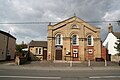 Martin Village Hall - geograph.org.uk - 996674.jpg 640 × 427; 62 KB
-
 Martin, 47 High Street - geograph.org.uk - 4751419.jpg 1,280 × 960; 405 KB
-
 Metheringham Airfield Visitor Centre - geograph.org.uk - 3447539.jpg 640 × 427; 104 KB
-
 Metheringham Airfield Visitor Centre - geograph.org.uk - 3447544.jpg 640 × 427; 85 KB
-
 Metheringham Airfield Visitor Centre - geograph.org.uk - 3447563.jpg 640 × 427; 86 KB
-
 Metheringham Airfield Visitor Centre - geograph.org.uk - 3447577.jpg 640 × 427; 98 KB
-
 Metheringham Airfield Visitor Centre - geograph.org.uk - 3447586.jpg 640 × 427; 83 KB
-
 Metheringham Airfield Visitor Centre - geograph.org.uk - 3447589.jpg 640 × 427; 85 KB
-
 Mill Drain - geograph.org.uk - 2436552.jpg 640 × 480; 108 KB
-
 Mill Drain - geograph.org.uk - 4649038.jpg 640 × 480; 72 KB
-
 Mill Drain and farm track - geograph.org.uk - 6233379.jpg 1,024 × 768; 190 KB
-
 Mill Drain bridge - geograph.org.uk - 2436563.jpg 640 × 480; 102 KB
-
 Mill Lane barn - geograph.org.uk - 2436338.jpg 640 × 480; 79 KB
-

-
 Monkey Puzzle Tree on B1189 - geograph.org.uk - 3384448.jpg 1,504 × 2,256; 2.56 MB
-
 Moor Lane (B1191) - geograph.org.uk - 4649197.jpg 640 × 480; 56 KB
-
 Moor Lane - geograph.org.uk - 464518.jpg 640 × 480; 66 KB
-
 Moor Lane, Martin (B1191) - geograph.org.uk - 4649174.jpg 640 × 480; 68 KB
-
 New Road - geograph.org.uk - 4648997.jpg 640 × 480; 50 KB
-
 New Road - geograph.org.uk - 4649007.jpg 640 × 480; 47 KB
-
 New Road - geograph.org.uk - 4649011.jpg 640 × 480; 55 KB
-
 North Moor house - geograph.org.uk - 2514626.jpg 1,280 × 960; 286 KB
-
 North Moor Lane - geograph.org.uk - 2373137.jpg 640 × 480; 137 KB
-
 North Moor Lane - geograph.org.uk - 2373141.jpg 640 × 480; 130 KB
-
 North Moor Lane - geograph.org.uk - 4649168.jpg 640 × 480; 63 KB
-

-
 Old Martin South Drove - geograph.org.uk - 914293.jpg 640 × 427; 84 KB
-

-
 Ornamental post on Carr Dyke - geograph.org.uk - 98541.jpg 426 × 640; 133 KB
-

-
 Pointing Doors, Timberland Delph - geograph.org.uk - 1978368.jpg 1,024 × 768; 233 KB
-
 Post Office and village shop, Martin - geograph.org.uk - 4649145.jpg 640 × 480; 64 KB
-
 Precise Directions - geograph.org.uk - 464517.jpg 640 × 480; 115 KB
-
 Public footpath near North Moor House - geograph.org.uk - 2514617.jpg 1,280 × 960; 476 KB
-
 Resurfacing on Kirkstead Bridge - geograph.org.uk - 4758500.jpg 1,024 × 659; 148 KB
-
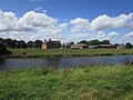
 River View - geograph.org.uk - 2441895.jpg 3,264 × 2,448; 1.35 MB
-
 River Witham - geograph.org.uk - 1978372.jpg 1,024 × 768; 219 KB
-

-

-

-
 River Witham downstream from Kirkstead Bridge - geograph.org.uk - 6217871.jpg 1,024 × 683; 175 KB
-
 Road to Metheringham Airfield Visitor Centre - geograph.org.uk - 3383889.jpg 2,256 × 1,504; 2.48 MB
-
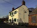
 Royal Oak Pub, Martin - geograph.org.uk - 2514560.jpg 1,280 × 960; 297 KB
-
 Second World War airfield blast shelter - geograph.org.uk - 3585426.jpg 1,024 × 768; 118 KB
-
 Shelter on the Fen - geograph.org.uk - 771778.jpg 640 × 427; 78 KB
-
 Sign for the Royal Oak, Martin - geograph.org.uk - 4649160.jpg 503 × 640; 46 KB
-

-
 Site of Kirkstead Abbey, aerial 2019 (2) - geograph.org.uk - 6133859.jpg 800 × 534; 109 KB
-
 Stall waste on Martin Fen - geograph.org.uk - 4598841.jpg 3,776 × 2,520; 4.02 MB
-

-
 Stubble field off North Moor Lane - geograph.org.uk - 4649166.jpg 640 × 480; 63 KB
-
 Stubble field, Martin Moor - geograph.org.uk - 6286941.jpg 1,024 × 768; 236 KB
-
 Sugar beet field and plantation near Bottom Farm - geograph.org.uk - 6233352.jpg 1,024 × 768; 264 KB
-
 Sugar beet, Martin Moor - geograph.org.uk - 6286942.jpg 1,024 × 768; 264 KB
-
 The churchyard at Holy Trinity, Martin, Lincs - geograph.org.uk - 6261210.jpg 4,608 × 3,072; 5.02 MB
-
 The High Street (B1191), Martin - geograph.org.uk - 5786204.jpg 2,592 × 1,944; 1.24 MB
-
 The Kings Arms - geograph.org.uk - 5406019.jpg 1,280 × 719; 204 KB
-

-
 The railway to Lincoln - geograph.org.uk - 3082601.jpg 1,024 × 768; 231 KB
-
 The River Witham and Brooks Farm - geograph.org.uk - 6233331.jpg 1,024 × 769; 196 KB
-
 The Royal Oak, Martin - geograph.org.uk - 4649157.jpg 640 × 401; 52 KB
-
 The sign of the Kings Arms - geograph.org.uk - 5406021.jpg 853 × 1,280; 283 KB
-
 The village hall, Martin - geograph.org.uk - 4598857.jpg 3,776 × 2,520; 4.3 MB
-
 The western edge of Martin village - geograph.org.uk - 418271.jpg 640 × 427; 148 KB
-
 Tin sheds - geograph.org.uk - 2436567.jpg 640 × 480; 97 KB
-
 Track across Martin Moor - geograph.org.uk - 2514637.jpg 1,280 × 960; 266 KB
-
 Track and drain towards Timberland Delph - geograph.org.uk - 3263193.jpg 2,256 × 1,504; 939 KB
-
 Track off Martin North Drove - geograph.org.uk - 3382158.jpg 1,504 × 2,256; 2.38 MB
-
 Track off Martin South Drove - geograph.org.uk - 4649124.jpg 640 × 480; 69 KB
-
 Track to a poultry unit, Martin Moor - geograph.org.uk - 6286939.jpg 1,024 × 768; 196 KB
-
 Track to Dormer House - geograph.org.uk - 3382166.jpg 2,256 × 1,504; 1.97 MB
-
 Trees near Thornton Wood - geograph.org.uk - 556003.jpg 480 × 640; 125 KB
-
 Uncultivated field near North Moor Farm - geograph.org.uk - 6405062.jpg 1,024 × 768; 182 KB
-
 War memorial in Martin churchyard - geograph.org.uk - 6261195.jpg 4,608 × 3,072; 5.17 MB
-
 Water Tower at Metheringham - geograph.org.uk - 952598.jpg 640 × 480; 58 KB
-
 Woodland beside the B1189 - geograph.org.uk - 4649201.jpg 640 × 427; 50 KB
-
 B road through Old Woodhall - geograph.org.uk - 555969.jpg 640 × 480; 95 KB
-
 Blankney Barff - geograph.org.uk - 406310.jpg 640 × 427; 76 KB
-
 Blankney Fen - geograph.org.uk - 110443.jpg 640 × 480; 365 KB
-
 Blankney Fen - geograph.org.uk - 837460.jpg 640 × 427; 110 KB
-
 Blankney North Drove - geograph.org.uk - 110434.jpg 640 × 480; 412 KB
-
 Bridleway to Poolham - geograph.org.uk - 258837.jpg 640 × 480; 92 KB
-
 Brown Railings - geograph.org.uk - 464511.jpg 640 × 480; 53 KB
-
 Car Dyke - geograph.org.uk - 110524.jpg 480 × 640; 484 KB
-
 Car Dyke - geograph.org.uk - 110526.jpg 640 × 480; 443 KB
-
 Car Dyke - geograph.org.uk - 110530.jpg 640 × 480; 456 KB
-
 Carr Dyke Farm - geograph.org.uk - 110440.jpg 640 × 480; 356 KB
-
 Crop of rape - geograph.org.uk - 723577.jpg 640 × 480; 105 KB
-
 Drainage Ditch Alongside Field - geograph.org.uk - 771493.jpg 640 × 427; 112 KB
-
 Farm road near Thornton Wood - geograph.org.uk - 556008.jpg 640 × 480; 89 KB
-
 Farmland near Horncastle - geograph.org.uk - 524984.jpg 640 × 480; 74 KB
-
 Farmland near Horncastle - geograph.org.uk - 524990.jpg 640 × 480; 109 KB
-
 Fields of Gold on Martin Fen - geograph.org.uk - 771792.jpg 640 × 427; 53 KB
-
 Flower Trough - geograph.org.uk - 464533.jpg 640 × 480; 93 KB
-
 Green Square - geograph.org.uk - 771488.jpg 640 × 427; 96 KB
-

-
 Low Dar Wood - geograph.org.uk - 464482.jpg 640 × 480; 79 KB
-
 Martin Fen - geograph.org.uk - 110473.jpg 640 × 480; 352 KB
-
 Martin Fen - geograph.org.uk - 110527.jpg 640 × 480; 402 KB
-
 North Moor House - geograph.org.uk - 276142.jpg 640 × 427; 59 KB
-
 Open Road - geograph.org.uk - 90658.jpg 640 × 480; 78 KB
-
 Over the edge - geograph.org.uk - 464528.jpg 640 × 480; 96 KB
-
 Path beside Beans - geograph.org.uk - 464479.jpg 640 × 480; 96 KB
-
 RAF Metheringham runway - geograph.org.uk - 406294.jpg 640 × 427; 38 KB
-
 Redcap Farm - geograph.org.uk - 464493.jpg 640 × 480; 80 KB
-
 Roadside - geograph.org.uk - 90664.jpg 640 × 480; 145 KB
-
 Shed and Tractor - geograph.org.uk - 259410.jpg 640 × 480; 96 KB
-
 Signs with Gate - geograph.org.uk - 464521.jpg 640 × 480; 93 KB
-
 Spa Trail - geograph.org.uk - 464523.jpg 640 × 480; 116 KB
-
 Timberland - geograph.org.uk - 90668.jpg 640 × 480; 90 KB

_-_geograph.org.uk_-_3382673.jpg)
_-_geograph.org.uk_-_4649122.jpg)


_-_geograph.org.uk_-_4649188.jpg)


,_Martin_-_geograph.org.uk_-_4649144.jpg)
,_Martin_-_geograph.org.uk_-_4649153.jpg)


_-_geograph.org.uk_-_4649113.jpg)

_-_geograph.org.uk_-_4649192.jpg)
_-_geograph.org.uk_-_4649020.jpg)


_-_geograph.org.uk_-_4649023.jpg)
_-_geograph.org.uk_-_4649030.jpg)
_-_geograph.org.uk_-_4649034.jpg)
_-_geograph.org.uk_-_4649108.jpg)
_-_geograph.org.uk_-_4649115.jpg)


_-_geograph.org.uk_-_4649195.jpg)

_-_geograph.org.uk_-_4649197.jpg)

_-_geograph.org.uk_-_4649174.jpg)


_-_geograph.org.uk_-_6133847.jpg)
_-_geograph.org.uk_-_6133859.jpg)


,_Martin_-_geograph.org.uk_-_5786204.jpg)


