Category:Marthall
Jump to navigation
Jump to search
English: Marthall is a village in in the unitary authority of Cheshire East and the ceremonial county of Cheshire, England. It is around 3 miles from Knutsford.
village and civil parish in Cheshire, UK  | |||||
| Upload media | |||||
| Instance of | |||||
|---|---|---|---|---|---|
| Location | Cheshire East, Cheshire, North West England, England | ||||
| Population |
| ||||
 | |||||
Subcategories
This category has the following 2 subcategories, out of 2 total.
A
- All Saints church, Marthall (5 F)
E
- The Egerton Arms, Marthall (4 F)
Media in category "Marthall"
The following 78 files are in this category, out of 78 total.
-
 Across the fields to Glevehouse Farm - geograph.org.uk - 3161472.jpg 3,456 × 2,304; 2.44 MB
-
 After the harvest - geograph.org.uk - 3161452.jpg 3,456 × 2,304; 2.99 MB
-
 Bate Mill - geograph.org.uk - 625090.jpg 640 × 431; 147 KB
-

-
 Carter Lane at Fir Tree Farm - geograph.org.uk - 3055413.jpg 3,456 × 2,304; 4.62 MB
-
 Chelford Road - geograph.org.uk - 2569369.jpg 640 × 481; 60 KB
-
 Chelford Road at Marthall - geograph.org.uk - 2569361.jpg 640 × 481; 91 KB
-

-
 Cheshire countryside east of Marthall - geograph.org.uk - 2326838.jpg 3,603 × 2,640; 3.26 MB
-
 Crop field off Pinfold Lane - geograph.org.uk - 4998155.jpg 640 × 480; 65 KB
-

-
 Dixon Drive, Chelford - geograph.org.uk - 3278622.jpg 4,320 × 3,240; 3.12 MB
-
 Down to Pedley Brook - geograph.org.uk - 3161398.jpg 3,456 × 2,304; 2.57 MB
-
 Entering Marthall - geograph.org.uk - 4997851.jpg 640 × 480; 83 KB
-

-
 Farm building off Sandhole Lane - geograph.org.uk - 4997859.jpg 640 × 480; 69 KB
-

-
 Farmland off Pedley Lane - geograph.org.uk - 4998161.jpg 640 × 480; 51 KB
-
 Farmland off Sandle Bridge Lane - geograph.org.uk - 4997869.jpg 640 × 480; 50 KB
-
 Field entrance off Snelson Lane - geograph.org.uk - 4997853.jpg 640 × 480; 73 KB
-
 Fir Tree Farm, Marthall Lane - geograph.org.uk - 3161597.jpg 3,414 × 2,220; 1.74 MB
-
 Firtree Farm near Ollerton, Cheshire - geograph.org.uk - 2328025.jpg 3,871 × 2,834; 4.68 MB
-
 Footpath to Marthall Lane - geograph.org.uk - 3672419.jpg 640 × 424; 66 KB
-
 Footpath to Mountplesant Farm - geograph.org.uk - 3672425.jpg 640 × 424; 64 KB
-
 From pasture to stubble - geograph.org.uk - 3161582.jpg 3,456 × 2,304; 1.56 MB
-
 From whence we came - geograph.org.uk - 3161466.jpg 3,390 × 2,205; 2.27 MB
-
 Graveyard at Marthall parish church - geograph.org.uk - 2326393.jpg 3,984 × 2,988; 5.61 MB
-
 Grazing Baguley Fold - geograph.org.uk - 4997871.jpg 640 × 480; 68 KB
-
 High water^ - geograph.org.uk - 3161478.jpg 3,456 × 2,304; 3.08 MB
-
 Into the wood - geograph.org.uk - 3161564.jpg 2,304 × 3,456; 4.1 MB
-
 Junction of Marthall, Pedley and Pinfold Lanes - geograph.org.uk - 3161603.jpg 3,456 × 2,304; 2.03 MB
-
 Late developing maize-field - geograph.org.uk - 3055407.jpg 3,456 × 2,304; 2.58 MB
-
 Layby on the Chelford Road - geograph.org.uk - 2771461.jpg 640 × 480; 54 KB
-
 Little Warford, at Sandle Bridge, Cheshire - geograph.org.uk - 2326844.jpg 3,581 × 2,715; 3.27 MB
-
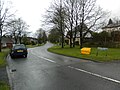
 Marthall crossroads - geograph.org.uk - 2771467.jpg 640 × 480; 73 KB
-
 Marthall Lane - geograph.org.uk - 3161380.jpg 3,456 × 2,304; 2.45 MB
-
 Marthall Lane - geograph.org.uk - 3161590.jpg 3,456 × 2,304; 1.62 MB
-
 Marthall Lane northeast of Ollerton - geograph.org.uk - 2656490.jpg 640 × 480; 51 KB
-
 Methodist Chapel, Pepper Street, Snelson - geograph.org.uk - 3055458.jpg 3,456 × 2,304; 3.46 MB
-
 Mountpleasant Farm - geograph.org.uk - 3161391.jpg 3,456 × 2,304; 2.08 MB
-
 Mountpleasant Farm near Knutsford, Cheshire - geograph.org.uk - 2328020.jpg 3,869 × 2,902; 3.72 MB
-
 New Barn Farm, Chelford Road - geograph.org.uk - 2326339.jpg 3,862 × 2,896; 4.97 MB
-
 New mere^ - geograph.org.uk - 3161385.jpg 3,456 × 2,304; 2.77 MB
-

-

-
 Ollerton ^ Marthall Village Hall, Sandlebridge Lane - geograph.org.uk - 2326834.jpg 3,702 × 2,801; 4.1 MB
-
 Pedley Brook near Pedley House Farm - geograph.org.uk - 2328016.jpg 3,771 × 2,846; 5.61 MB
-
 Pedley Lane - geograph.org.uk - 4998163.jpg 640 × 480; 61 KB
-
 Pepper Street bridleway entrance - geograph.org.uk - 3055442.jpg 3,456 × 2,304; 5.05 MB
-
 Pepper Street, Snelson - geograph.org.uk - 3055451.jpg 3,456 × 2,304; 4 MB
-
 Pig Farm at Chelford - geograph.org.uk - 4109845.jpg 4,184 × 2,789; 3 MB
-
 Pinfold Lane - geograph.org.uk - 4997874.jpg 640 × 480; 56 KB
-
 Pinfold Lane - geograph.org.uk - 4998159.jpg 640 × 480; 69 KB
-
 Ryecroft Farm near Ollerton, Cheshire - geograph.org.uk - 2328023.jpg 3,461 × 2,571; 2.96 MB
-
 Sandle Bridge Lane, Marthall - geograph.org.uk - 4997867.jpg 640 × 480; 104 KB
-
 Sandlebridge Lane, Marthall - geograph.org.uk - 5001304.jpg 640 × 480; 95 KB
-
 Small Pond near Springwood Farm - geograph.org.uk - 3672417.jpg 640 × 424; 78 KB
-
 Snelson Lane - geograph.org.uk - 4997857.jpg 640 × 480; 100 KB
-
 Snelson's Lane nears crossroads - geograph.org.uk - 4043321.jpg 640 × 480; 64 KB
-
 Springwood Farm - geograph.org.uk - 3161505.jpg 3,456 × 2,304; 2.82 MB
-
 Springwood Farm - geograph.org.uk - 3672411.jpg 424 × 640; 71 KB
-
 Stile on the way to Marthall Lane - geograph.org.uk - 3672442.jpg 640 × 424; 92 KB
-
 Stile ^ Farm Gate - geograph.org.uk - 3672434.jpg 640 × 424; 70 KB
-
 Storm clouds over Chelford - geograph.org.uk - 2771468.jpg 640 × 480; 49 KB
-
 Stubble and tracks - geograph.org.uk - 3161522.jpg 3,456 × 2,091; 2.75 MB
-
 That must be the path - geograph.org.uk - 3161573.jpg 3,456 × 2,304; 2.21 MB
-
 The A537 (Chelford Road) - geograph.org.uk - 4109809.jpg 5,184 × 3,456; 3.71 MB
-
 The A537 (Chelford Road) - geograph.org.uk - 4109831.jpg 4,180 × 2,786; 3.3 MB
-
 The A537 enters Chelford - geograph.org.uk - 2771471.jpg 640 × 480; 60 KB
-
 The Hall At Marthall - geograph.org.uk - 4997866.jpg 640 × 480; 90 KB
-
 The path onward - geograph.org.uk - 3161439.jpg 3,456 × 2,304; 2.85 MB
-
 The path to Springwood Farm - geograph.org.uk - 3161484.jpg 3,456 × 2,304; 3.25 MB
-
 The stile and beyond - geograph.org.uk - 3161586.jpg 3,456 × 2,304; 3.05 MB
-
 Towards Pedley Brook - geograph.org.uk - 3161425.jpg 3,456 × 2,304; 1.78 MB
-
 Victorian postbox on Sandlebridge Lane, Marthall - geograph.org.uk - 5001300.jpg 1,596 × 2,712; 929 KB
-
 Batemill Lane - geograph.org.uk - 1499280.jpg 640 × 480; 87 KB
-
 Marthall Lane Looking NE - geograph.org.uk - 89646.jpg 640 × 441; 46 KB
-
 Pedley House Farm, Pedley Lane - geograph.org.uk - 89657.jpg 640 × 480; 73 KB


_off_Pinfold_Lane_-_geograph.org.uk_-_4998151.jpg)


_-_geograph.org.uk_-_4109809.jpg)
_-_geograph.org.uk_-_4109831.jpg)


