Category:Marsworth
Jump to navigation
Jump to search
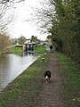
English: Marsworth is a village and also a civil parish within Aylesbury Valedistrict in Buckinghamshire, England. It is about two miles north of Tring, in Hertfordshire and six miles east of Aylesbury.
village and civil parish in Buckinghamshire, United Kingdom  | |||||
| Upload media | |||||
| Instance of | |||||
|---|---|---|---|---|---|
| Location | Buckinghamshire, South East England, England | ||||
| Population |
| ||||
 | |||||
Subcategories
This category has the following 5 subcategories, out of 5 total.
B
- Bridges in Marsworth (8 F)
M
- Marsworth Locks (24 F)
S
- Signs in Marsworth (7 F)
T
- Tring Reservoirs (104 F)
Media in category "Marsworth"
The following 200 files are in this category, out of 695 total.
(previous page) (next page)-
 "Alcyone" passes under Bridge No 131 - geograph.org.uk - 1468254.jpg 640 × 480; 65 KB
-
 "Big Paddy" has reappeared at College Lake - geograph.org.uk - 5651327.jpg 3,641 × 1,658; 1.48 MB
-
-

-

-
 "Silvered" Silver Birch - geograph.org.uk - 3258542.jpg 2,237 × 2,983; 1.25 MB
-
 A Bend in the frozen canal at Marsworth - geograph.org.uk - 3258481.jpg 3,253 × 2,440; 1.85 MB
-
 A bend in the Grand Union Canal - geograph.org.uk - 6421288.jpg 1,600 × 1,066; 431 KB
-
 A Black Swan chases off two Mute Swans at College Lake - geograph.org.uk - 4862388.jpg 1,789 × 1,341; 332 KB
-
 A Black-tailed Godwit on the Marsh at College Lake - geograph.org.uk - 4094411.jpg 1,348 × 1,011; 312 KB
-

-
 A canal barge "Castle" on "The Old Bovine" - geograph.org.uk - 5555170.jpg 2,081 × 2,100; 729 KB
-
 A Cold Look to Lock 40 on the Grand Union Canal - geograph.org.uk - 3258541.jpg 3,600 × 2,400; 1.41 MB
-
 A colourful stand on the central bund at College Lake - geograph.org.uk - 4758109.jpg 3,233 × 2,424; 6.4 MB
-
 A Cornflower in the Cornfield at College Lake - geograph.org.uk - 2981695.jpg 1,713 × 1,284; 256 KB
-
 A dredger approaching Lock 42 on the Grand Union Canal - geograph.org.uk - 5210166.jpg 3,238 × 2,428; 2.51 MB
-
 A dredger in Lock 42 of the Grand Union Canal - geograph.org.uk - 5210199.jpg 3,648 × 2,736; 3.92 MB
-
 A dredger travelling along the canal toward Lock 41 - geograph.org.uk - 5210235.jpg 3,480 × 2,320; 3.34 MB
-
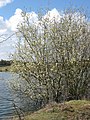 A Flooded Willow Tree - geograph.org.uk - 1233475.jpg 2,448 × 3,264; 5.71 MB
-
 A Frosty View of a large Canalside House at Bulbourne - geograph.org.uk - 3259396.jpg 2,139 × 2,852; 2.03 MB
-
 A Frosty View of Lock 44, Grand Union Canal near Tring - geograph.org.uk - 3258577.jpg 3,582 × 2,388; 2.04 MB
-
 A Fungi Exhibition in The Barn at College Lake - geograph.org.uk - 4200848.jpg 3,000 × 4,000; 2.63 MB
-
 A gateway on the ring road at College Lake, near Tring - geograph.org.uk - 4581315.jpg 3,256 × 2,442; 4.05 MB
-

-
 A Goose and Coot at Startops Reservoir - geograph.org.uk - 3258477.jpg 3,304 × 2,478; 2.08 MB
-

-
 A heron on the Marsh at College Lake, near Tring - geograph.org.uk - 4026472.jpg 1,513 × 2,017; 732 KB
-
 A Magnificent Lichen at College Lake, near Tring - geograph.org.uk - 4580751.jpg 4,000 × 2,664; 2.53 MB
-
 A mass of teasels by the road to the Barn, College Lake - geograph.org.uk - 4094315.jpg 4,000 × 2,667; 2.28 MB
-

-
 A new art work ^^^ at College Lake - geograph.org.uk - 4758102.jpg 2,000 × 1,500; 1.29 MB
-
 A path between the trees in Elder Wood at College Lake - geograph.org.uk - 4687629.jpg 2,736 × 3,648; 7.11 MB
-
 A Quiet Moment at a Stall with a View at College Lake - geograph.org.uk - 5547991.jpg 3,648 × 2,736; 1.2 MB
-
 A Rare Combination at College Lake - geograph.org.uk - 4094427.jpg 3,323 × 2,491; 1.37 MB
-
 A Red-Legged Partridge at College Lake - geograph.org.uk - 5801062.jpg 2,052 × 2,736; 827 KB
-
 A Robin in a frosty bush by the Grand Union Canal - geograph.org.uk - 3258599.jpg 1,860 × 1,240; 385 KB
-
 A rowing boat at the bottom of The Twist, College Lake - geograph.org.uk - 4144390.jpg 3,648 × 2,736; 2.46 MB
-
 A sea of oxeye daisies on the Marsh at College Lake - geograph.org.uk - 5790172.jpg 3,432 × 2,574; 1.92 MB
-
 A Seat with a View at College Lake - geograph.org.uk - 4093320.jpg 3,831 × 2,554; 1.79 MB
-
 A Seat with a View at College Lake - geograph.org.uk - 4144837.jpg 3,992 × 1,707; 1.46 MB
-
 A seat with a view at College Lake - geograph.org.uk - 5651361.jpg 3,648 × 2,736; 2.14 MB
-
 A Seat with a View at College Lake - geograph.org.uk - 5948263.jpg 2,736 × 3,648; 1.53 MB
-
 A Surprise on a track through Elder Wood - geograph.org.uk - 5572036.jpg 3,648 × 2,736; 1.8 MB
-
 A View across the Marsh at College Lake, near Tring - geograph.org.uk - 4093151.jpg 3,602 × 2,702; 2.48 MB
-
 A View of East Bank of College Lake from the Fitter Hide - geograph.org.uk - 1233490.jpg 3,264 × 2,448; 3.36 MB
-

-
 A View over the Frozen Startops Reservoir, near Tring - geograph.org.uk - 3258495.jpg 4,000 × 3,000; 2.34 MB
-
 A Winter View across College Lake - geograph.org.uk - 4334955.jpg 4,000 × 2,664; 1.57 MB
-
 A Wooden Fox in the Grass at College Lake - geograph.org.uk - 5572054.jpg 2,762 × 2,071; 1.33 MB
-
 Abandoned machinery, College Lake - geograph.org.uk - 3221012.jpg 1,000 × 1,333; 1.55 MB
-
 Abandoned Telephone Box in the Startops End Car Park - geograph.org.uk - 5824320.jpg 3,648 × 2,736; 1.95 MB
-
 All Saints Church - geograph.org.uk - 2167354.jpg 640 × 480; 71 KB
-
 All Saints Church in Marsworth - geograph.org.uk - 5001194.jpg 800 × 557; 136 KB
-
 All Saints' church, Marsworth - geograph.org.uk - 4135285.jpg 4,320 × 3,240; 4.34 MB
-
 All Saints' churchyard - geograph.org.uk - 6421290.jpg 1,600 × 1,200; 529 KB
-

-
 An ammonite and the Visitor Centre at College Lake - geograph.org.uk - 5572018.jpg 2,736 × 3,648; 2.88 MB
-
 An intermediate level track at College Lake - geograph.org.uk - 5790536.jpg 3,648 × 2,432; 2.65 MB
-
 Angus, the Old Bovine, negotiates Lock 39 at Marsworth - geograph.org.uk - 5555150.jpg 3,648 × 2,736; 1.78 MB
-

-
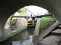
 Approaching Bridge 131 on the Grand Union Canal at Marsworth - geograph.org.uk - 3257561.jpg 3,802 × 2,534; 1.82 MB
-

-
 At Lock 43 on the Grand Union Canal - geograph.org.uk - 3258569.jpg 3,496 × 2,622; 1.32 MB
-
 Autumn on the Marsworth Basin of the Grand Union Canal - geograph.org.uk - 4711846.jpg 3,035 × 2,275; 4.62 MB
-
 Avocet on the Marsh at College Lake, near Tring - geograph.org.uk - 4094397.jpg 2,142 × 1,606; 573 KB
-

-

-
 Aylesbury Arm - Lock No 2 Bottom Gates - geograph.org.uk - 1228456.jpg 640 × 480; 111 KB
-

-

-

-
 Aylesbury Arm - Marsworth Lock (No 3) - geograph.org.uk - 1228864.jpg 480 × 640; 118 KB
-
-
 Aylesbury Arm - Towpath beyond Lock No 3 - geograph.org.uk - 1228878.jpg 480 × 640; 118 KB
-

-

-
 Aylesbury arm, bridge no 1 - geograph.org.uk - 5211078.jpg 5,202 × 3,465; 3.42 MB
-

-
 Bird Watching from the Visitor Centre Hide, College Lake - geograph.org.uk - 4184983.jpg 3,279 × 2,186; 1.35 MB
-
 Black Swans at College Lake, near Tring - geograph.org.uk - 4862385.jpg 1,024 × 683; 118 KB
-
 Bluebells - geograph.org.uk - 1398861.jpg 640 × 480; 199 KB
-
 Bluebells Cafe, Marsworth - geograph.org.uk - 4158525.jpg 3,648 × 2,736; 2.6 MB
-
 Bluebells Tea Room Car Park, Marsworth - geograph.org.uk - 3671965.jpg 640 × 640; 133 KB
-

-

-

-
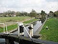
 Boat leaving Marsworth Top Lock - geograph.org.uk - 5008722.jpg 640 × 480; 159 KB
-

-

-
 Braunston 55 miles - geograph.org.uk - 2154164.jpg 520 × 640; 298 KB
-
 Braw Lass - geograph.org.uk - 5277310.jpg 2,560 × 1,920; 2.62 MB
-
 Bridge 1, Grand Junction Canal - Aylesbury Arm - geograph.org.uk - 2826602.jpg 4,000 × 3,000; 4.95 MB
-
 Bridge 1, Grand Junction Canal - Wendover Arm - geograph.org.uk - 2826238.jpg 4,000 × 3,000; 4.74 MB
-
 Bridge 127, Grand Junction Canal - geograph.org.uk - 3433946.jpg 4,000 × 3,000; 4.69 MB
-
 Bridge 128, Grand Junction Canal - geograph.org.uk - 3433939.jpg 4,000 × 3,000; 4.5 MB
-
 Bridge 129, Grand Junction Canal - geograph.org.uk - 2824989.jpg 4,000 × 3,000; 4.69 MB
-
 Bridge 130, Grand Junction Canal - geograph.org.uk - 3433922.jpg 4,000 × 3,000; 4.77 MB
-
 Bridge 131, Grand Junction Canal - geograph.org.uk - 2825018.jpg 4,000 × 3,000; 4.9 MB
-
 Bridge 132, Grand Junction Canal - geograph.org.uk - 2825063.jpg 4,000 × 3,000; 4.71 MB
-

-
 Bridleway towards the canal - geograph.org.uk - 6416114.jpg 1,600 × 1,066; 431 KB
-
 British Waterways information board near Startop's End - geograph.org.uk - 6387696.jpg 2,592 × 1,944; 1.32 MB
-

-

-
 Bulbourne Canal works - geograph.org.uk - 5208731.jpg 5,184 × 3,456; 6.4 MB
-
 Bulbourne canal works - geograph.org.uk - 6345508.jpg 2,903 × 1,638; 2.24 MB
-
 Bulbourne canal.jpg 4,288 × 3,216; 6.7 MB
-
 Bulbourne dry dock - geograph.org.uk - 2153760.jpg 640 × 390; 215 KB
-
 Bulbourne dry dock - geograph.org.uk - 2154178.jpg 640 × 427; 208 KB
-
 Bulbourne Dry Dock - geograph.org.uk - 3795700.jpg 1,202 × 1,000; 1.02 MB
-
 Bulbourne Dry Dock and Canal Boat - geograph.org.uk - 5302815.jpg 2,592 × 1,944; 1.39 MB
-
 Bulbourne Drydock at Bulbourne Junction - geograph.org.uk - 5256427.jpg 800 × 528; 119 KB
-
 Bulbourne Junction - geograph.org.uk - 6341530.jpg 3,840 × 2,160; 4.22 MB
-
 Bulbourne Junction - geograph.org.uk - 742582.jpg 640 × 480; 62 KB
-
 Bulbourne Works through Bridge 133 - geograph.org.uk - 1274244.jpg 640 × 480; 193 KB
-
 Bulbourne works, Grand Union Canal - geograph.org.uk - 5008680.jpg 640 × 480; 155 KB
-
 Bulbourne works, Grand Union Canal - geograph.org.uk - 5008710.jpg 640 × 480; 152 KB
-
 Bulbourne yard - geograph.org.uk - 2153748.jpg 640 × 416; 246 KB
-
 Burdock at College Lake Nature Reserve, near Tring - geograph.org.uk - 4094234.jpg 1,787 × 2,382; 1.1 MB
-

-

-
 Canada Geese among the reeds at College Lake - geograph.org.uk - 4704589.jpg 2,809 × 2,107; 3.26 MB
-
 Canada Geese at Sunset at Marsworth Reservoir - geograph.org.uk - 4709218.jpg 2,904 × 2,178; 2.95 MB
-
 Canada geese emerge from the grass - geograph.org.uk - 3997124.jpg 1,333 × 1,000; 1.44 MB
-
 Canada Goose family going for a stroll - geograph.org.uk - 3997116.jpg 1,333 × 1,000; 1.28 MB
-
 Canada goslings in the grass - geograph.org.uk - 3997119.jpg 1,333 × 1,000; 1.23 MB
-
 Canal boats on the Grand Union, Startop's End - geograph.org.uk - 6478315.jpg 1,000 × 1,179; 1.01 MB
-
 Canal bridge near Marsworth - geograph.org.uk - 5211062.jpg 5,184 × 3,456; 6.09 MB
-

-
 Canal lock with the former pub in the background - geograph.org.uk - 5671633.jpg 4,608 × 3,456; 4.45 MB
-
 Canal side vegetation near Bulbourne - geograph.org.uk - 5208765.jpg 4,705 × 3,363; 5.4 MB
-

-
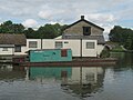
 Canal wharf at Marsworth - geograph.org.uk - 1358783.jpg 640 × 480; 68 KB
-
 Canal ^ River Trust notice near Startop's End - geograph.org.uk - 6387639.jpg 2,592 × 1,944; 1.39 MB
-
 Cheddington Lane, Long Marston - geograph.org.uk - 3559343.jpg 3,264 × 2,448; 2.95 MB
-
 Cheddington Telephone Exchange - geograph.org.uk - 1930753.jpg 3,072 × 2,304; 1.78 MB
-
 Clearing the scrub at College Lake - geograph.org.uk - 5651338.jpg 2,923 × 1,949; 1.28 MB
-
 Cliff at the end of The Twist, College Lake - geograph.org.uk - 4144353.jpg 3,151 × 2,362; 1.5 MB
-
 Clouds over the Canal - geograph.org.uk - 4713370.jpg 4,000 × 2,480; 1.93 MB
-
 Clouds over the canal at Marsworth - geograph.org.uk - 5555107.jpg 3,648 × 2,736; 1.15 MB
-
 Clouds over The Marsh at College Lake - geograph.org.uk - 4184991.jpg 3,582 × 2,686; 1.07 MB
-
 College Lake - Panorama Board looking West - geograph.org.uk - 4093402.jpg 4,000 × 2,667; 1.6 MB
-
 College Lake - Path closed for obvious reasons - geograph.org.uk - 3997108.jpg 1,333 × 1,000; 1.51 MB
-
 College Lake - Southern Pool - geograph.org.uk - 2105944.jpg 640 × 480; 195 KB
-
 College Lake Wildlife Centre - geograph.org.uk - 3052083.jpg 1,333 × 1,000; 1.31 MB
-
 College Lake, Marsworth - geograph.org.uk - 3018071.jpg 3,264 × 2,448; 3.11 MB
-
 Coltsfoot at College Lake - geograph.org.uk - 1226766.jpg 1,826 × 1,229; 1.39 MB
-
 Coppiced Willows at College Lake - geograph.org.uk - 1226806.jpg 3,264 × 2,448; 5.53 MB
-
 Corn Poppy in Cornfield at College Lake - geograph.org.uk - 2981703.jpg 1,812 × 1,359; 388 KB
-
 Cottage next to Marsworth Lock No 38 - geograph.org.uk - 5001103.jpg 800 × 600; 151 KB
-
 Cottage next to Marsworth Lock No 44 - geograph.org.uk - 5256416.jpg 800 × 621; 167 KB
-
 Countryside from the canal towpath. - geograph.org.uk - 5208850.jpg 4,964 × 3,243; 4.37 MB
-
 Cruise boat on Grand Union Canal - geograph.org.uk - 5008348.jpg 640 × 480; 139 KB
-
 Cutting north of Tring Station - geograph.org.uk - 2254852.jpg 640 × 394; 89 KB
-
 Cyclamen at College Lake, near Tring - geograph.org.uk - 4687643.jpg 3,648 × 2,736; 5.22 MB
-
 Cyclamen by the path at College Lake - geograph.org.uk - 4687639.jpg 2,736 × 3,648; 6.68 MB
-
 Daffodils in the Wildlife Garden at College Lake - geograph.org.uk - 5719336.jpg 3,271 × 2,181; 2.88 MB
-
 Decorative ironwork at Bulbourne - geograph.org.uk - 3888753.jpg 1,000 × 1,096; 1.08 MB
-

-

-
 Discussing the Event at College Lake - geograph.org.uk - 4097236.jpg 3,267 × 2,178; 1.16 MB
-
 DIsplay Panels in the Visitor Centre, College Lake - geograph.org.uk - 4184984.jpg 4,000 × 3,000; 1.93 MB
-
 Dog Rose (Rosa canina) and bee - geograph.org.uk - 3997112.jpg 1,378 × 1,000; 1,011 KB
-
 Dry Dock, Bulbourne Junction - geograph.org.uk - 4713361.jpg 4,000 × 2,664; 2.67 MB
-
 Duckboards on the low level path at College Lake - geograph.org.uk - 5790188.jpg 3,648 × 2,736; 2.23 MB
-
 Ducks in a Ring on the Canal at Marsworth - geograph.org.uk - 3257665.jpg 2,344 × 1,562; 788 KB
-
 Dunstable and District Boat Club - geograph.org.uk - 2702142.jpg 4,000 × 3,000; 4.8 MB
-
 Dunstable and District Boat Club - geograph.org.uk - 5001078.jpg 800 × 462; 96 KB
-
 Dunstable ^ District Boat Club - geograph.org.uk - 3994594.jpg 640 × 480; 100 KB
-
 Empty house at Bulbourne - geograph.org.uk - 5208744.jpg 4,580 × 3,114; 4.41 MB
-
 Entrance to disused airbase - geograph.org.uk - 6415905.jpg 1,600 × 1,066; 362 KB
-
 Entrance to Marsworth Airfield - geograph.org.uk - 3436157.jpg 4,000 × 3,000; 5.08 MB
-
 Evening view across Startopsend Reservoir - geograph.org.uk - 3795738.jpg 1,567 × 1,000; 903 KB
-

-
 Fallen Crab Apples in the Garden at College Lake - geograph.org.uk - 5946062.jpg 2,736 × 3,648; 2.67 MB
-
 Farm track by Cheddington Lane - geograph.org.uk - 6416119.jpg 1,600 × 1,066; 416 KB
-
 Field by Long Marston Road - geograph.org.uk - 6415904.jpg 1,600 × 1,066; 296 KB
-
 Field Cow-Wheat in Cornfield at College Lake - geograph.org.uk - 2981698.jpg 1,351 × 1,013; 262 KB
-
 Fields between the railway and canal - geograph.org.uk - 3628734.jpg 640 × 416; 27 KB
-
 Fieldscape near Long Marston - geograph.org.uk - 3559007.jpg 3,264 × 2,448; 3.11 MB
-

-

-
 Flower head of Teasel at College Lake, near Tring - geograph.org.uk - 4094264.jpg 4,000 × 3,000; 2.51 MB
-
 Footpath to Cheddington - geograph.org.uk - 6415898.jpg 1,066 × 1,600; 655 KB
-
 Footpath towards Cheddington Road - geograph.org.uk - 6421287.jpg 1,600 × 1,066; 479 KB
-
 Footpath under repair at College Lake - geograph.org.uk - 5790520.jpg 2,736 × 3,648; 2.33 MB
-
 Former canal workshops, Bulbourne - geograph.org.uk - 3888745.jpg 1,333 × 1,000; 1.13 MB
-
 Frost covered Trees and Marsworth Church Tower - geograph.org.uk - 3257576.jpg 2,772 × 1,848; 1 MB
-
 Frost on a Spider's Web - geograph.org.uk - 3257594.jpg 2,751 × 2,063; 1.32 MB
-
 Frost-covered Old Man's Beard - geograph.org.uk - 3258595.jpg 3,209 × 2,407; 1.49 MB
-
 Frost-covered Trees by the Canal at Marsworth - geograph.org.uk - 3257667.jpg 3,269 × 2,451; 1.52 MB
-
 Frosted Ivy Berries and Leaves - geograph.org.uk - 3258524.jpg 3,119 × 2,339; 1.1 MB
-
 Frosted Pampas Grass by the canal. - geograph.org.uk - 3258829.jpg 2,076 × 2,768; 2.08 MB
-
 Frosted Trees at Lock 41 on the Grand Union Canal - geograph.org.uk - 3258536.jpg 3,287 × 2,465; 1.62 MB
-
 Frosted Trees on the edge of Marsworth Reservoir - geograph.org.uk - 3258510.jpg 3,842 × 2,561; 1.33 MB
-
 Frosty Fields at Marsworth - geograph.org.uk - 3257502.jpg 3,417 × 2,278; 1.19 MB
-
 Frosty Reeds in the Side Pond, Lock 45 , Tring Summit - geograph.org.uk - 3258606.jpg 3,707 × 2,471; 1.64 MB
-
 Fungi at College Lake, near Tring - geograph.org.uk - 4201027.jpg 3,115 × 2,336; 1.24 MB
-
 Fungi growing on rotting wood at College Lake - geograph.org.uk - 4757387.jpg 4,000 × 2,664; 5.31 MB
-


_-_geograph.org.uk_-_2982809.jpg)


_and_Canal-side_House_-_geograph.org.uk_-_1228944.jpg)
_-_geograph.org.uk_-_1228949.jpg)


_-_geograph.org.uk_-_1228864.jpg)
_looking_towards_Bridge_No_1_-_geograph.org.uk_-_1228874.jpg)


_and_bee_-_geograph.org.uk_-_3997112.jpg)


