Category:Marston Vale Line
Jump to navigation
Jump to search
The Marston Vale Line is the railway line from Bletchley to Bedford in England. It is one of two surviving passenger-carrying sections of the "Varsity Line" between Oxford and Cambridge.
railway line in the UK  | |||||
| Upload media | |||||
| Instance of |
| ||||
|---|---|---|---|---|---|
| Part of |
| ||||
| Location | Buckinghamshire, South East England, England | ||||
| Owned by | |||||
| Operator | |||||
| Length |
| ||||
| Terminus |
| ||||
 | |||||
Subcategories
This category has the following 13 subcategories, out of 13 total.
A
- Aspley Guise railway station (6 F)
B
F
- Fenny Stratford railway station (13 F)
K
L
- Lidlington railway station (6 F)
R
- Ridgmont railway station (12 F)
S
- Stewartby railway station (6 F)
W
- Woburn Sands railway station (11 F)
Media in category "Marston Vale Line"
The following 18 files are in this category, out of 18 total.
-
 Bedford - Bletchley line - geograph.org.uk - 5626230.jpg 640 × 480; 153 KB
-
 Bedford - railway track beyond St John's station.jpg 3,264 × 2,448; 1.62 MB
-
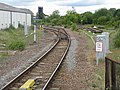
 Bedford to Bletchley Line - geograph.org.uk - 430532.jpg 640 × 480; 113 KB
-
 Bletchley - Bedford line - geograph.org.uk - 5624344.jpg 640 × 480; 119 KB
-
 Bletchley - Bedford line - geograph.org.uk - 5626228.jpg 640 × 480; 142 KB
-
 By the railway - geograph.org.uk - 727096.jpg 640 × 480; 78 KB
-
 Driver's cab, class 230, Marston Vale Line (48549655707).jpg 3,024 × 4,032; 2.78 MB
-
 I found the Woburn Road level crossing! (51290601067).jpg 4,032 × 3,024; 5.93 MB
-
 Marston Vale line.png 2,186 × 1,946; 2.74 MB
-
 Ouse Valley Trail Bedford rail bridge 01.jpg 4,000 × 3,000; 3.46 MB
-
 Ouse Valley Trail Bedford rail bridge 02.jpg 4,000 × 3,000; 4 MB
-
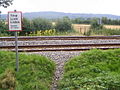 Public footpath crossing a railway - geograph.org.uk - 209270.jpg 640 × 480; 176 KB
-
 Railway going to Bletchley - geograph.org.uk - 6004052.jpg 1,600 × 1,066; 432 KB
-
 The line to Bletchley - geograph.org.uk - 2462699.jpg 2,592 × 1,944; 3.28 MB
-
 The line to Bletchley - geograph.org.uk - 3498726.jpg 1,600 × 1,068; 723 KB
-
 The Silverlink Line - geograph.org.uk - 667417.jpg 640 × 480; 72 KB
-
 View from the end of the platform - geograph.org.uk - 2462714.jpg 2,592 × 1,944; 3.01 MB
-
 Woburn Road level crossing (51292357450).jpg 14,608 × 3,628; 20.71 MB


.jpg)
.jpg)


.jpg)