Category:Marston Moretaine
Jump to navigation
Jump to search
village in Bedfordshire, UK  | |||||
| Upload media | |||||
| Instance of | |||||
|---|---|---|---|---|---|
| Location | Marston Moretaine, Central Bedfordshire, Bedfordshire, East of England, England | ||||
 | |||||
English: Marston Moretaine (Marston Moreteyne) is a large village on the A421 between Bedford and Milton Keynes. It has a population of about 4,000 and is served by Millbrook railway station, which is about a mile away, on the Marston Vale Line.
Italiano: Marston Moretaine è un paese di 4.000 abitanti della contea del Bedfordshire, in Inghilterra.
Nederlands: Marston Moretaine is een dorp in het Engelse graafschap Bedfordshire. Het dorp ligt in het district Bedford en telt ca. 4000 inwoners.
Subcategories
This category has the following 6 subcategories, out of 6 total.
Media in category "Marston Moretaine"
The following 198 files are in this category, out of 198 total.
-
 10 miles to Milton Keynes - geograph.org.uk - 2673627.jpg 640 × 410; 29 KB
-
 A bevy of swans at Stewartby Lake - geograph.org.uk - 6218920.jpg 4,608 × 3,456; 4.62 MB
-
 A fork in the path - geograph.org.uk - 2677765.jpg 1,600 × 1,200; 664 KB
-
 A Methodist Chapel in Lower Shelton circa 1920 - geograph.org.uk - 5229987.jpg 933 × 1,254; 432 KB
-
 A421 - approaching Marston Junction - geograph.org.uk - 2676037.jpg 640 × 459; 35 KB
-
 A421 at Marston Moretaine - geograph.org.uk - 3188810.jpg 640 × 480; 54 KB
-
 A421 northbound - geograph.org.uk - 4431315.jpg 640 × 444; 39 KB
-
 A421 northbound - geograph.org.uk - 4431323.jpg 640 × 466; 43 KB
-
 A421 skirting Marston Moretaine - geograph.org.uk - 2673609.jpg 640 × 435; 38 KB
-
 A421 towards Bedford - geograph.org.uk - 5623298.jpg 640 × 428; 65 KB
-
 A421 towards Bedford - geograph.org.uk - 5623420.jpg 640 × 421; 60 KB
-
 A421 towards Bedford - geograph.org.uk - 5623640.jpg 640 × 428; 65 KB
-
 A421 View - geograph.org.uk - 5977706.jpg 800 × 600; 137 KB
-
 A421 west of Marston Moretaine - geograph.org.uk - 2673620.jpg 640 × 436; 28 KB
-
 A421, southbound - geograph.org.uk - 5449138.jpg 640 × 429; 33 KB
-
 Allotments at Marston Moretaine - geograph.org.uk - 3498719.jpg 1,600 × 1,068; 611 KB
-
 An old clay pit - geograph.org.uk - 4741112.jpg 640 × 426; 50 KB
-
 Barkers Piece - geograph.org.uk - 3339257.jpg 640 × 480; 65 KB
-
 Beancroft Road - geograph.org.uk - 5103053.jpg 640 × 428; 82 KB
-
 Beancroft Road - geograph.org.uk - 5103067.jpg 640 × 480; 93 KB
-
 Beancroft Road - geograph.org.uk - 5103073.jpg 640 × 480; 83 KB
-
 Beancroft Road, near Cranfield - geograph.org.uk - 3188820.jpg 640 × 480; 98 KB
-
 Bedford Road Methodist Chapel, Marston Moretaine - geograph.org.uk - 2181758.jpg 2,272 × 1,704; 753 KB
-
 Bedford Road near Upper Shelton - geograph.org.uk - 5312060.jpg 2,048 × 1,536; 1.47 MB
-
 Bedford Road, Marston Moretaine - geograph.org.uk - 2714349.jpg 3,264 × 2,448; 3.98 MB
-
 Bedford Road, Upper Shelton - geograph.org.uk - 5312081.jpg 2,048 × 1,536; 1.01 MB
-
 Bird Hide - geograph.org.uk - 984157.jpg 640 × 480; 97 KB
-
 Brick Making Equipment - geograph.org.uk - 1981771.jpg 1,280 × 853; 368 KB
-
 Brick Press - geograph.org.uk - 6230709.jpg 851 × 1,280; 553 KB
-
 Brick work relics at the Visitor’s Centre - geograph.org.uk - 6218906.jpg 4,608 × 3,456; 2.58 MB
-
 Bridge over the A421 - geograph.org.uk - 5449153.jpg 640 × 415; 35 KB
-
 Bridleway down to the stream - geograph.org.uk - 3639604.jpg 1,600 × 1,067; 653 KB
-
 Bridleway to Longcroft Spinney - geograph.org.uk - 3640267.jpg 1,600 × 1,069; 484 KB
-
 Bridleway towards Marston Moretaine - geograph.org.uk - 3500618.jpg 1,600 × 1,068; 508 KB
-
 Burridge Close - geograph.org.uk - 3179187.jpg 640 × 480; 66 KB
-
 Burridge Close - geograph.org.uk - 3338597.jpg 640 × 480; 92 KB
-
 Car park and playing field at Marston Moretaine - geograph.org.uk - 2714359.jpg 3,264 × 2,448; 5.74 MB
-
 Carved frog sculpture - geograph.org.uk - 6218905.jpg 4,608 × 3,456; 4.29 MB
-
 Carved seat, Millennium Country Park - geograph.org.uk - 6218904.jpg 4,608 × 3,456; 5.91 MB
-
 Centre View - geograph.org.uk - 5977870.jpg 800 × 600; 134 KB
-
 Chimney quartet, Stewartby - geograph.org.uk - 6218925.jpg 4,608 × 3,456; 3.99 MB
-
 Church at Marston Moretaine appearing above the trees - geograph.org.uk - 6218903.jpg 4,608 × 3,456; 3.63 MB
-
 Country Park footpath - geograph.org.uk - 3595612.jpg 1,600 × 1,068; 730 KB
-
 Country road junction near Cranfield - geograph.org.uk - 3188826.jpg 640 × 480; 51 KB
-
 Country road near Upper Shelton - geograph.org.uk - 3188332.jpg 640 × 480; 74 KB
-

-
 Development at Woodford - geograph.org.uk - 5845000.jpg 3,264 × 2,448; 3.03 MB
-
 Disused pit by Marston Thrift - geograph.org.uk - 3500652.jpg 1,600 × 1,068; 551 KB
-
 Drain at Marston Moretaine - geograph.org.uk - 3188787.jpg 480 × 640; 110 KB
-
 Drain near Stewartby Lake - geograph.org.uk - 3188430.jpg 480 × 640; 130 KB
-
 Drive through Marston Thrift - geograph.org.uk - 3500646.jpg 1,200 × 1,600; 784 KB
-
 Drive through the spinney - geograph.org.uk - 3639613.jpg 1,200 × 1,600; 666 KB
-
 Farmland near Lower Shelton - geograph.org.uk - 3179197.jpg 640 × 480; 60 KB
-
 Farmland near Lower Shelton - geograph.org.uk - 3179389.jpg 640 × 480; 62 KB
-
 Fence and ditch - geograph.org.uk - 4786192.jpg 640 × 426; 46 KB
-
 Field and wood by Roxhill Manor Farm - geograph.org.uk - 3639629.jpg 1,600 × 1,066; 420 KB
-
 Field of linseed in flower - geograph.org.uk - 3534178.jpg 4,320 × 3,240; 4.96 MB
-
 Fields, Roxhill Manor Farm - geograph.org.uk - 2662178.jpg 1,600 × 1,200; 461 KB
-
 Filling Station View - geograph.org.uk - 5977713.jpg 800 × 592; 97 KB
-
 Footbridge on the path to Manor Farm - geograph.org.uk - 3498701.jpg 1,600 × 1,076; 455 KB
-
 Footpath around Stewartby Lake - geograph.org.uk - 2714226.jpg 3,264 × 2,448; 5.38 MB
-
 Footpath at Marston Moretaine - geograph.org.uk - 2714347.jpg 3,264 × 2,448; 6.3 MB
-
 Footpath from Millbrook Road - geograph.org.uk - 3498715.jpg 1,600 × 1,067; 485 KB
-
 Footpath into Marston - geograph.org.uk - 3500698.jpg 1,600 × 1,068; 587 KB
-
 Footpath off the Bedford Road - geograph.org.uk - 3639619.jpg 1,200 × 1,600; 812 KB
-
 Footpath off Wood End Road - geograph.org.uk - 3500670.jpg 1,600 × 1,067; 537 KB
-
 Footpath to Bourne End Farm - geograph.org.uk - 3640270.jpg 1,600 × 1,068; 595 KB
-
 Footpath to Lower Shelton - geograph.org.uk - 3500730.jpg 1,600 × 1,067; 420 KB
-
 Footpath to Marston Mortaine - geograph.org.uk - 3595599.jpg 1,600 × 1,068; 586 KB
-
 Footpath to Millbrook - geograph.org.uk - 3498692.jpg 1,200 × 1,600; 799 KB
-
 Footpath towards Ashbrook - geograph.org.uk - 3639624.jpg 1,200 × 1,600; 581 KB
-
 Former brickworks at Stewartby - geograph.org.uk - 5440007.jpg 4,608 × 3,456; 4.12 MB
-
 Four industrial chimneys at Stewartby - geograph.org.uk - 5440017.jpg 4,608 × 3,456; 4.46 MB
-
 Franklin Close - geograph.org.uk - 3179356.jpg 640 × 480; 61 KB
-
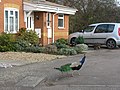 Free-range peacock at Caulcott - geograph.org.uk - 2714137.jpg 3,264 × 2,448; 4.95 MB
-
 Gate on the footpath to Lower Shelton - geograph.org.uk - 3500725.jpg 1,600 × 1,068; 592 KB
-
 George VI postbox on Lower Shelton Road - geograph.org.uk - 3639578.jpg 1,200 × 1,600; 511 KB
-
 High seat by the path to Ashbrook - geograph.org.uk - 3640276.jpg 1,600 × 1,068; 586 KB
-
 Horseshoe Close, Caulcott - geograph.org.uk - 3188410.jpg 640 × 480; 62 KB
-
 Industrial Unit at Beancroft Farm - geograph.org.uk - 3500705.jpg 1,600 × 1,067; 328 KB
-
 Island View - geograph.org.uk - 5977732.jpg 800 × 590; 83 KB
-
 John Bunyan Trail on the track to Roxhill Manor Farm - geograph.org.uk - 3530580.jpg 1,600 × 1,067; 512 KB
-
 John Bunyan Trail towards Cranfield - geograph.org.uk - 3530573.jpg 1,600 × 1,070; 548 KB
-
 Jubilee Cottage Allotments - geograph.org.uk - 2181725.jpg 2,272 × 1,704; 679 KB
-

-
 Landfill gas pipes on the Brogborough landfill site - geograph.org.uk - 3500576.jpg 1,600 × 1,071; 498 KB
-
 Lane from Roxhill Manor Farm to Ashbrook Farm - geograph.org.uk - 2667376.jpg 1,200 × 1,600; 516 KB
-
 Lichen-covered tree at Marston Vale - geograph.org.uk - 2714200.jpg 3,264 × 2,448; 6.17 MB
-
 Looking across Bedford Road to Church Lane - geograph.org.uk - 2714365.jpg 3,264 × 2,448; 4.64 MB
-
 Lounge of India, Caulcott - geograph.org.uk - 3188418.jpg 640 × 480; 50 KB
-
 Lower East Farm from Strawberry Hill - geograph.org.uk - 3500659.jpg 1,600 × 1,068; 503 KB
-
 Lower Shelton - geograph.org.uk - 3339182.jpg 480 × 640; 86 KB
-
 Lower Shelton Road - geograph.org.uk - 2708223.jpg 640 × 480; 86 KB
-
 Lower Shelton Road - geograph.org.uk - 2846076.jpg 640 × 480; 50 KB
-
 Lower Shelton Road - geograph.org.uk - 3179193.jpg 640 × 480; 59 KB
-
 Lower Shelton Road - geograph.org.uk - 3338609.jpg 640 × 480; 54 KB
-
 Lower Shelton Road - geograph.org.uk - 3339163.jpg 640 × 480; 50 KB
-
 Lower Shelton Road - geograph.org.uk - 3639573.jpg 1,600 × 1,067; 443 KB
-
 Marina on Stewartby Lake - geograph.org.uk - 3595450.jpg 1,600 × 1,067; 587 KB
-
 Marston Hill east of Cranfield - geograph.org.uk - 5312078.jpg 1,994 × 1,462; 733 KB
-
 Marston Hill east of Cranfield - geograph.org.uk - 5312079.jpg 2,048 × 1,536; 1.02 MB
-
 Marston Hill west of Upper Shelton - geograph.org.uk - 5312080.jpg 2,014 × 1,490; 772 KB
-
 Marston Hill, near Cranfield - geograph.org.uk - 3188833.jpg 640 × 480; 43 KB
-
 Marston Hill, near Cranfield - geograph.org.uk - 3188845.jpg 640 × 480; 50 KB
-
 Marston Interchange, A421 - geograph.org.uk - 5449131.jpg 640 × 369; 39 KB
-
 Marston Moreteyne Village Hall - geograph.org.uk - 2714141.jpg 3,264 × 2,448; 4.35 MB
-
 Marston Mortaine - geograph.org.uk - 3339239.jpg 640 × 480; 57 KB
-
 Marston Social Club - geograph.org.uk - 3498721.jpg 1,600 × 1,067; 426 KB
-
 Marston Vale Millennium Country Park - geograph.org.uk - 2714205.jpg 3,264 × 2,448; 4.85 MB
-
 Marston Vale Millennium Country Park - geograph.org.uk - 2714210.jpg 2,448 × 3,264; 3.58 MB
-
 Marston Vale Millennium Country Park - geograph.org.uk - 3188465.jpg 640 × 480; 121 KB
-
 Marston Vale Millennium Country Park - geograph.org.uk - 6227821.jpg 1,280 × 851; 398 KB
-
 Marston Vale visitor centre - geograph.org.uk - 4685554.jpg 1,600 × 1,200; 679 KB
-
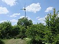 MarstonTurbineFromLake.JPG 2,816 × 2,112; 2.66 MB
-
 MarstonValeForestCentre.JPG 1,280 × 960; 360 KB
-
 Millbrook (Bedfordshire) railway station - geograph.org.uk - 3386111.jpg 1,024 × 768; 166 KB
-
 Millbrook Level Crossing - geograph.org.uk - 6227717.jpg 1,280 × 851; 364 KB
-
 Millbrook railway station - geograph.org.uk - 5440036.jpg 4,608 × 3,456; 3.47 MB
-
 Millbrook signal box - geograph.org.uk - 2666795.jpg 640 × 449; 46 KB
-
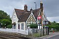 Millbrook Station - geograph.org.uk - 6227632.jpg 1,280 × 851; 423 KB
-

-
 Millbrook Vehicle Proving Ground - geograph.org.uk - 3010260.jpg 3,264 × 2,448; 2.66 MB
-
 Millbrook Vehicle Proving Ground - geograph.org.uk - 3015916.jpg 3,264 × 2,448; 2.93 MB
-
 NCR 51 MarstonMoretane.JPG 1,024 × 768; 233 KB
-
 New bridge, new graffiti - geograph.org.uk - 2674237.jpg 640 × 385; 29 KB
-
 New junction for Marston Moretaine - geograph.org.uk - 2677665.jpg 640 × 424; 34 KB
-
 Old brick-clay workings at Stewartby - geograph.org.uk - 5845015.jpg 2,988 × 2,448; 1.29 MB
-
 Pan Rollers - geograph.org.uk - 6230703.jpg 1,280 × 851; 508 KB
-
 Parrott Grove View - geograph.org.uk - 5977721.jpg 800 × 600; 129 KB
-
 Path to Stewartby - geograph.org.uk - 2714005.jpg 3,264 × 2,448; 5.2 MB
-
 Path to Stewartby - geograph.org.uk - 3595446.jpg 1,600 × 1,068; 552 KB
-
 Path, Marston Vale Country Park - geograph.org.uk - 3145124.jpg 1,024 × 682; 256 KB
-
 Petrol Station, Marston Moretaine - geograph.org.uk - 3793909.jpg 1,024 × 682; 165 KB
-

-
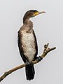 Phalacrocorax carbo 174108054.jpg 1,536 × 2,048; 2.62 MB
-
 Phone mast by the line to London - geograph.org.uk - 3498667.jpg 1,600 × 1,066; 536 KB
-
 Playground behind the social club - geograph.org.uk - 3498714.jpg 1,600 × 1,068; 544 KB
-
 Pond in a field - geograph.org.uk - 4786191.jpg 531 × 640; 59 KB
-

-
 Power boat - geograph.org.uk - 2115307.jpg 1,977 × 1,276; 674 KB
-
 Public Footpath - geograph.org.uk - 2181776.jpg 1,704 × 2,272; 701 KB
-
 Public Footpath - geograph.org.uk - 2181778.jpg 1,704 × 2,272; 678 KB
-
 Public footpath near Cranfield - geograph.org.uk - 3188815.jpg 640 × 480; 107 KB
-
 Racing Boats, Stewartby Lake - geograph.org.uk - 3145135.jpg 1,024 × 682; 171 KB
-
 Racing Boats, Stewartby Lake - geograph.org.uk - 3145141.jpg 1,024 × 682; 171 KB
-
 Reed Bed View - geograph.org.uk - 5991178.jpg 800 × 600; 110 KB
-

-
 Road to Roxhill Manor Farm - geograph.org.uk - 3534170.jpg 4,320 × 3,240; 3.41 MB
-
 Roberts Close - geograph.org.uk - 3339277.jpg 640 × 480; 70 KB
-
 Row of houses and club - geograph.org.uk - 727092.jpg 640 × 480; 51 KB
-
 Roxhill Cottages - geograph.org.uk - 5103082.jpg 640 × 428; 82 KB
-
 Scrubland near to Stewartby Lake - geograph.org.uk - 6218908.jpg 4,608 × 3,456; 6.3 MB
-
 Services entrance - geograph.org.uk - 5725724.jpg 640 × 480; 64 KB
-
 Station Road, Marston Moretaine - geograph.org.uk - 3188802.jpg 640 × 480; 54 KB
-
 Steps to the lake - geograph.org.uk - 3595618.jpg 1,200 × 1,600; 646 KB
-
 Stewartby Lake - geograph.org.uk - 2115325.jpg 3,872 × 2,592; 2.32 MB
-
 Stewartby Lake - geograph.org.uk - 2144462.jpg 1,024 × 681; 263 KB
-
 Stewartby Lake - geograph.org.uk - 2713990.jpg 3,264 × 2,448; 6.15 MB
-
 Stewartby Lake - geograph.org.uk - 2714223.jpg 3,264 × 2,448; 4.24 MB
-
 Stewartby Lake - geograph.org.uk - 3595596.jpg 1,600 × 1,074; 387 KB
-
 Stewartby Lake - geograph.org.uk - 5440014.jpg 4,608 × 3,456; 3.64 MB
-
 Stewartby Lake - geograph.org.uk - 6230722.jpg 851 × 1,280; 442 KB
-
 Stewartby Lake and chimneys - geograph.org.uk - 6218910.jpg 4,608 × 3,456; 4.35 MB
-
 Stewartby Lake Flood Balancing Reservoir Outlet - geograph.org.uk - 2714008.jpg 3,264 × 2,448; 5.48 MB
-
 Stewartby lake from the viewpoint - geograph.org.uk - 3595602.jpg 1,600 × 1,068; 486 KB
-
 Stream at the edge of Marston Moretaine - geograph.org.uk - 3498712.jpg 1,600 × 1,068; 724 KB
-
 Stubble and power - geograph.org.uk - 3639570.jpg 1,600 × 1,069; 411 KB
-
 Sunset View - geograph.org.uk - 5977880.jpg 800 × 600; 140 KB
-
 Table with a view - geograph.org.uk - 3595453.jpg 1,600 × 1,068; 594 KB
-
 The Bell at Marston Moretaine - geograph.org.uk - 2714387.jpg 3,264 × 2,448; 2.05 MB
-
 The co-operative at Marston Moretaine - geograph.org.uk - 2714379.jpg 3,264 × 2,448; 3.85 MB
-
 The Forest Centre at Marston Moretaine - geograph.org.uk - 2713979.jpg 3,264 × 2,448; 4.59 MB
-
 The John Bunyan Trail by a pond - geograph.org.uk - 3639610.jpg 1,600 × 1,074; 598 KB
-

-

-
 Top Farm - geograph.org.uk - 3639603.jpg 1,600 × 1,068; 472 KB
-
 Track by new trees on the Brogborough site - geograph.org.uk - 3500581.jpg 1,600 × 1,068; 482 KB
-
 Track down towards Brogborough - geograph.org.uk - 3500643.jpg 1,600 × 1,068; 539 KB
-
 Travelodge Scene - geograph.org.uk - 5977727.jpg 800 × 600; 73 KB
-
 Untaken harvest - geograph.org.uk - 2713997.jpg 2,448 × 3,264; 4.89 MB
-
 View between trees - wind turbine, Stewartby Lake - geograph.org.uk - 6218924.jpg 4,608 × 3,456; 5.39 MB
-
 View into Millbrook Proving Ground - geograph.org.uk - 727095.jpg 640 × 480; 72 KB
-
 Visitor Centre at Marston Moretaine - geograph.org.uk - 2713983.jpg 3,264 × 2,448; 4.38 MB
-
 Vivarail D Train between Stewartby and Millbrook - geograph.org.uk - 6227826.jpg 1,280 × 851; 511 KB
-
 Wetlands Nature Reserve - geograph.org.uk - 4750717.jpg 1,600 × 1,200; 521 KB
-
 Wetlands, Marston Vale Country Park - geograph.org.uk - 3145118.jpg 1,024 × 682; 227 KB
-
 Wheatfield by Longcroft Spinney - geograph.org.uk - 474193.jpg 640 × 480; 197 KB
-
 White House - geograph.org.uk - 430076.jpg 640 × 427; 60 KB
-
 Wind turbine at Stewartby Lake - geograph.org.uk - 6218916.jpg 4,608 × 3,456; 3.99 MB
-
 Wind turbine on the horizon - geograph.org.uk - 5440028.jpg 4,608 × 3,456; 2.83 MB
-
 Wind turbine, Marston Vale - geograph.org.uk - 5440012.jpg 4,608 × 3,456; 3.42 MB
-
 Across the fields to Millbrook - geograph.org.uk - 727099.jpg 640 × 480; 67 KB
-

-
 Lake at Marston Millennium Park - geograph.org.uk - 406504.jpg 640 × 480; 109 KB
-
 Millennium Forest Centre - geograph.org.uk - 406517.jpg 640 × 480; 62 KB
-
 Pylon - geograph.org.uk - 430078.jpg 640 × 427; 49 KB
-
 Reed Beds - geograph.org.uk - 656884.jpg 640 × 480; 81 KB
-
 Woodworks Festival - geograph.org.uk - 426727.jpg 640 × 427; 119 KB


_railway_station_-_geograph.org.uk_-_3386111.jpg)


_-_geograph.org.uk_-_855809.jpg)


